
TROPICAL DEPRESSION OBET ADVISORY NO. 01Issued at: 2:00 PM PhT (06:00 GMT) Thursday, 20 October 2022
Next update: 8:00 PM PhT (12:00 GMT) Thursday, 20 October 2022 |
|
|---|---|
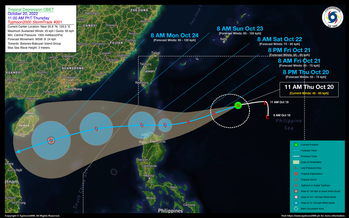
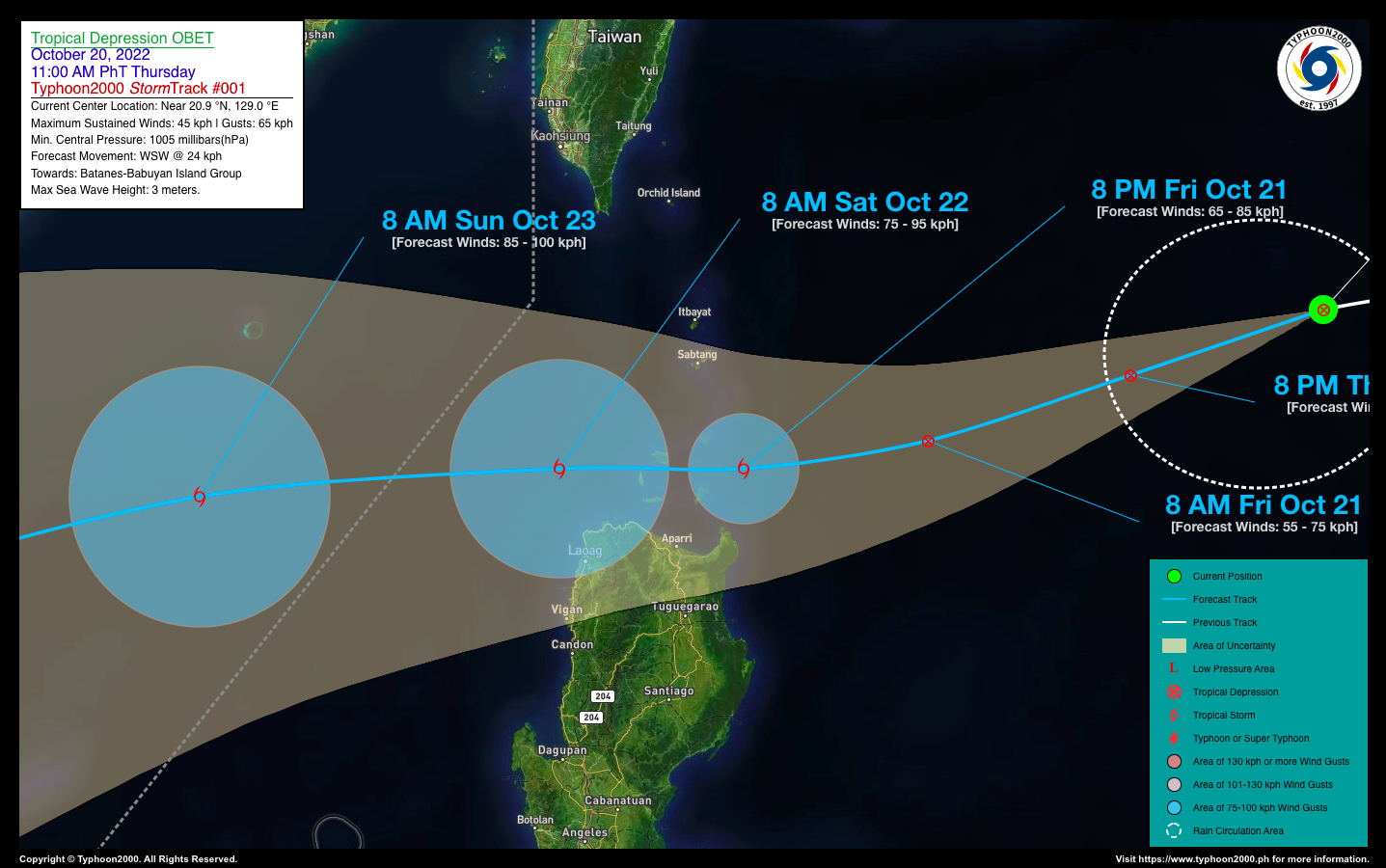
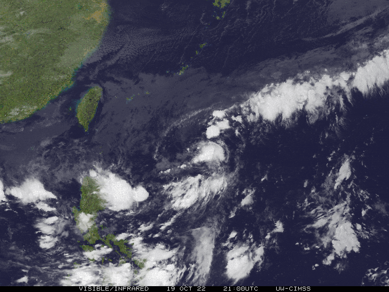
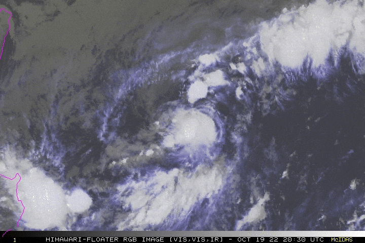
| Current Status & Outlook | OBET is now a Tropical Depression (TD) as it moves slowly, westward across the North Philippine Sea. This cyclone is expected to traverse the Babuyan and Batanes Group of Islands on Friday evening (Oct 21) as a minimal Tropical Storm (TS).
24-hr Outlook: TD OBET is forecast to slowly intensify over the North Philippine Sea while moving west-southwest towards Batanes-Babuyan Group, with an increased forward speed of 24 km/hr. This cyclone will continue to enhance the Northeast Monsoon (Amihan) and bring occasional rains with severe thunderstorms, and gusty winds (15-65 kph) across Northern Luzon today. The risk of floods and landslides is at medium to high. |
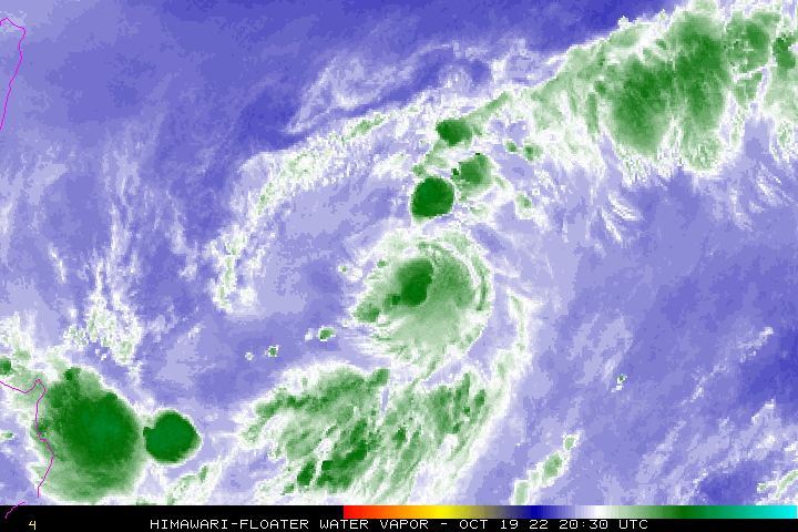
| Where is OBET? | As of 11:00 AM PhT today, October 20…0300 GMT:
|
| How strong is it? | Maximum Sustained Winds (1-min avg): 45 kph near the center…Gustiness: 65 kph. |
| Past Movement (06 hrs) | West @ 14 kph, towards the Batanes & Babuyan Group of Islands. |
| Potential Philippine Major Landfall Area(s) |
|
| What Philippine areas will be directly affected? | Heavy to Extreme Rainfall (50 mm to >100 mm expected for 24 hrs):
Damaging Winds (gusts of more than 100 km/hr expected):
|
| Potential Storm Surge/Coastal Flooding Areas+ |
+Waves of 3 meters in height are expected in storm surge-prone areas, particularly in coastal areas where the Tropical Cyclone is headed. Kindly visit the PAGASA Storm Surge Updates for more details. |
| 3-Day Forecast Outlook Summary** |
**Important Note: Please be reminded that the Forecast Outlook changes every 6 hours, and the Day 2 and 3 Forecast Track have an average error of 100 and 250 km respectively… while the wind speed forecast error, averages 35 km/hr per day. Therefore, a turn to the left or right of its future track and changes in its wind speed must be anticipated from time to time. |
| Other Storm’s Meteorological Information |
|
| Disclaimer: Information based on data collected by Typhoon2000 (T2k) shall not be taken as official data. Weather information broadcasted and distributed by PAGASA remains as official data. Typhoon2000 (T2k) shall not be responsible for the private use and reliance of its weather information. | |
Issued by: David Michael V. Padua for Typhoon2000 (T2k)
Typhoon2000 (T2K) Integrated Multi-Agency Tracks
:: Not Yet Available
PAGASA TROPICAL CYCLONE WIND SIGNAL

Image/Screenshot Source: DOST-PAGASA (https://bagong.pagasa.dost.gov.ph/tropical-cyclone/severe-weather-bulletin)


