
TROPICAL DEPRESSION KABAYAN (JELAWAT) ADVISORY NO. 04Issued at: 8:00 PM PhT (12:00 GMT) Monday, 18 Dec 2023
Next update: 2:00 AM PhT (18:00 GMT) Tuesday, 19 Dec 2023 |
|
|---|---|
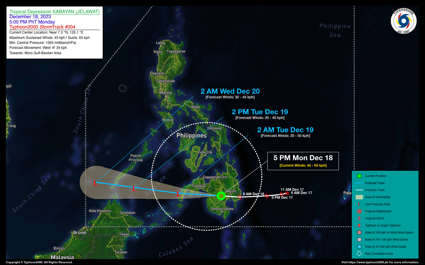
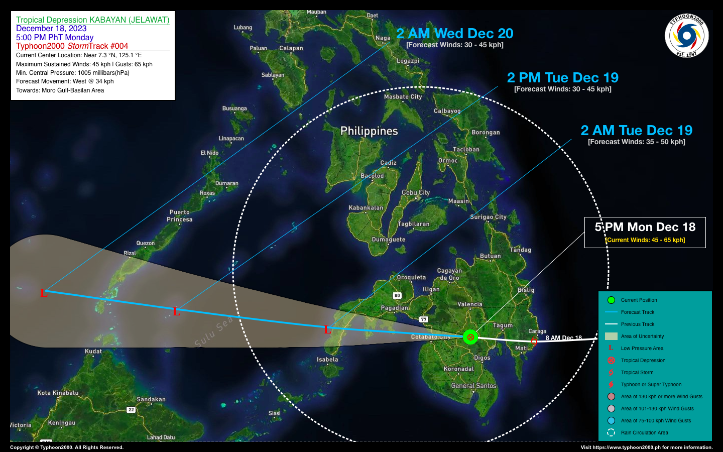
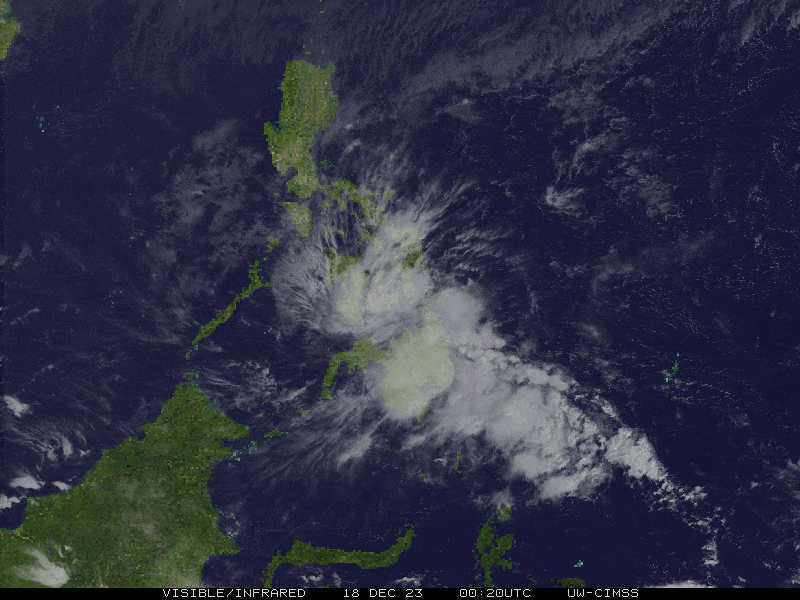
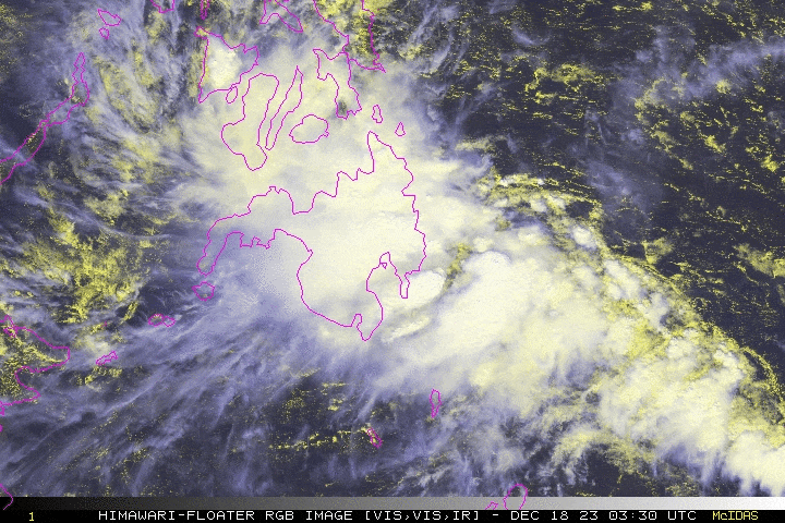
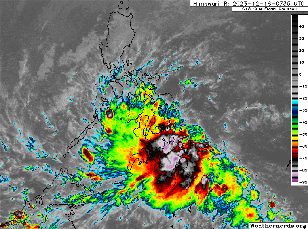
| Current Status & Outlook | KABAYAN {JELAWAT} has weakened into a Tropical Depression (TD) as it continues to move across the rugged terrain of North Cotabato…likely to become a remnant low pressure within the next 06 to 12 hours. Widespread rainfall will continue to affect a wide area of Mindanao and Visayas tonight, with improving weather conditions tomorrow.
36-hr Outlook: TD KABAYAN is forecast to accelerate westward and will become a remnant low upon its passage over the Zamboanga Peninsula early tomorrow morning. Its remnants will emerge over the Sulu Sea before passing over the southernmost part of Palawan tomorrow evening. By early Wednesday morning, it will then emerge over the West Philippine Sea. Meanwhile, TD KABAYAN’s rain circulation will still bring widespread rainfall across Visayas and Mindanao tonight, and will spread across Sulu Archipelago and Palawan tomorrow, Tuesday. Please take all necessary precautions against floods and landslides incl. lahars that will be brought about by this system. Meanwhile, the Northeast Monsoon (Amihan) has started to weaken, just affecting Northern Luzon incl. Batanes-Babuyan Group. |
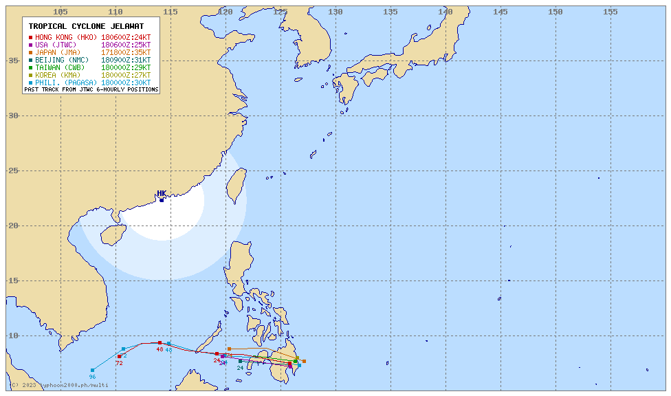
| Where is KABAYAN (JELAWAT)? | As of 5:00 PM PhT today, December 18…0900 GMT:
|
| How strong is it? | Maximum Sustained Winds (1-min avg): 45 kph near the center…Gustiness: 65 kph. |
| Past Movement (06 hrs) | West @ 20 kph, towards Moro Gulf-Zamboanga. |
| Potential Philippine Major Landfall Area(s) |
|
| What Philippine areas will be directly affected? | Heavy to Extreme Rainfall (50 mm to >100 mm expected for 24 hrs):
Damaging Winds (gusts of more than 100 km/hr expected):
|
| Potential Storm Surge/Coastal Flooding Areas+ |
+Waves of 3 meters in height are expected in storm surge-prone areas, particularly in coastal areas where the Tropical Cyclone is headed. Kindly visit the PAGASA Storm Surge Updates for more details. |
| 1-Day Forecast Outlook Summary** |
**Important Note: Please be reminded that the Forecast Outlook changes every 6 hours, and the Day 2 and 3 Forecast Track have an average error of 100 and 250 km respectively… while the wind speed forecast error, averages 35 km/hr per day. Therefore, a turn to the left or right of its future track and changes in its wind speed must be anticipated from time to time. |
| Other Storm’s Meteorological Information |
|
| Disclaimer: Information based on data collected by Typhoon2000 (T2k) shall not be taken as official data. Weather information broadcasted and distributed by PAGASA remains as official data. Typhoon2000 (T2k) shall not be responsible for the private use and reliance of its weather information. | |
Issued by: David Michael V. Padua for Typhoon2000 (T2k)
Typhoon2000 (T2K) Integrated Multi-Agency Tracks
For more info visit: (http://www.typhoon2000.ph/multi/?name=JELAWAT)
PAGASA TROPICAL CYCLONE WIND SIGNAL
:: Now Lowered.
Image/Screenshot Source: DOST-PAGASA (https://bagong.pagasa.dost.gov.ph/tropical-cyclone/severe-weather-bulletin)


