


TROPICAL DISTURBANCE (LPA) OBET STORMWATCH NO. 01Issued at: 2:30 PM PhT (06:30 GMT) Wednesday, 19 October 2022
Next update: 2:00 PM PhT (06:00 GMT) Thursday, 20 October 2022 |
|
|---|---|
| Current Status and Outlook |
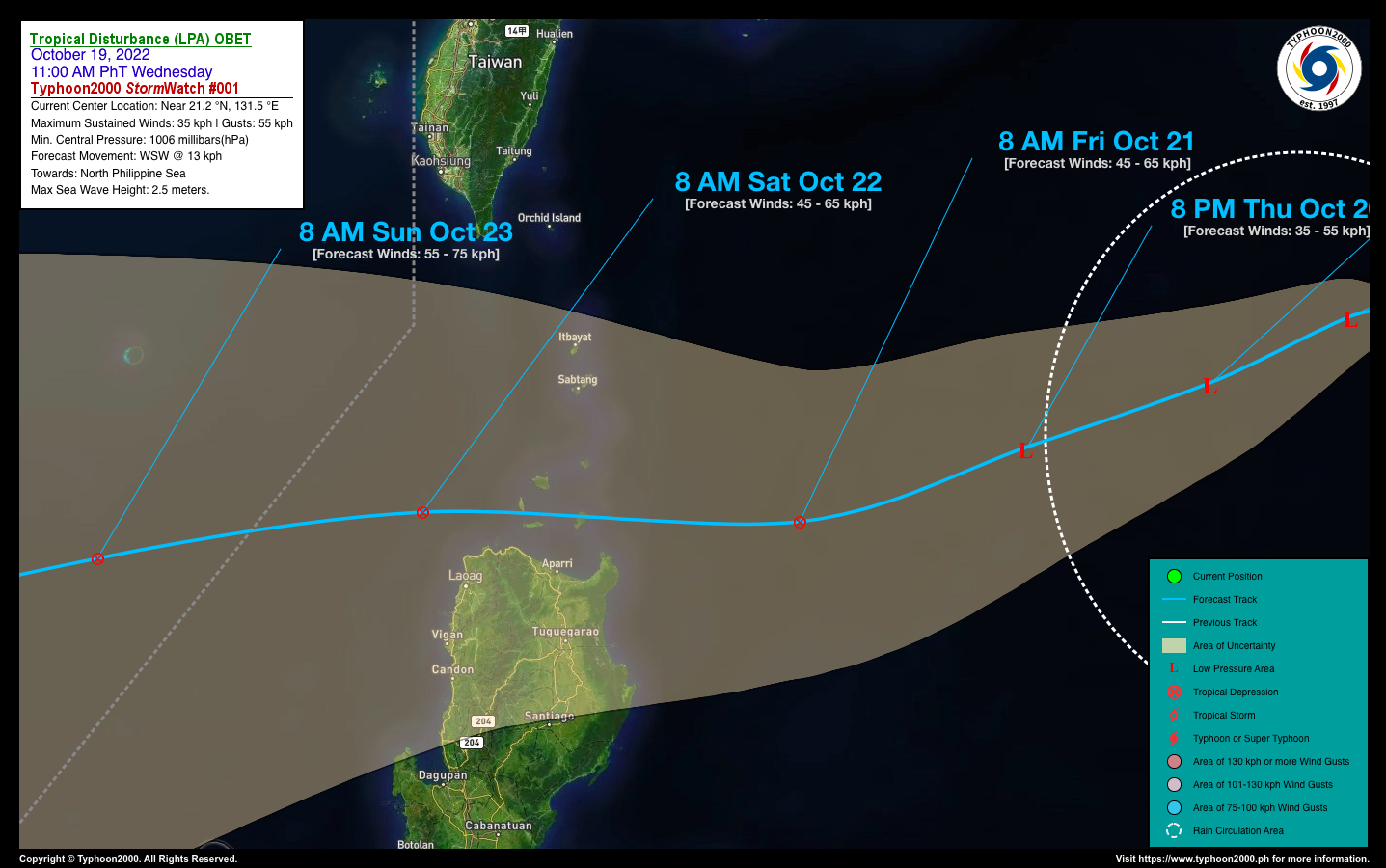
An elongated area of low pressure is slowly developing over the North Philippine Sea and could pose a threat to Extreme Northern Luzon this weekend. This LPA is now named locally by PAGASA as “OBET” which they considered it already as a Tropical Depression (TD). This disturbance is not yet affecting any part of the country and will be closely monitored for possible development into a Tropical Depression (TD) within the next couple of days. |
| Where is LPA OBET? | As of 11:00 AM PhT today, October 19…0300 GMT:
|
| How strong is it? | Maximum Sustained Winds (1-min avg): 35 kph near the center…Gustiness: 55 kph. |
| Past Movement (06 hrs) | North @ 22 kph, across the North Philippine Sea. |
| Forecast Highlights |
|
| This StormWatch is valid for the next 24 hours.
Information based on data collected by Typhoon2000 (T2k) shall not be taken as official data. Weather information broadcasted and distributed by PAGASA remains as official data. Typhoon2000 (T2k) shall not be responsible for the private use and reliance of its weather information. |
|
Issued by: David Michael V. Padua for Typhoon2000 (T2K)
PAGASA TROPICAL CYCLONE WIND SIGNAL
:: None
Image/Screenshot Source: DOST-PAGASA (https://bagong.pagasa.dost.gov.ph/tropical-cyclone/severe-weather-bulletin)


