

TYPHOON NENENG (NESAT) ADVISORY NO. 07 [FINAL]Issued at: 8:00 PM PhT (12:00 GMT) Sunday, 16 October 2022
|
|
|---|---|
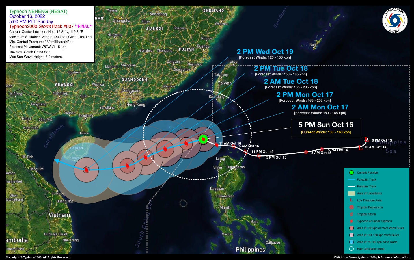
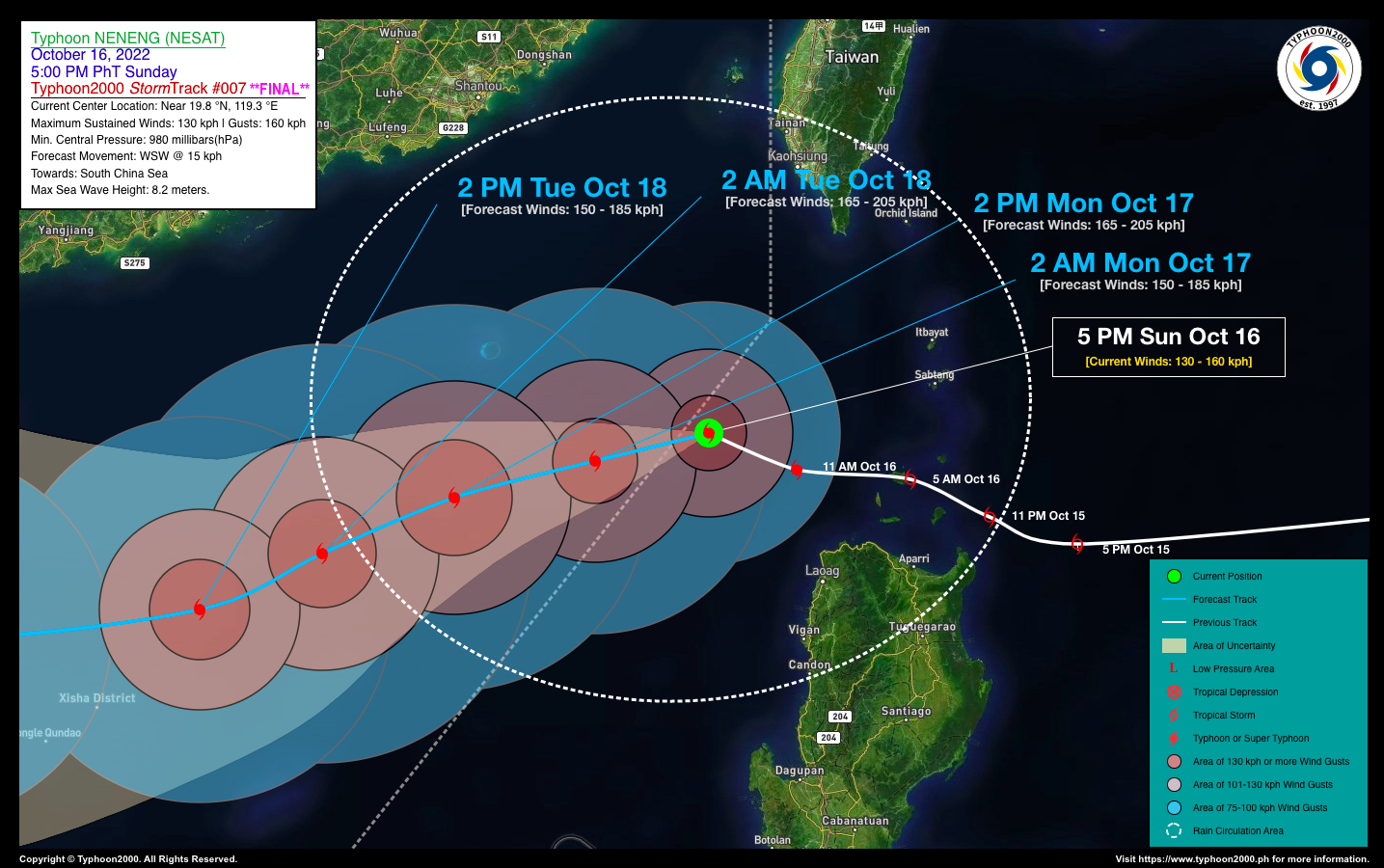
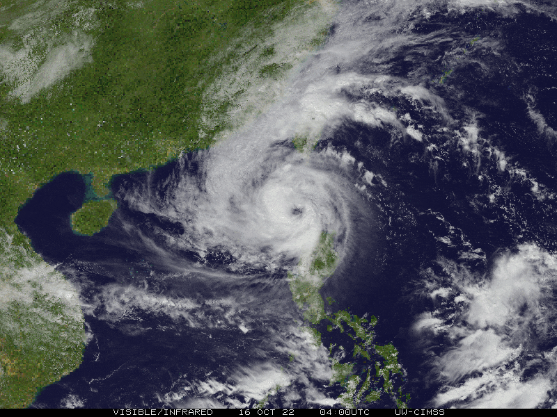
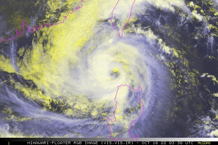
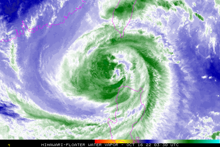
| Current Status & Outlook | Typhoon NENENG (NESAT) is now moving out of the Philippine Area of Responsibility (PAR) after it rapidly intensified during the past six hours. Improving weather conditions will be expected beginning tonight through tomorrow as its southern rainbands has started to depart Extreme Northern Luzon.
This is the Final Advisory on this Tropical Cyclone. 24-hr Outlook: NENENG is forecast to become a Category 2 Typhoon and will move on a generally west-southwest direction across the South China Sea, with a decreasing forward speed of 15 km/hr. |
| Where is NENENG (NESAT)? | As of 5:00 PM PhT today, October 16…0900 GMT:
|
| How strong is it? | Maximum Sustained Winds (1-min avg): 130 kph near the center…Gustiness: 160 kph. |
| Past Movement (06 hrs) | West-Northwest @ 19 kph, towards the West Philippine & South China Seas. |
| Potential Philippine Major Landfall Area(s) |
|
| What Philippine areas will be directly affected? | Heavy to Extreme Rainfall (50 mm to >100 mm expected for 24 hrs):
Damaging Winds (expected gusts of 100 kph or more):
|
| Potential Storm Surge/Coastal Flooding Areas+ |
+Waves of 2 to 3 meters in height are expected in storm surge-prone areas, particularly in coastal areas where the Tropical Cyclone is headed. Kindly visit the PAGASA Storm Surge Updates for more details. |
| 3-Day Forecast Outlook Summary** |
**Important Note: Please be reminded that the Forecast Outlook changes every 6 hours, and the Day 2 and 3 Forecast Track have an average error of 100 and 250 km respectively… while the wind speed forecast error, averages 35 km/hr per day. Therefore, a turn to the left or right of its future track and changes in its wind speed must be anticipated from time to time. |
| Other Storm’s Meteorological Information |
|
| Disclaimer: Information based on data collected by Typhoon2000 (T2k) shall not be taken as official data. Weather information broadcasted and distributed by PAGASA remains as official data. Typhoon2000 (T2k) shall not be responsible for the private use and reliance of its weather information. | |
Issued by: David Michael V. Padua for Typhoon2000 (T2k)
Typhoon2000 (T2K) Integrated Multi-Agency Tracks

For complete details, visit: http://www.typhoon2000.ph/multi/?name=NESAT
PAGASA TROPICAL CYCLONE WIND SIGNAL
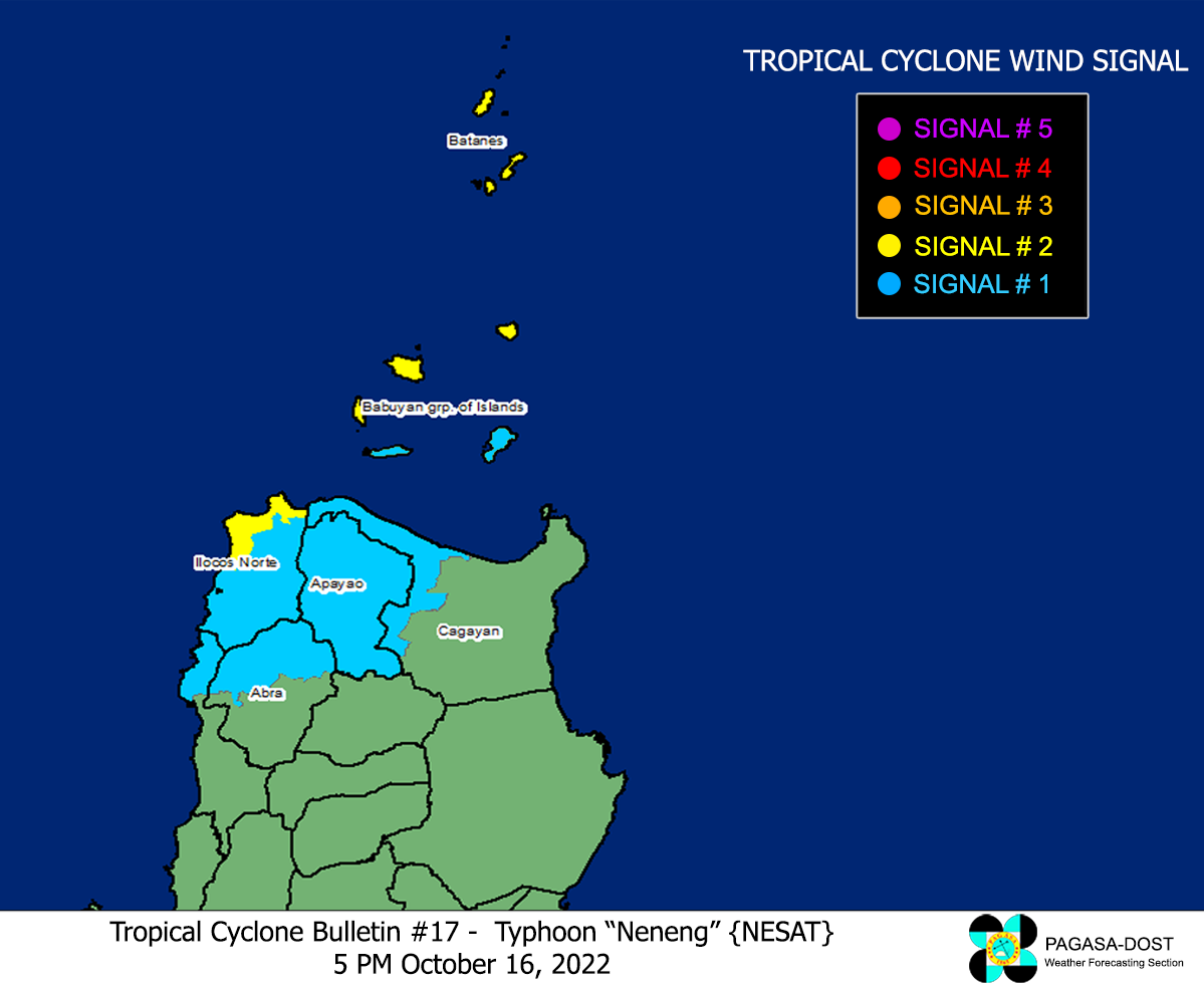
Image/Screenshot Source: DOST-PAGASA (https://bagong.pagasa.dost.gov.ph/tropical-cyclone/severe-weather-bulletin)


