
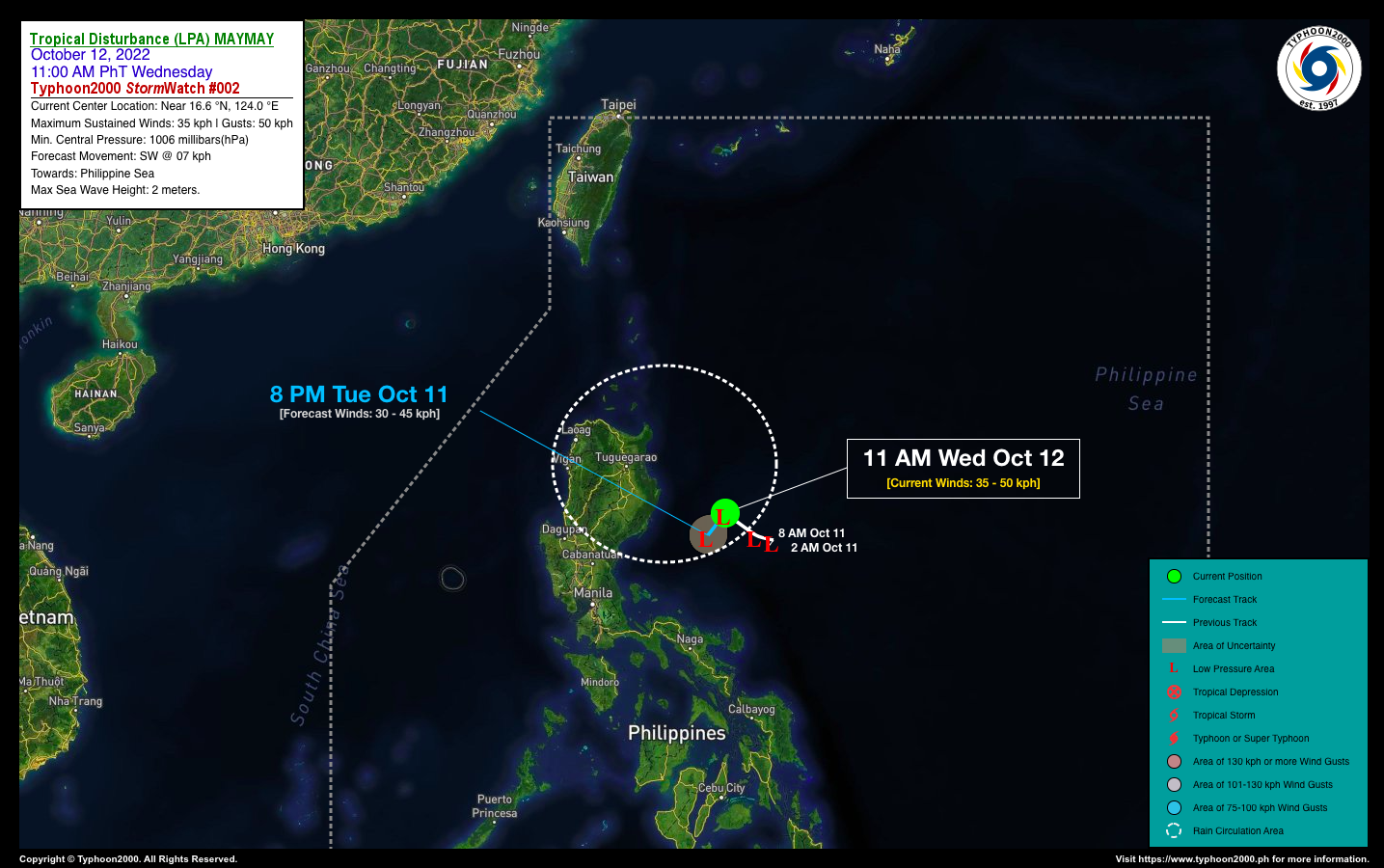


TROPICAL DISTURBANCE (LPA) MAYMAY STORMWATCH NO. 02Issued at: 2:00 PM PhT (06:00 GMT) Wednesday, 12 October 2022
Next update: 2:00 PM PhT (06:00 GMT) Thursday, 13 October 2022 |
|
|---|---|
| Current Status and Outlook |
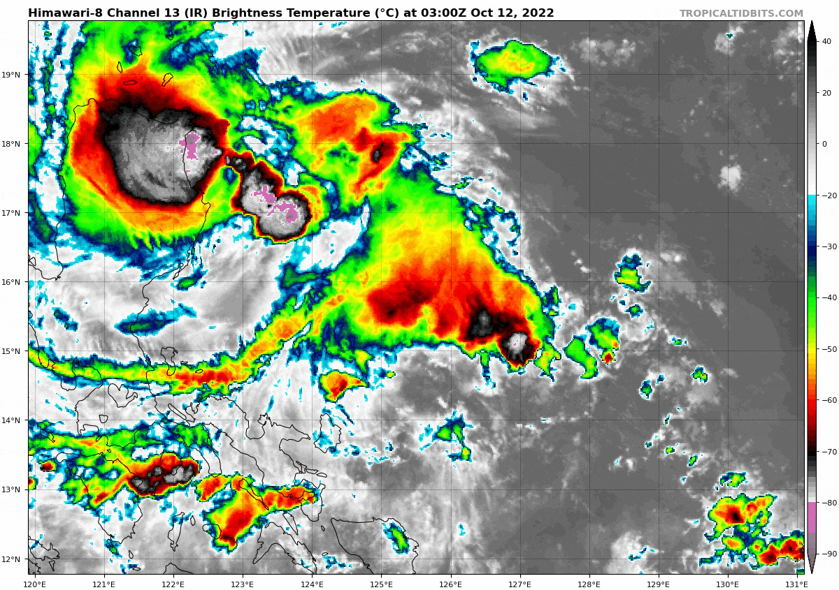
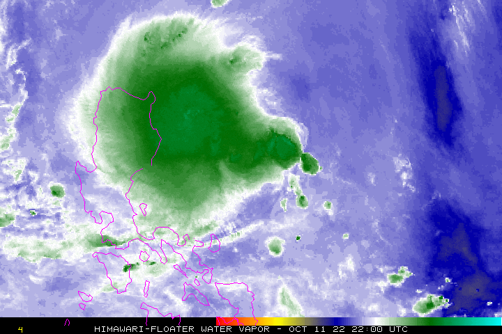
Tropical Disturbance (LPA) MAYMAY continues to fight for survival as its circulation remains disorganized and quasi-stationary, with most of its thick northwestern rain-cloud convection fluctuating over Cagayan Valley. Occasional light to moderate to at times heavy rains will prevail across the region with high risk of flooding and landslides. This disturbance together with the enhanced Northeast Monsoon (Amihan) will continue to affect the coastal waters of Extreme Northern Luzon especially along the Batanes and Babuyan Group. Wind gusts of up to 65 kph with rough seas will prevail, making it dangerous to sea crafts and fishing vessels. For updates on PAGASA Wind Signals see graphic at the bottom of this StormWatch. |
| Where is LPA MAYMAY? | As of 11:00 AM PhT Today, October 12…0300 GMT:
|
| How strong is it? | Maximum Sustained Winds (1-min avg): 35 kph near the center…Gustiness: 50 kph. |
| Past Movement (06 hrs) | West-Northwest @ 09 kph, across the Central Philippine Sea. |
| Forecast Highlights |
|
| This StormWatch is valid for the next 24 hours.
Information based on data collected by Typhoon2000 (T2k) shall not be taken as official data. Weather information broadcasted and distributed by PAGASA remains as official data. Typhoon2000 (T2k) shall not be responsible for the private use and reliance of its weather information. |
|
Issued by: David Michael V. Padua for Typhoon2000 (T2K)
PAGASA TROPICAL CYCLONE WIND SIGNAL

Image/Screenshot Source: DOST-PAGASA (https://bagong.pagasa.dost.gov.ph/tropical-cyclone/severe-weather-bulletin)


