

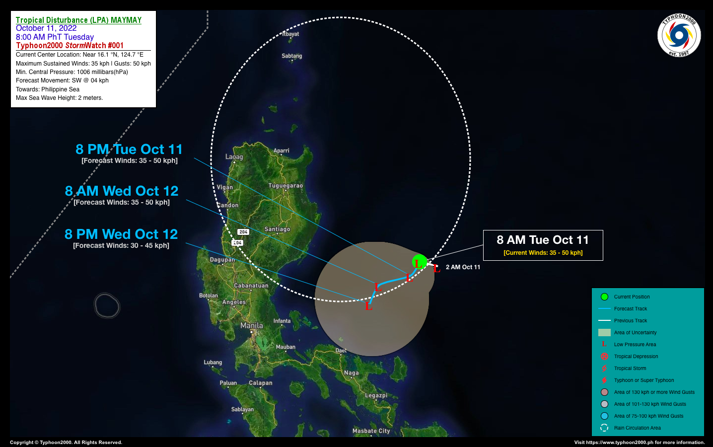


TROPICAL DISTURBANCE (LPA) MAYMAY STORMWATCH NO. 01Issued at: 12:00 PM PhT (04:00 GMT) Tuesday, 11 October 2022
Next update: 12:00 PM PhT (04:00 GMT) Wednesday, 12 October 2022 |
|
|---|---|
| Current Status and Outlook |
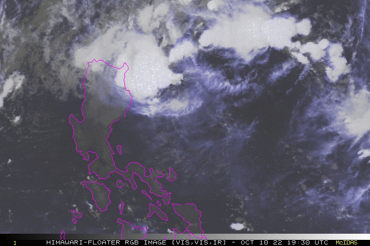
A slow-moving Tropical Disturbance (LPA) near the coastal waters of Aurora is enhancing the first surge of the Northeast Monsoon (Amihan) across Extreme Northern Luzon. This disturbance is currently struggling to organize due to an unfavorable atmospheric wind environment. The Global Typhoon Models (GTM) continues to show little development on this system with complete dissipation in 48 hours. Meanwhile, PAGASA has upgraded this system into a Tropical Depression with the local name “MAYMAY”. Occasional rains and thunderstorms with gale-force winds reaching 60 kph will be expected across the monsoon affected areas of Extreme Northern Luzon. For updates on PAGASA Wind Signals see graphic at the bottom of this StormWatch. |
| Where is LPA MAYMAY? | As of 8:00 AM PhT Today, October 11…0000 GMT:
|
| How strong is it? | Maximum Sustained Winds (1-min avg): 35 kph near the center…Gustiness: 50 kph. |
| Past Movement (06 hrs) | West @ 07 kph, across the Central Philippine Sea. |
| Forecast Highlights |
|
| This StormWatch is valid for the next 24 hours.
Information based on data collected by Typhoon2000 (T2k) shall not be taken as official data. Weather information broadcasted and distributed by PAGASA remains as official data. Typhoon2000 (T2k) shall not be responsible for the private use and reliance of its weather information. |
|
Issued by: David Michael V. Padua for Typhoon2000 (T2K)
PAGASA TROPICAL CYCLONE WIND SIGNAL
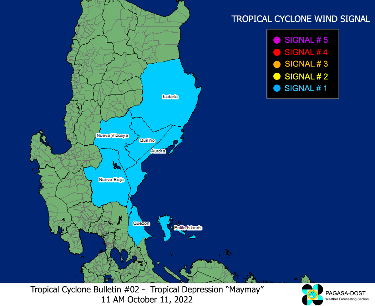
Image/Screenshot Source: DOST-PAGASA (https://bagong.pagasa.dost.gov.ph/tropical-cyclone/severe-weather-bulletin)


