


TYPHOON KARDING (NORU) ADVISORY NO. 13 [FINAL]Issued at: 8:00 PM PhT (12:00 GMT) Monday, 26 September 2022
|
|
|---|---|
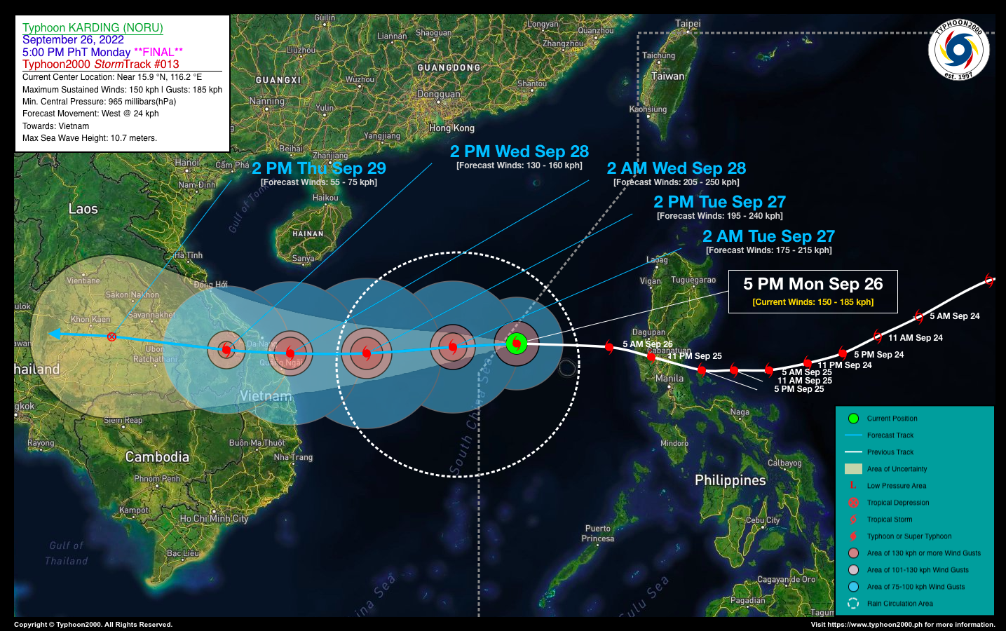
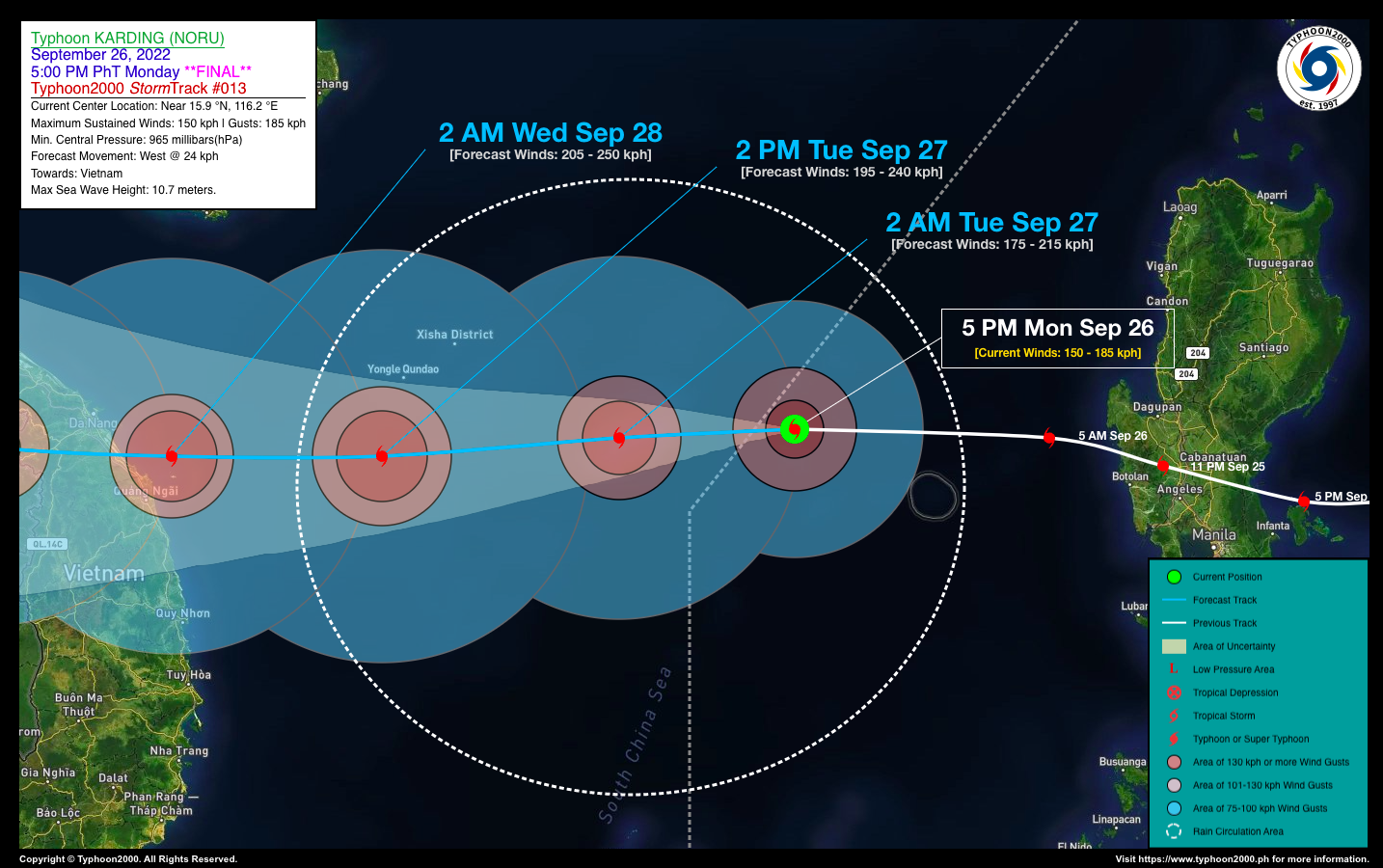
| Current Status & Outlook | Typhoon KARDING [NORU] re-organizing over the West Philippine Sea as it grows in size…about to exit the Philippine Area of Responsibility (PAR).
This will be the last advisory on this Tropical Cyclone. 24-hr Outlook: TY KARDING is forecast to continue re-intensifying while over the South China Sea and could reach Category 3 status by tomorrow afternoon. It will maintain its westward track towards Vietnam, and will eventually make landfall near Da Nang City within the next 36 hours. Meanwhile, this typhoon will continue to enhance the Southwest Monsoon (Habagat) bringing scattered to occasional rains and thunderstorms across CaLaBaRZon, Metro Manila, MiMaRoPa, Kalayaan Island Group, Sulu Archipelago, and Western Visayas tonight and tomorrow. |
| Where is KARDING (NORU)? | As of 5:00 PM PhT today, September 26…0900 GMT:
|
| How strong is it? | Maximum Sustained Winds (1-min avg): 150 kph near the center…Gustiness: 185 kph. |
| Past Movement (06 hrs) | West-Northwest @ 27 kph, towards Vietnam. |
| Potential Philippine Major Landfall Area(s) |
|
| What Philippine areas will be directly affected? | Heavy to Extreme Rainfall (50 mm to >100 mm expected for 24 hrs):
Damaging Winds (gusts of more than 100 km/hr expected):
|
| Potential Storm Surge/Coastal Flooding Areas+ |
+Waves of 2 to 3 meters in height are expected in storm surge-prone areas, particularly in coastal areas where the Tropical Cyclone is headed. Kindly visit the PAGASA Storm Surge Updates for more details. |
| 2-Day Forecast Outlook Summary** |
**Important Note: Please be reminded that the Forecast Outlook changes every 6 hours, and the Day 2 and 3 Forecast Track have an average error of 100 and 250 km respectively… while the wind speed forecast error, averages 35 km/hr per day. Therefore, a turn to the left or right of its future track and changes in its wind speed must be anticipated from time to time. |
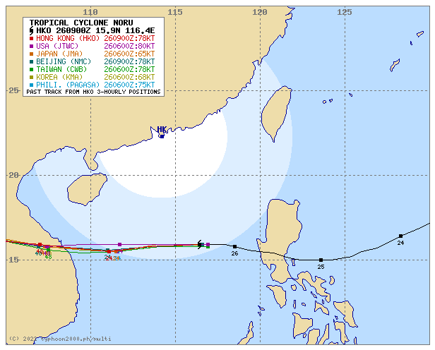
| Other Storm’s Meteorological Information |
|
| Information based on data collected by Typhoon2000 (T2k) shall not be taken as official data. Weather information broadcasted and distributed by PAGASA remains as official data. Typhoon2000 (T2k) shall not be responsible for the private use and reliance of its weather information. | |
Issued by: David Michael V. Padua for Typhoon2000 (T2k)
Typhoon2000 (T2K) Integrated Multi-Agency Tracks
PAGASA TROPICAL CYCLONE WIND SIGNAL
:: All Wind Signals Now Lifted.
Image/Screenshot Source: DOST-PAGASA (https://bagong.pagasa.dost.gov.ph/tropical-cyclone/severe-weather-bulletin)


