

SEVERE TROPICAL STORM JULIAN (MAYSAK) STORMWATCH NO. 02Issued at: 1:00 PM PhT (05:00 GMT) Saturday, 29 August 2020
Next update: 1:00 PM PhT (05:00 GMT) Sunday, 30 August 2020 |
|
|---|---|
| Current Status and Outlook |
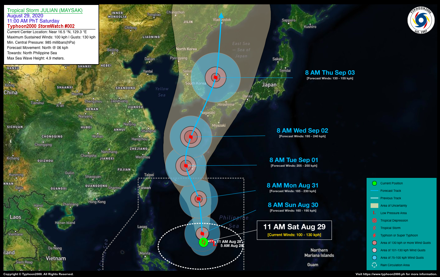
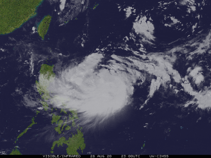
JULIAN grew rapidly into a Severe Tropical Storm (STS) as its large elongated circulation overwhelm most parts of the Philippine Sea. It remained quasi-stationary over the past 24 hours, and is now named internationally as “MAYSAK”, a kind of Cambodian tree. For the next couple of days, STS JULIAN (MAYSAK) is forecast to accelerate northward across the North Philippine Sea, and shall leave the northern border of the Philippine Area of Responsibility (PAR) by late Monday evening (Aug 31). *This storm is expected to enhance the Westerly and Southwesterly Surface Windflows and bring cloudy skies with isolated to scattered rain showers and thunderstorms across the Western Philippines. Meanwhile, its Trough will continue to bring cloudy conditions with some isolated rain showers and thunderstorms across the Bicol Region and Central Luzon today. |
| Where is JULIAN (MAYSAK)? | As of 11:00 AM PhT today, August 29…0300 GMT. The center was located over the northern part of the Central Philippine Sea (near 16.5°N 129.3°E), about 770 km east of Casiguran, Aurora or 786 km east-southeast of Santa Ana, Cagayan. |
| How strong is it? | Maximum Sustained Winds (1-min avg): 100 kph near the center…Gustiness: 130 kph. |
| Past Movement (06 hrs) | Southwest @ 03 kph (Quasi-Stationary), towards the North Philippine Sea. |
| Forecast Highlights |
|
| Information based on data collected by Typhoon2000 (T2k) shall not be taken as official data. Weather information broadcasted and distributed by PAGASA remains as official data. Typhoon2000 (T2k) shall not be responsible for the private use and reliance of its weather information. | |
Issued by: David Michael V. Padua for T2K


