


TYPHOON JULIAN (MAYSAK) STORMWATCH NO. 03Issued at: 1:00 PM PhT (05:00 GMT) Sunday, 30 August 2020
Next update: 1:00 PM PhT (05:00 GMT) Monday, 31 August 2020 |
|
|---|---|
| Current Status and Outlook |
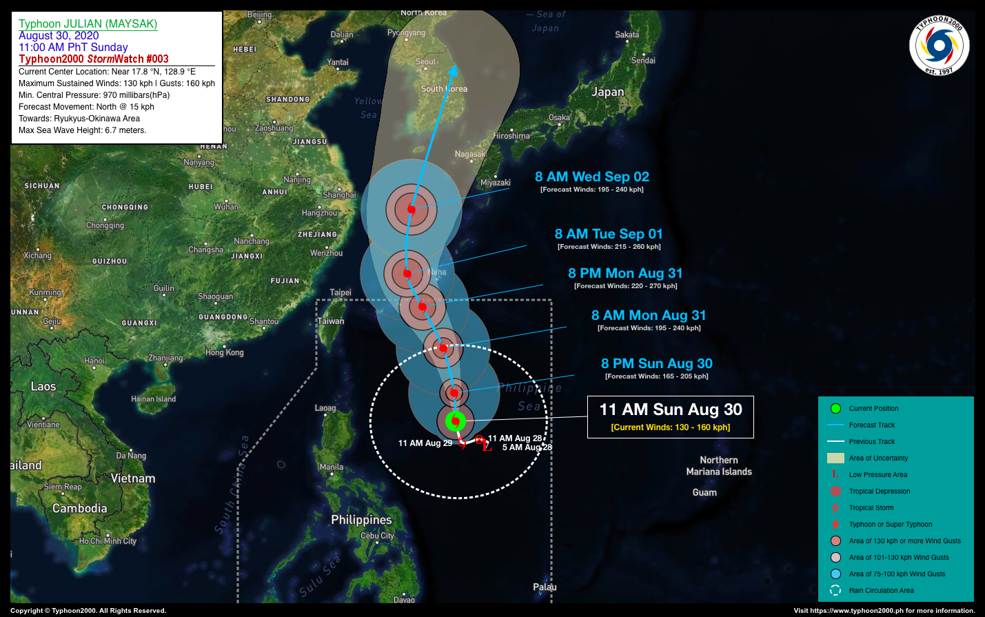
JULIAN (MAYSAK) has rapidly intensified into a Typhoon (TY) and is now starting to move north towards the Southern Islands of Japan, after stalling over the north-central part of the Philippine Sea for two (2) days. It is forecast to exit the northern border of the Philippine Area of Responsibility (PAR) by tomorrow evening (Aug 31). *This typhoon is expected to enhance the Westerly and Southwesterly Surface Windflows and bring cloudy skies with scattered to widepread rain showers and thunderstorms across the western sections of Luzon and Visayas including MiMaRoPa and Sulu Archipelago. Meanwhile, its Trough will continue to bring mostly cloudy conditions with some isolated rain showers and thunderstorms across Northern Luzon and the coastal areas of Northern & Eastern Bicol Region today. |
| Where is JULIAN (MAYSAK)? | As of 11:00 AM PhT today, August 30…0300 GMT. The center was located over the northernmost part of the Central Philippine Sea (near 17.8°N 128.9°E), about 695 km east of Palanan, Isabela or 717 km east of Santa Ana, Cagayan. |
| How strong is it? | Maximum Sustained Winds (1-min avg): 130 kph near the center…Gustiness: 160 kph. |
| Past Movement (06 hrs) | North @ 15 kph, towards the Ryukyus-Okinawa Area. |
| Forecast Highlights |
|
| Information based on data collected by Typhoon2000 (T2k) shall not be taken as official data. Weather information broadcasted and distributed by PAGASA remains as official data. Typhoon2000 (T2k) shall not be responsible for the private use and reliance of its weather information. | |
Issued by: David Michael V. Padua for T2K


