
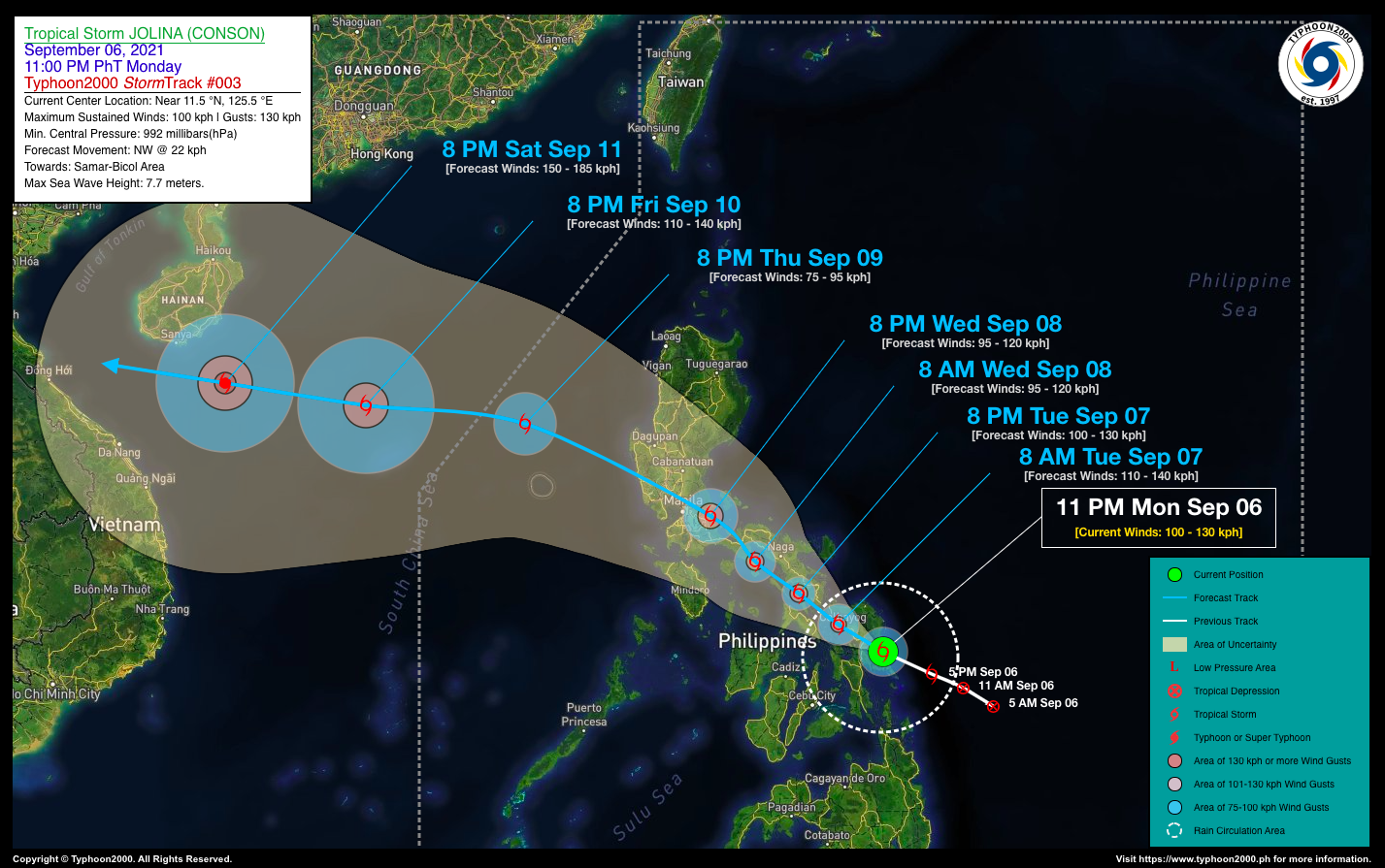
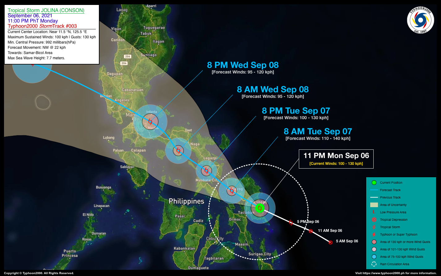
SEVERE TROPICAL STORM JOLINA (CONSON) ADVISORY NO. 03Issued at: 1:00 AM PhT (17:00 GMT) Tuesday, 07 September 2021
Next update: 7:00 AM PhT (23:00 GMT) Tuesday, 07 September 2021 |
|
|---|---|
| Current Status & Outlook | JOLINA (CONSON) becomes a Severe Tropical Storm (STS) and has started traversing Samar Island, after making landfall in the vicinity of Hernani, Eastern Samar between 10-11 PM last night. Stormy weather will continue to prevail across Eastern Visayas…and is expected to reach the southern portions of Bicol Region later today.
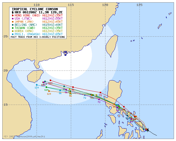
24-hr Outlook: STS JOLINA (CONSON) is forecast to slightly weaken after crossing Samar Island, and will maintain its northwestward track at an accelerated forward speed of 22 km/hr. The storm will be along the southern part of Ragay Gulf tonight passing very close to Ticao and Burias Islands. Meanwhile, Tropical Depression (TD) 19W has intensified slightly as it drifts northward. At 11 PM today, it was located about 1,758 km East of Central Luzon (14.9N 137.9E), with 1-min sustained winds of 55 kph and was moving NNW @ 13 kph. This system is not yet a threat to any part of the country as it is forecast to move towards Taiwan within the next 5 days. |
| Where is JOLINA (CONSON)? | As of 11:00 PM PhT last night, September 06…1500 GMT:
|
| How strong is it? | Maximum Sustained Winds (1-min avg): 100 kph near the center…Gustiness: 130 kph. |
| Past Movement (06 hrs) | West-Northwest @ 22 kph, towards Samar & Southern Bicol Area |
| Potential Philippine Landfall Area(s) |
|
| What Philippine areas will be directly affected? | Heavy to Extreme Rainfall (50 mm to >100 mm expected for 24 hrs):
Damaging Winds (gusts of more than 100 km/hr expected):
|
| Potential Storm Surge/Coastal Flooding Areas+ |
+Waves of 3 meters in height is expected in storm surge-prone areas, particularly in coastal areas on where the Tropical Cyclone is headed. Kindly visit the PAGASA Storm Surge Updates for more details. |
| 3-Day Forecast Outlook Summary** |
**Important Note: Please be reminded that the Forecast Outlook changes every 6 hours, and the Day 2 and 3 Forecast Track have an average error of 100 and 250 km respectively… while the wind speed forecast error, averages 35 km/hr per day. Therefore, a turn to the left or right of its future track and changes in its wind speed must be anticipated from time to time. |
| Other Storm’s Meteorological Information |
|
| Information based on data collected by Typhoon2000 (T2k) shall not be taken as official data. Weather information broadcasted and distributed by PAGASA remains as official data. Typhoon2000 (T2k) shall not be responsible for the private use and reliance of its weather information. | |
Issued by: David Michael V. Padua for Typhoon2000 (T2K)
Typhoon2000 (T2K) Integrated Multi-Agency Tracks
PAGASA TROPICAL CYCLONE WIND SIGNAL
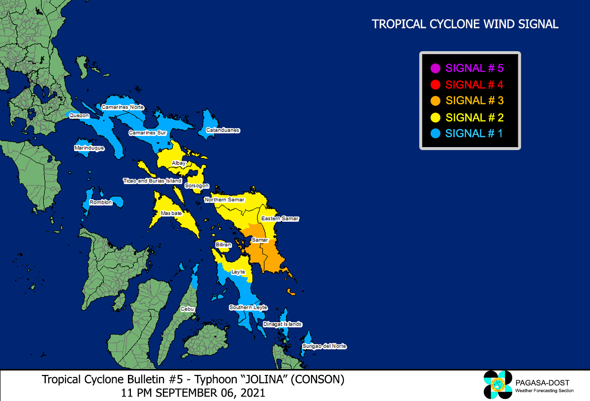
Image/Screenshot Source: DOST-PAGASA (http://bagong.pagasa.dost.gov.ph/tropical-cyclone-bulletin-iframe)


