

TROPICAL DEPRESSION JENNY (KOINU) ADVISORY NO. 01Issued at: 2:00 PM PhT (06:00 GMT) Saturday, 30 Sept 2023
Next update: 8:00 PM PhT (12:00 GMT) Saturday, 30 Sept 2023 |
|
|---|---|
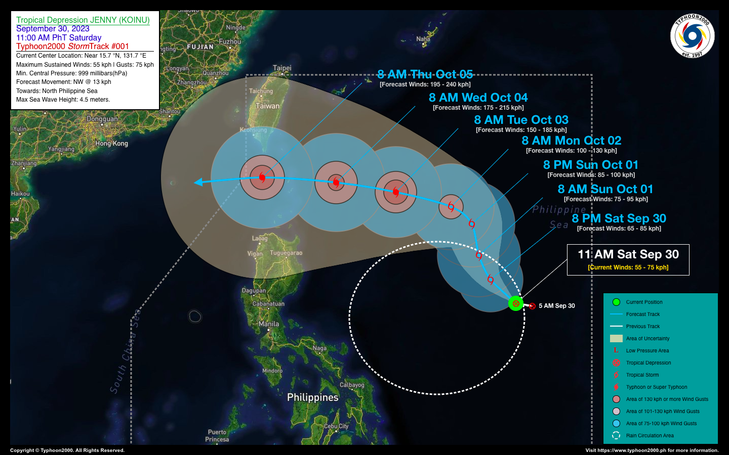
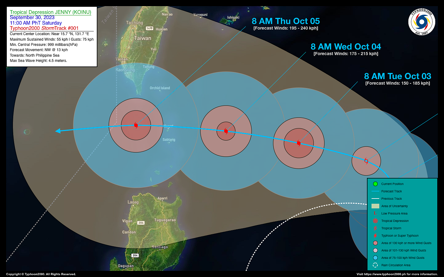
| Current Status & Outlook | Tropical Depression (TD) JENNY (KOINU) newly-formed over the Central Philippine Sea inside the Philippine Area of Responsibility (PAR). This system is likely to become a Tropical Storm (TS) later today with a future track that could bring it over Batanes Group within the next 4-5 days (Oct 4-5).
48-hr Outlook: TD JENNY is forecast to move on a north-northwest direction across the North Philippine Sea between Sunday to Monday (Oct 1-2) while intensifying into a Severe Tropical Storm (STS) on Monday morning. During this outlook, JENNY will not yet affect any part of the country. Meanwhile, the presence of TD JENNY’s Trough (aka. Extension) and the weakening Southwest Monsoon (Habagat) will bring isolated to scattered to at times occasional rain showers and severe thunderstorms across Central & Southern Luzon incl. NCR and Bicol Region, MiMaRoPa, Sulu Archipelago, Visayas, & Western Mindanao beginning today through early next week. It will be more frequent during the afternoon or evening. Please take all necessary precautions against flash floods and landslides incl. lahars that will be brought about by these systems. |
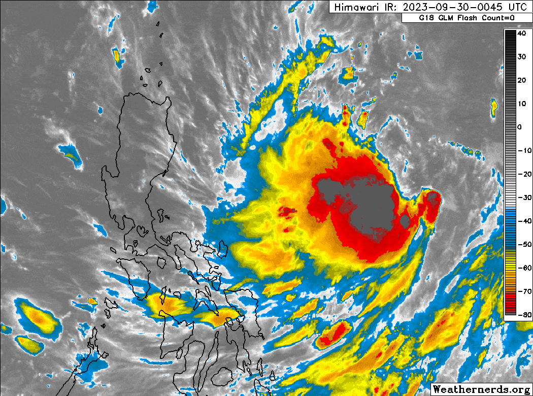
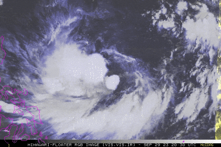
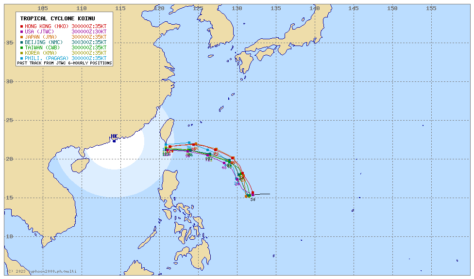
| Where is JENNY (KOINU)? | As of 11:00 AM PhT today, September 30…0300 GMT:
|
| How strong is it? | Maximum Sustained Winds (1-min avg): 55 kph near the center…Gustiness: 75 kph. |
| Past Movement (06 hrs) | West @ 22 kph, across the Central Philippine Sea. |
| Potential Philippine Major Landfall Area(s) |
|
| What Philippine areas will be directly affected? | Heavy to Extreme Rainfall (50 mm to >100 mm expected for 24 hrs):
Damaging Winds (gusts of more than 100 km/hr expected):
|
| Potential Storm Surge/Coastal Flooding Areas+ |
+Waves of 3 meters in height are expected in storm surge-prone areas, particularly in coastal areas where the Tropical Cyclone is headed. Kindly visit the PAGASA Storm Surge Updates for more details. |
| 3-Day Forecast Outlook Summary** |
**Important Note: Please be reminded that the Forecast Outlook changes every 6 hours, and the Day 2 and 3 Forecast Track have an average error of 100 and 250 km respectively… while the wind speed forecast error, averages 35 km/hr per day. Therefore, a turn to the left or right of its future track and changes in its wind speed must be anticipated from time to time. |
| Other Storm’s Meteorological Information |
|
| Disclaimer: Information based on data collected by Typhoon2000 (T2k) shall not be taken as official data. Weather information broadcasted and distributed by PAGASA remains as official data. Typhoon2000 (T2k) shall not be responsible for the private use and reliance of its weather information. | |
Issued by: David Michael V. Padua for Typhoon2000 (T2k)
Typhoon2000 (T2K) Integrated Multi-Agency Tracks
For more info visit: (http://www.typhoon2000.ph/multi/?name=KOINU)
PAGASA TROPICAL CYCLONE WIND SIGNAL
—
Image/Screenshot Source: DOST-PAGASA (https://bagong.pagasa.dost.gov.ph/tropical-cyclone/severe-weather-bulletin)


