

TYPHOON INDAY (MUIFA) STORMWATCH NO. 05Issued at: 8:00 PM PhT (12:00 GMT) Sunday, 11 September 2022
Next update: 8:00 PM PhT (12:00 GMT) Monday, 12 September 2022 |
|
|---|---|
| Current Status and Outlook |
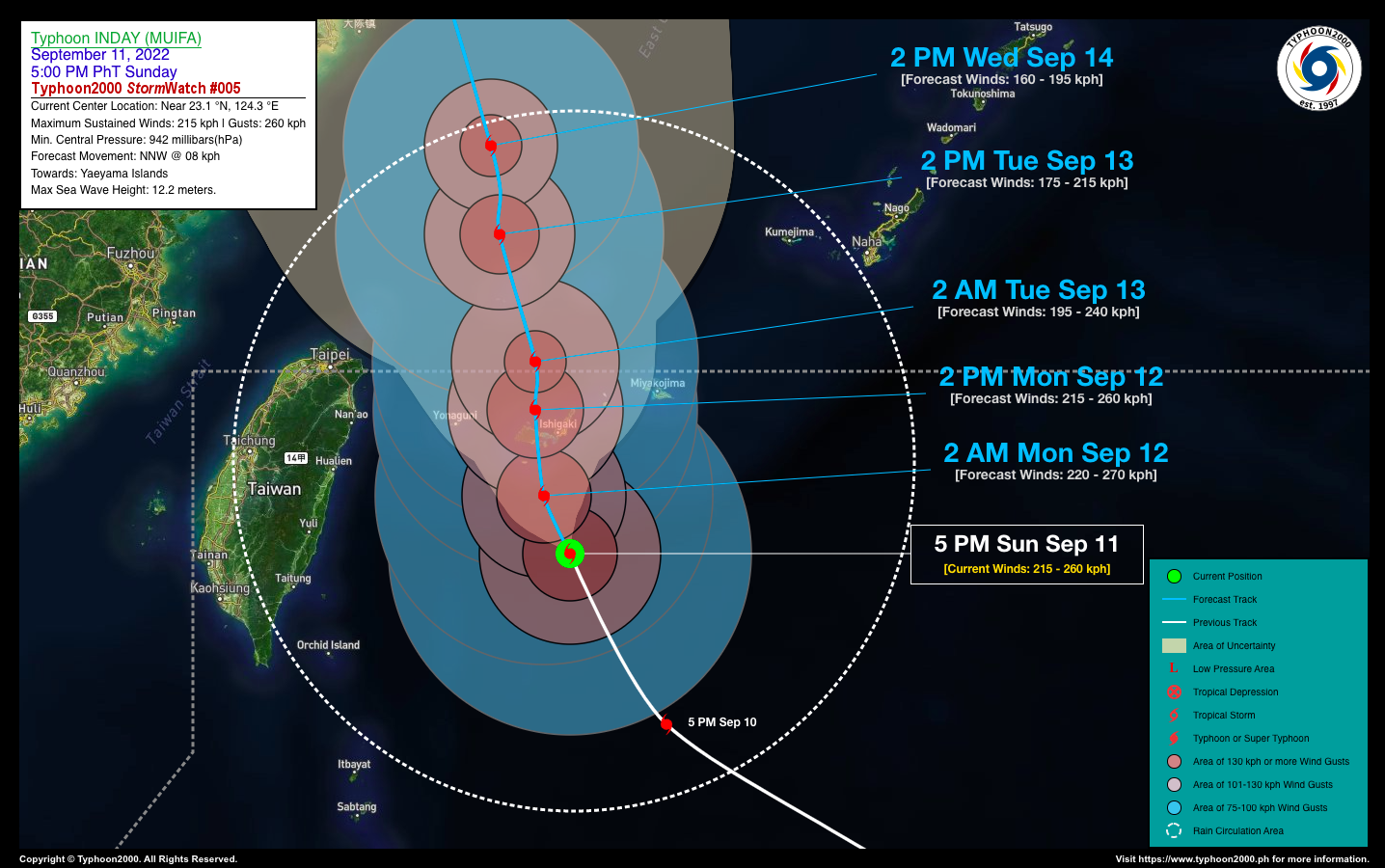
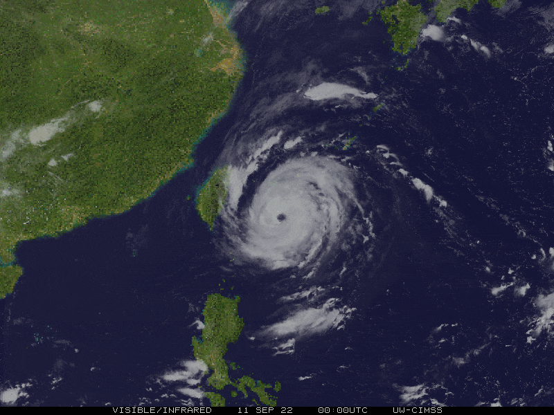
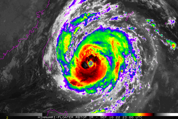
Typhoon INDAY (MUIFA) has slowed down to 06 kph while moving barely north across the East Taiwan Sea…now a strong Category 4 Typhoon, dangerously approaching the Yaeyama Island Group. Meanwhile, no indirect effects are being observed during the passage of this typhoon as the Southwest Monsoon (Habagat) is currently on a break. |
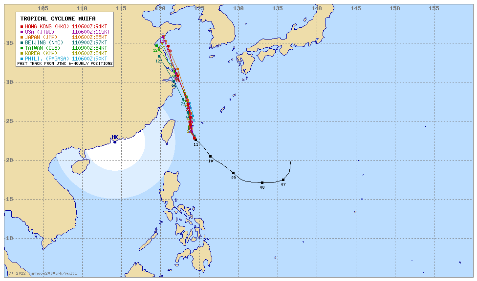
| Where is INDAY (MUIFA)? | As of 5:00 PM PhT today, September 11…0900 GMT:
|
| How strong is it? | Maximum Sustained Winds (1-min avg): 215 kph near the center…Gustiness: 260 kph. |
| Past Movement (06 hrs) | North-Northwest @ 06 kph, towards the Yaeyama Island Group. |
| Forecast Highlights |
|
| This StormWatch is valid for the next 24 hours.
Information based on data collected by Typhoon2000 (T2k) shall not be taken as official data. Weather information broadcasted and distributed by PAGASA remains as official data. Typhoon2000 (T2k) shall not be responsible for the private use and reliance of its weather information. |
|
Issued by: David Michael V. Padua for Typhoon2000 (T2K)
Typhoon2000 (T2K) Integrated Multi-Agency Tracks
PAGASA TROPICAL CYCLONE WIND SIGNAL
:: None ::
Image/Screenshot Source: DOST-PAGASA (https://bagong.pagasa.dost.gov.ph/tropical-cyclone/severe-weather-bulletin)


