


TYPHOON INDAY (MUIFA) STORMWATCH NO. 06 [FINAL]Issued at: 8:00 PM PhT (12:00 GMT) Monday, 12 September 2022
|
|
|---|---|
| Current Status and Outlook |
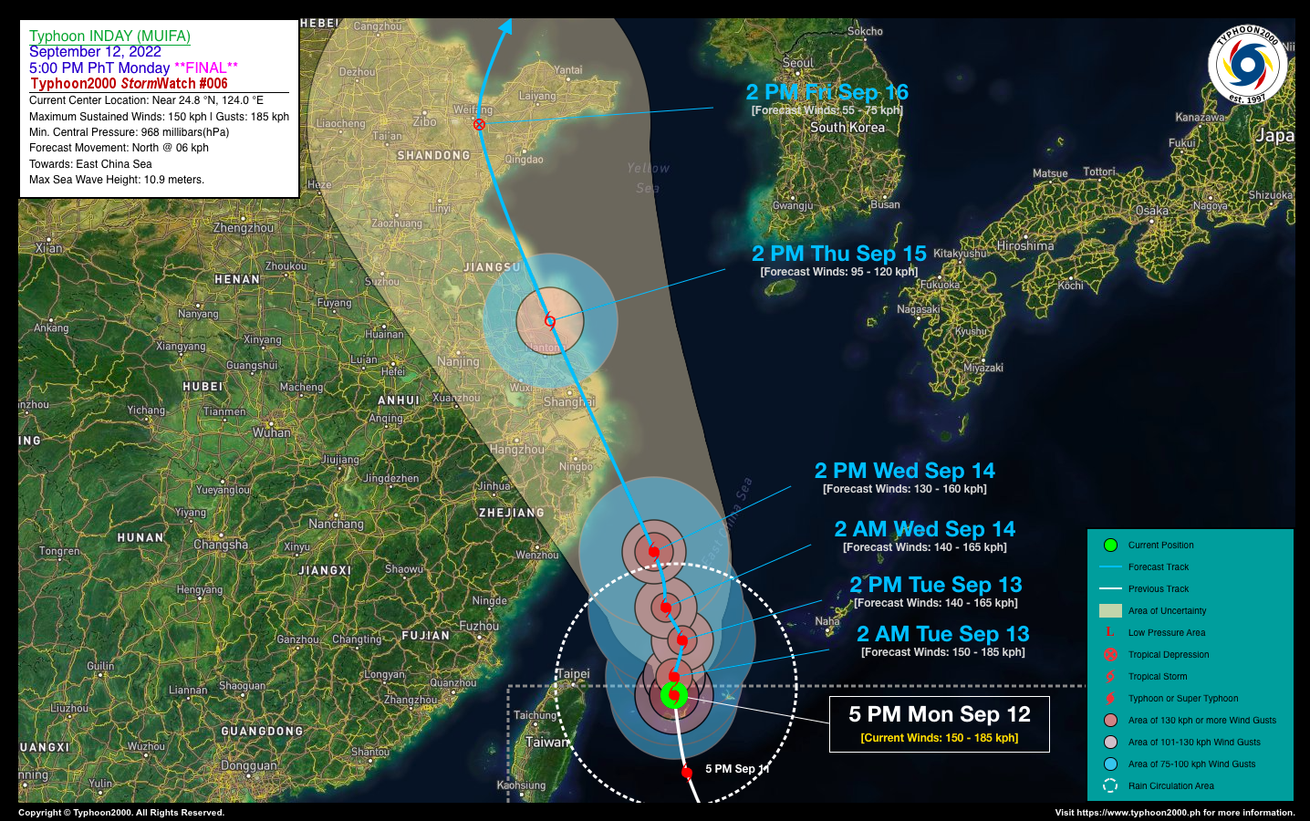
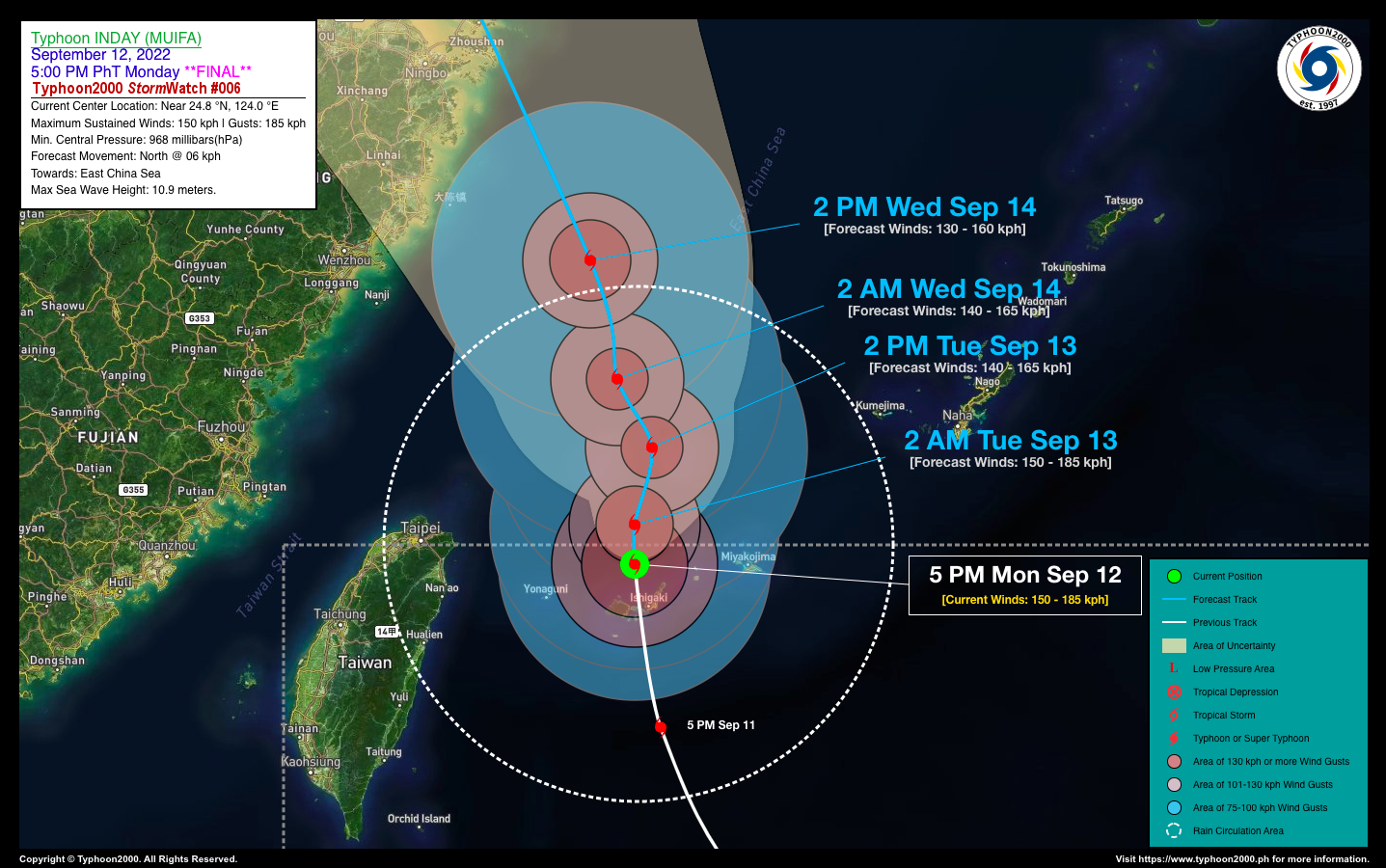
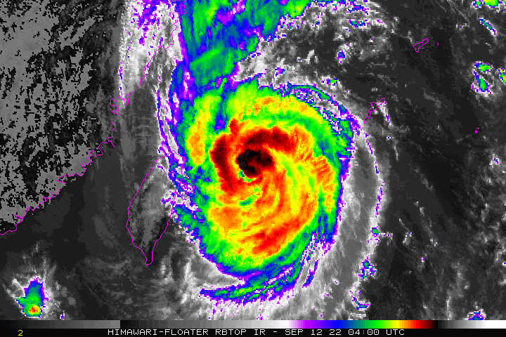
INDAY (MUIFA) has weakened into a Category 1 Typhoon after crossing Yaeyama Islands…about to exit the northern border of the Philippine Area of Responsibility (PAR). This is the Final StormWatch on this Tropical Cyclone. |
| Where is INDAY (MUIFA)? | As of 5:00 PM PhT today, September 12…0900 GMT:
|
| How strong is it? | Maximum Sustained Winds (1-min avg): 150 kph near the center…Gustiness: 185 kph. |
| Past Movement (06 hrs) | North-Northwest @ 06 kph, towards the East China Sea. |
| Forecast Highlights |
|
| Information based on data collected by Typhoon2000 (T2k) shall not be taken as official data. Weather information broadcasted and distributed by PAGASA remains as official data. Typhoon2000 (T2k) shall not be responsible for the private use and reliance of its weather information. | |
Issued by: David Michael V. Padua for Typhoon2000 (T2K)
o
Typhoon2000 (T2K) Integrated Multi-Agency Tracks

o
PAGASA TROPICAL CYCLONE WIND SIGNAL
:: None ::
Image/Screenshot Source: DOST-PAGASA (https://bagong.pagasa.dost.gov.ph/tropical-cyclone/severe-weather-bulletin)


