

TYPHOON INDAY (MUIFA) STORMWATCH NO. 04Issued at: 8:00 PM PhT (12:00 GMT) Saturday, 10 September 2022
Next update: 8:00 PM PhT (12:00 GMT) Sunday, 11 September 2022 |
|
|---|---|
| Current Status and Outlook |
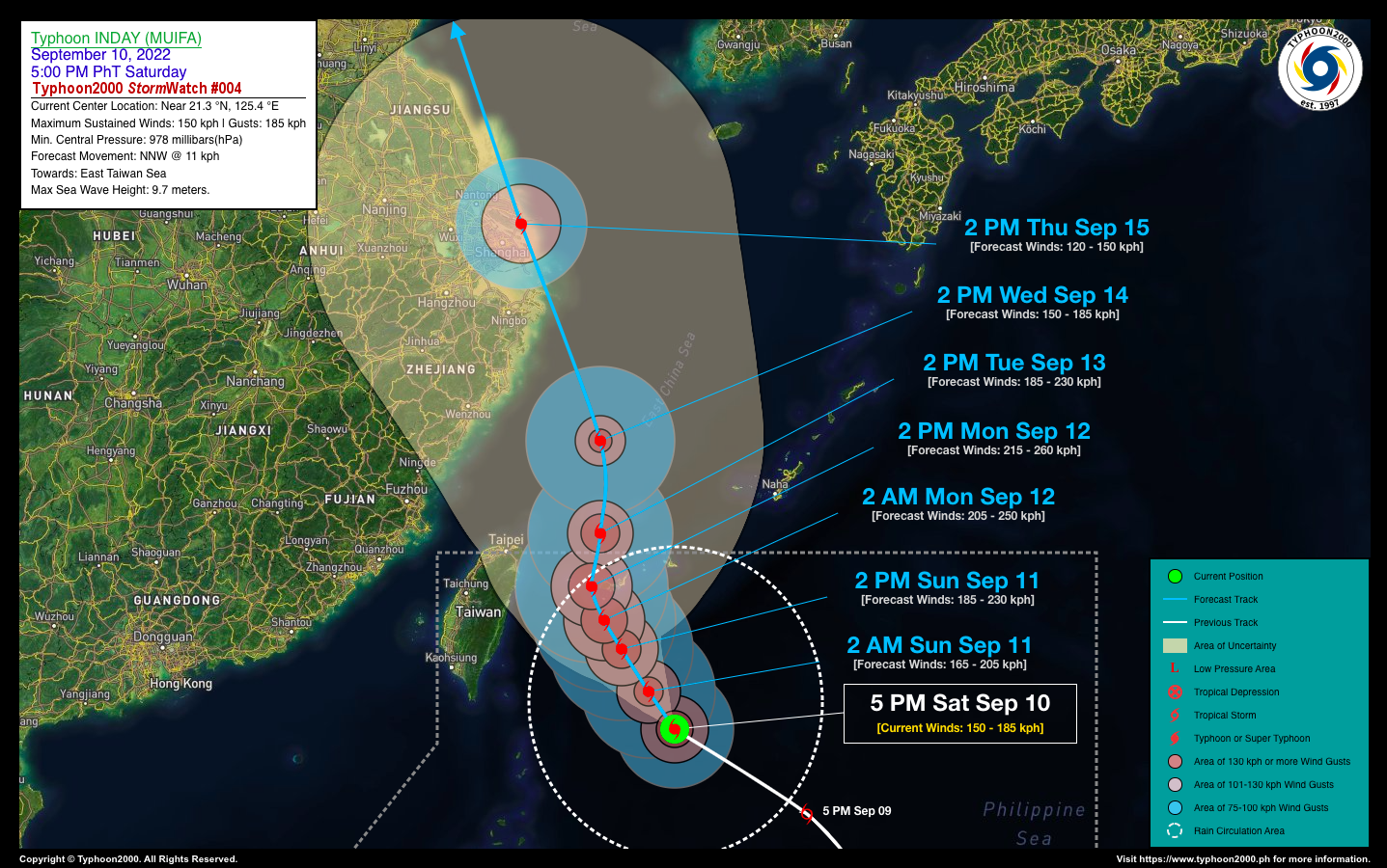
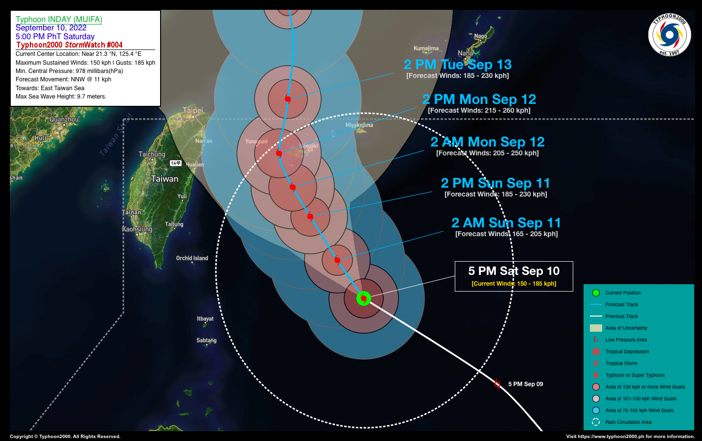
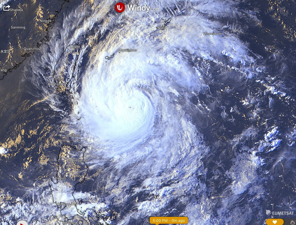
INDAY (MUIFA) has strengthened into a full-blown Typhoon as it moves northwest towards East Taiwan Sea. Its threat to the Philippine Islands remains low. However, its southwesternmost outer rainbands will reach the Batanes and Babuyan Island Group where occasional rain showers and some breezy conditions will be expected this weekend. Meanwhile, a slight enhancement of the Southwest Monsoon (Habagat) will bring isolated to scattered rain showers and thunderstorms across the Western Sections of Central & Southern Luzon including Metro Manila, Mindoro, and Palawan today and tomorrow. |
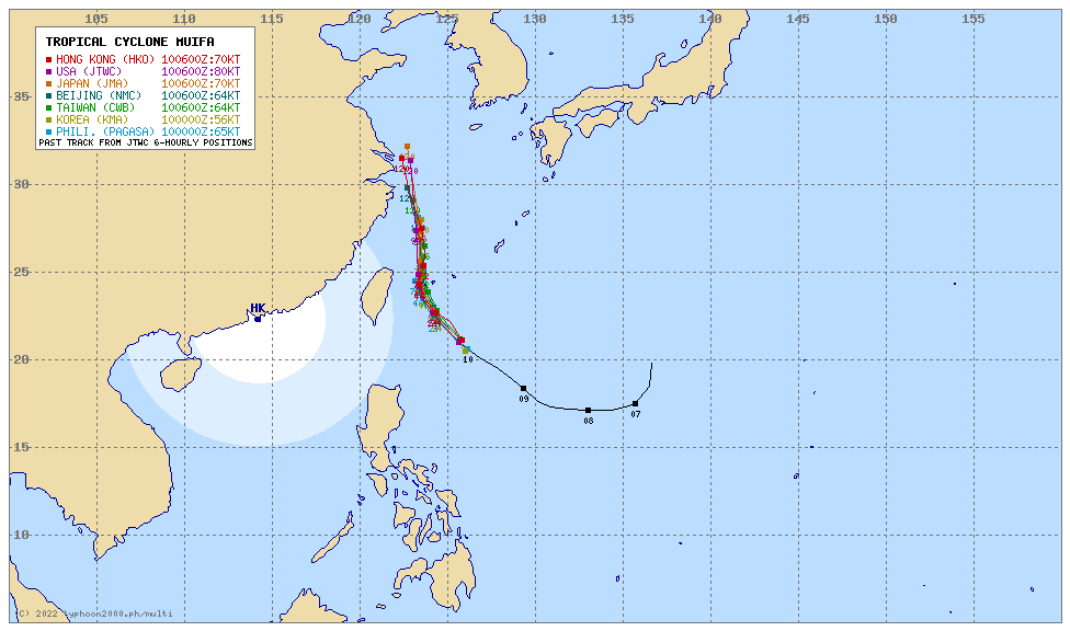
| Where is INDAY (MUIFA)? | As of 5:00 PM PhT today, September 10…0900 GMT:
|
| How strong is it? | Maximum Sustained Winds (1-min avg): 150 kph near the center…Gustiness: 185 kph. |
| Past Movement (06 hrs) | Northwest @ 12 kph, towards the East Taiwan Sea. |
| Forecast Highlights |
|
| This StormWatch is valid for the next 24 hours.
Information based on data collected by Typhoon2000 (T2k) shall not be taken as official data. Weather information broadcasted and distributed by PAGASA remains as official data. Typhoon2000 (T2k) shall not be responsible for the private use and reliance of its weather information. |
|
Issued by: David Michael V. Padua for Typhoon2000 (T2K)
Typhoon2000 (T2K) Integrated Multi-Agency Tracks
PAGASA TROPICAL CYCLONE WIND SIGNAL
:: None ::
Image/Screenshot Source: DOST-PAGASA (https://bagong.pagasa.dost.gov.ph/tropical-cyclone/severe-weather-bulletin)


