
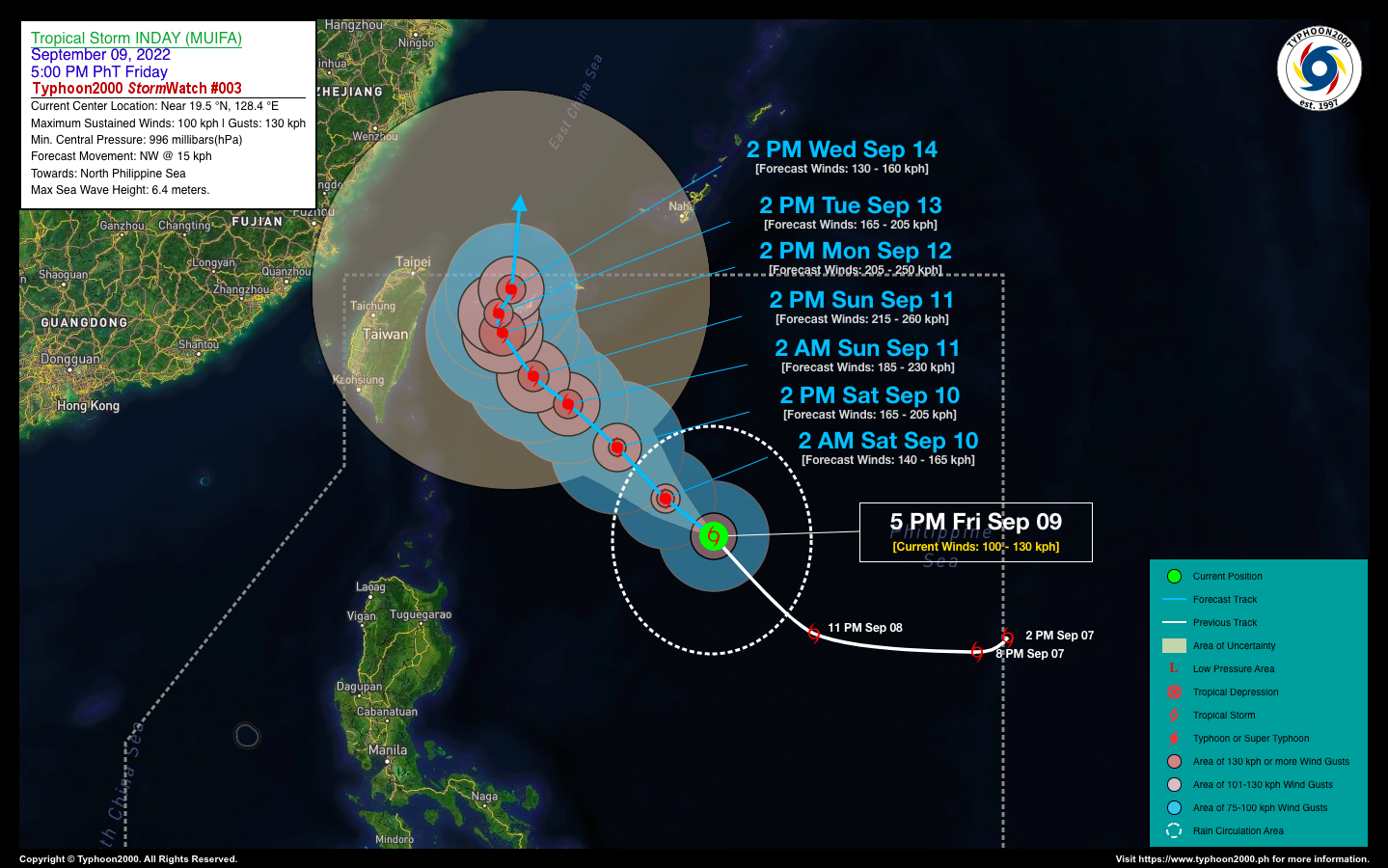
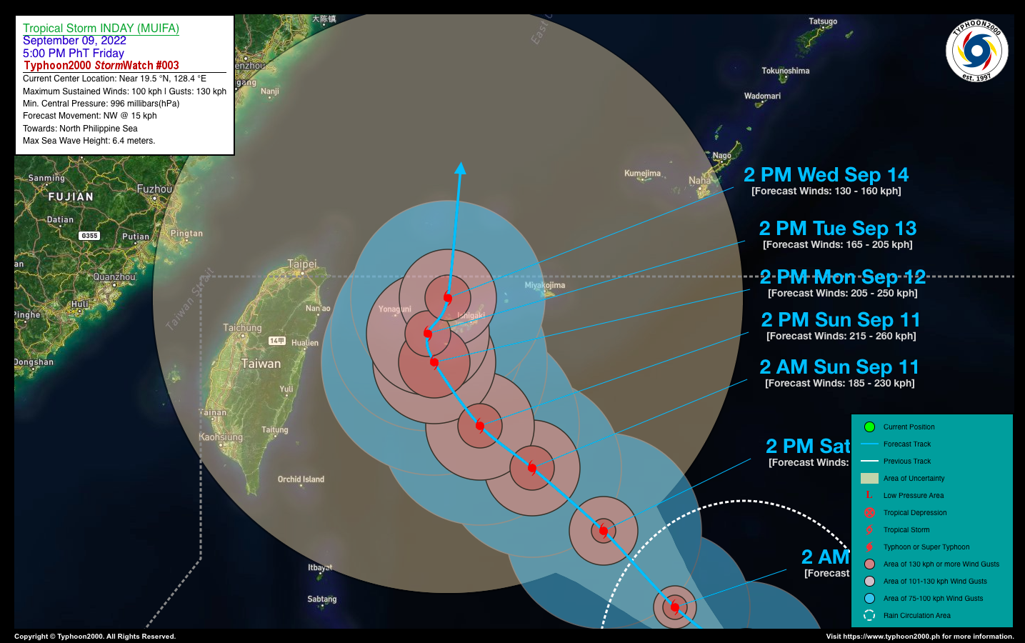
SEVERE TROPICAL STORM INDAY (MUIFA) STORMWATCH NO. 03Issued at: 8:00 PM PhT (12:00 GMT) Friday, 09 September 2022
Next update: 8:00 PM PhT (12:00 GMT) Saturday, 10 September 2022 |
|
|---|---|
| Current Status and Outlook |
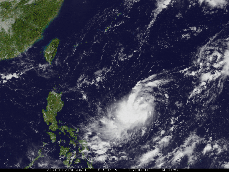
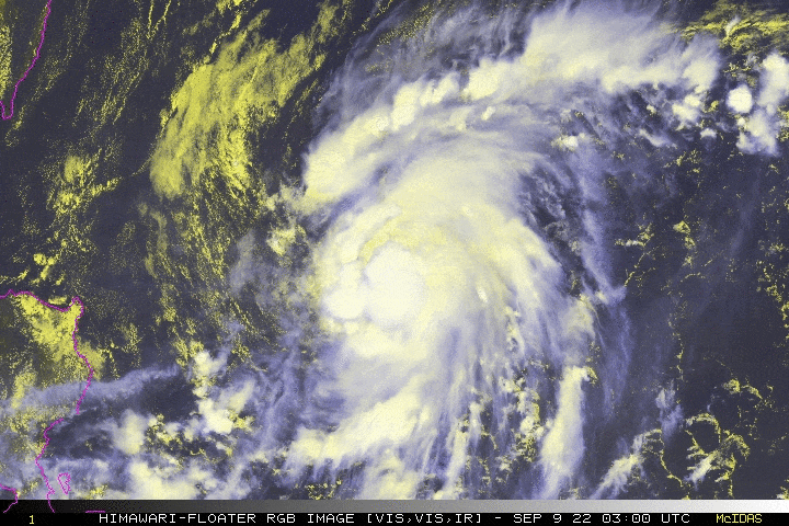
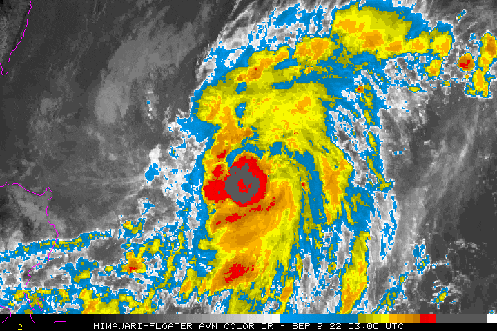
INDAY (MUIFA) has strengthened into a Severe Tropical Storm (STS) during the past 24 hours as it tracks more to the northwest across the North Philippine Sea. The storm is likely to become a Typhoon later tonight or early Saturday. Threat to the Philippines remains low. Its Western Trough (extension) will continue to bring isolated to scattered rain showers and thunderstorms across Bicol Region, CaLaBaRZon, Mindoro & some portions of Central Luzon today. |
| Where is INDAY (MUIFA)? | As of 5:00 PM PhT today, September 09…0900 GMT:
|
| How strong is it? | Maximum Sustained Winds (1-min avg): 100 kph near the center…Gustiness: 130 kph. |
| Past Movement (06 hrs) | Northwest @ 17 kph, across the North Philippine Sea. |
| Forecast Highlights |
|
| This StormWatch is valid for the next 24 hours.
Information based on data collected by Typhoon2000 (T2k) shall not be taken as official data. Weather information broadcasted and distributed by PAGASA remains as official data. Typhoon2000 (T2k) shall not be responsible for the private use and reliance of its weather information. |
|
Issued by: David Michael V. Padua for Typhoon2000 (T2K)
Typhoon2000 (T2K) Integrated Multi-Agency Tracks

PAGASA TROPICAL CYCLONE WIND SIGNAL
:: None ::
Image/Screenshot Source: DOST-PAGASA (https://bagong.pagasa.dost.gov.ph/tropical-cyclone/severe-weather-bulletin)


