


TYPHOON HENRY (HINNAMNOR) STORMWATCH NO. 03Issued at: 2:00 PM PhT (06:00 GMT) Friday, 02 September 2022
Next update: 2:00 PM PhT (06:00 GMT) Saturday, 03 September 2022 |
|
|---|---|
| Current Status and Outlook |
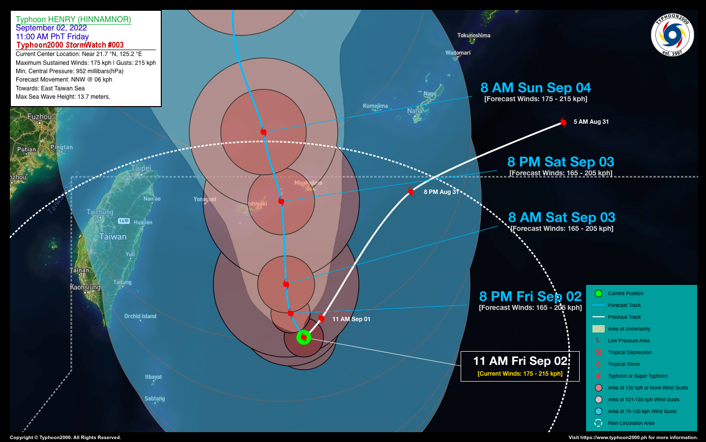
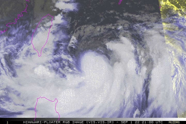
HENRY (HINNAMNOR) is no longer a Super Typhoon (STY) as it weakened rapidly into a Category 2 Typhoon during the past 24 hours. Then, after remaining quasi-stationary early this morning, HENRY is now starting to drift very slowly northwestward across the North Philippine Sea (east of Taiwan’s Southern Tip). Its outer rainbands has expanded across Extreme Northern Luzon bringing occasional rains and gusty winds especially along the Batanes Group. The coastal waters along these areas will be rough and dangerous to small fishing vessels. For the next 2 days (Sept 3-4), the presence of TY HENRY (HINNAMNOR) will continue to enhance the Southwest Monsoon (Habagat) across Ilocos & Cordillera Regions, Western Section of Central Luzon, National Capital Region, MiMaRoPa and Western Visayas incl. Sulu Archipelago. Scattered to occasional rains with thunderstorms and gusty winds of 30-60 kph will be expected across these areas. Risk of flooding and landslides will remain at Medium to High. |
| Where is HENRY (HINNAMNOR)? | As of 11:00 AM PhT today, September 02…0300 GMT:
|
| How strong is it? | Maximum Sustained Winds (1-min avg): 175 kph near the center…Gustiness: 215 kph. |
| Past Movement (06 hrs) | Northwest @ 08 kph, towards the East Taiwan Sea. |
| Forecast Highlights |
|
| This StormWatch is valid for the next 24 hours.
Information based on data collected by Typhoon2000 (T2k) shall not be taken as official data. Weather information broadcasted and distributed by PAGASA remains as official data. Typhoon2000 (T2k) shall not be responsible for the private use and reliance of its weather information. |
|
Issued by: David Michael V. Padua for Typhoon2000 (T2K)
Typhoon2000 (T2K) Integrated Multi-Agency Tracks

PAGASA TROPICAL CYCLONE WIND SIGNAL
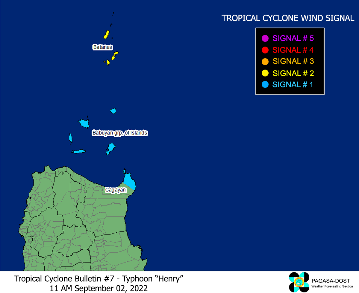
Image/Screenshot Source: DOST-PAGASA (https://bagong.pagasa.dost.gov.ph/tropical-cyclone/severe-weather-bulletin)


