


SUPER TYPHOON HENRY (HINNAMNOR) STORMWATCH NO. 02Issued at: 2:00 PM PhT (06:00 GMT) Thursday, 01 September 2022
Next update: 2:00 PM PhT (06:00 GMT) Friday, 02 September 2022 |
|
|---|---|
| Current Status and Outlook |
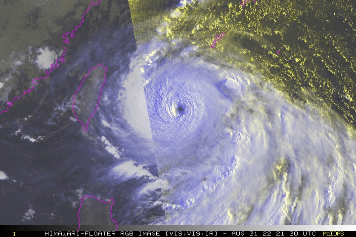
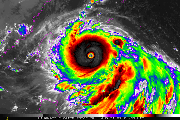
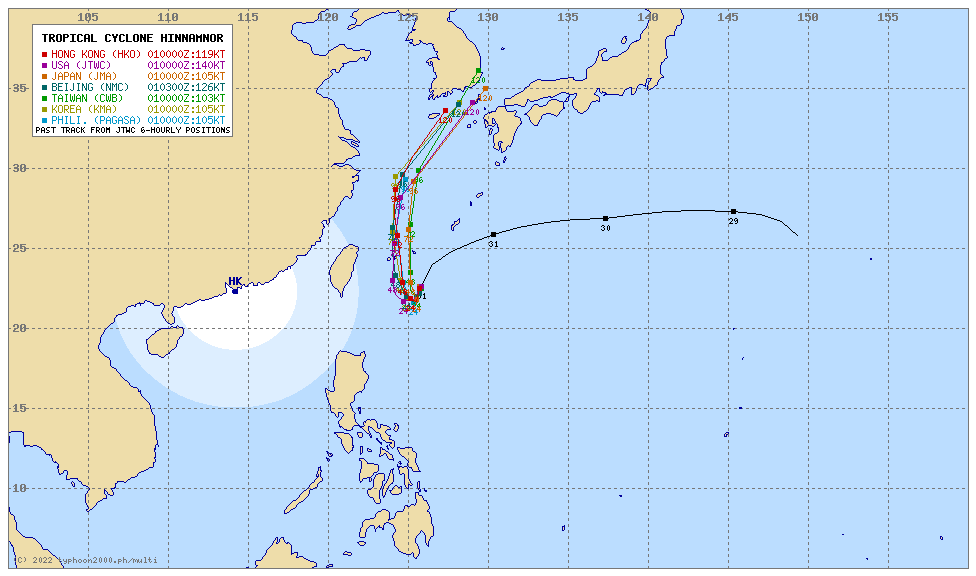
HINNAMNOR is now locally named HENRY as it continues to accelerate southwestward across the North Philippine Sea, regaining Super Typhoon classification. Meanwhile, Tropical Depression (TD) GARDO has dissipated and already been assimilated into the strong circulation of HENRY. The super typhoon is forecast to slow down and remain quasi-stationary for the next 24 hours before heading north towards the Yaeyama-Okinawa Islands Area. Within the next 3 days (Sept 2-4), the presence of STY HENRY (HINNAMNOR) will enhance the Southwest Monsoon (Habagat) across Western Luzon, MiMaRoPa and Western Visayas incl. Sulu Archipelago. Scattered to occasional rains with thunderstorms and gusty winds of 30-50 kph will be expected across the above monsoon-affected areas. Risk of flooding and landslides will be Medium to High. |
| Where is HENRY (HINNAMNOR)? | As of 11:00 AM PhT today, September 01…0600 GMT:
|
| How strong is it? | Maximum Sustained Winds (1-min avg): 260 kph near the center…Gustiness: 315 kph. |
| Past Movement (06 hrs) | South-Southwest @ 20 kph, across the North Philippine Sea. |
| Forecast Highlights |
|
| This StormWatch is valid for the next 24 hours.
Information based on data collected by Typhoon2000 (T2k) shall not be taken as official data. Weather information broadcasted and distributed by PAGASA remains as official data. Typhoon2000 (T2k) shall not be responsible for the private use and reliance of its weather information. |
|
Issued by: David Michael V. Padua for Typhoon2000 (T2K)


