
STY HINNAMNOR-TD GARDO STORMWATCH NO. 01Issued at: 2:00 PM PhT (06:00 GMT) Wednesday, 31 August 2022
Next update: 2:00 PM PhT (06:00 GMT) Thursday, 01 September 2022 |
|
|---|---|
| Current Status and Outlook |
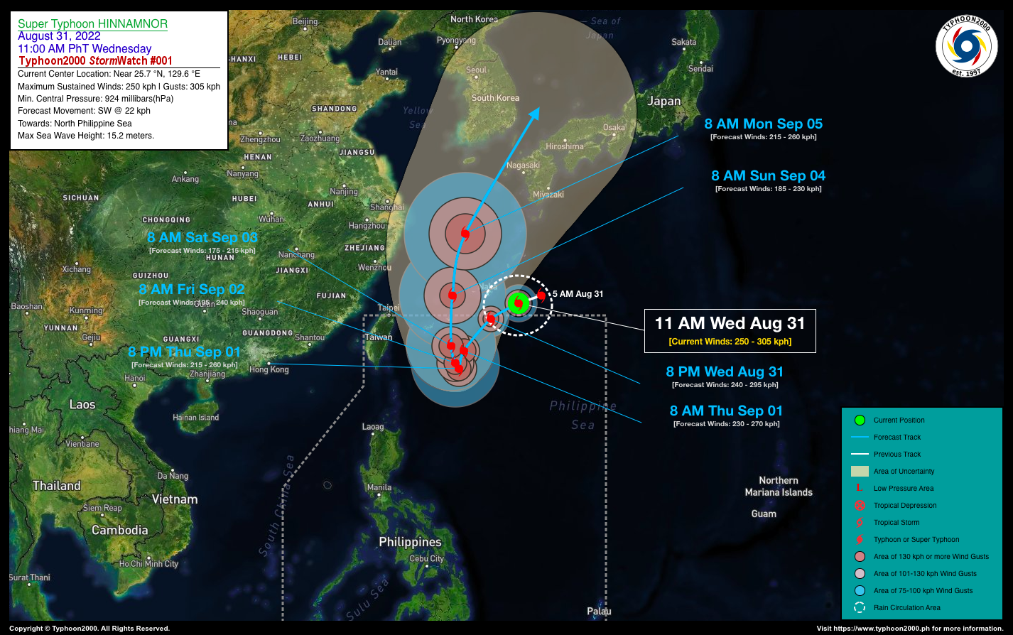
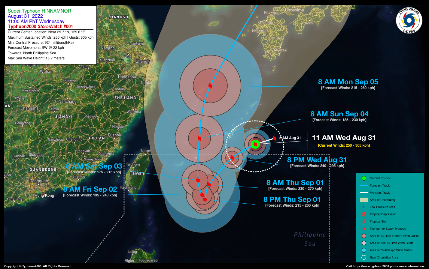
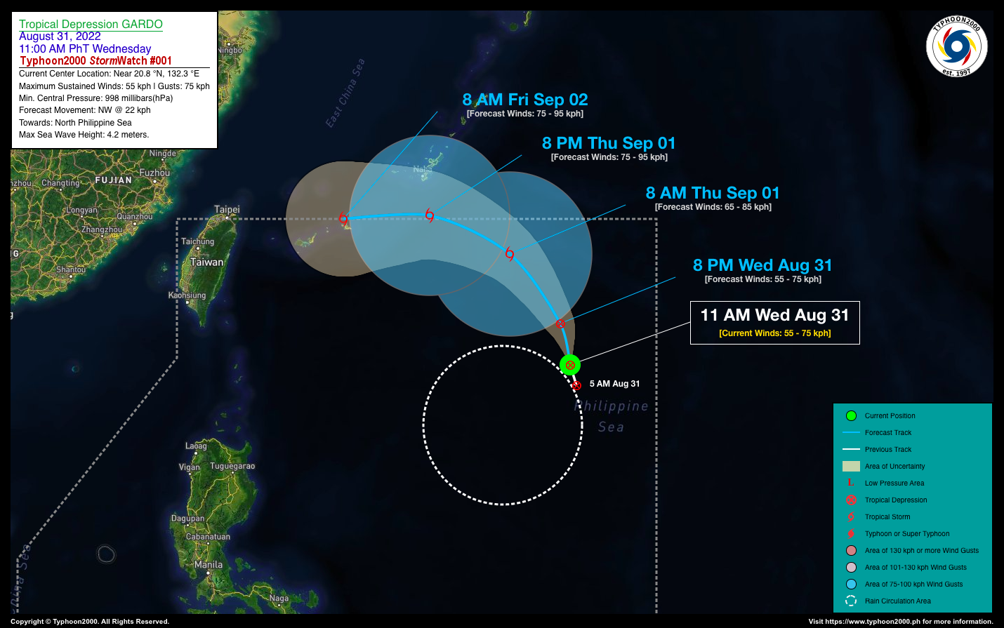
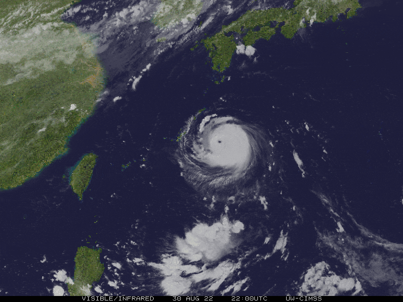
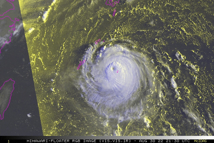
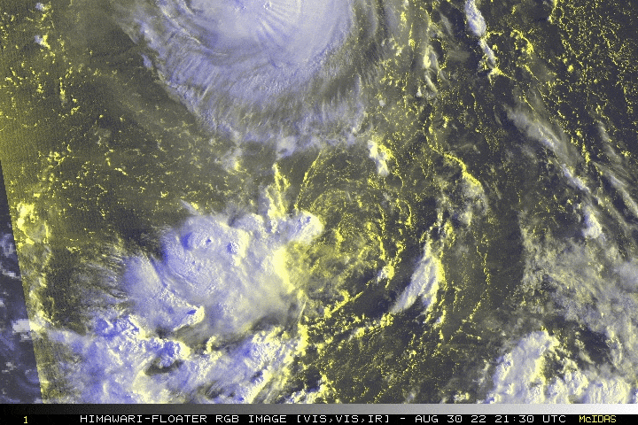
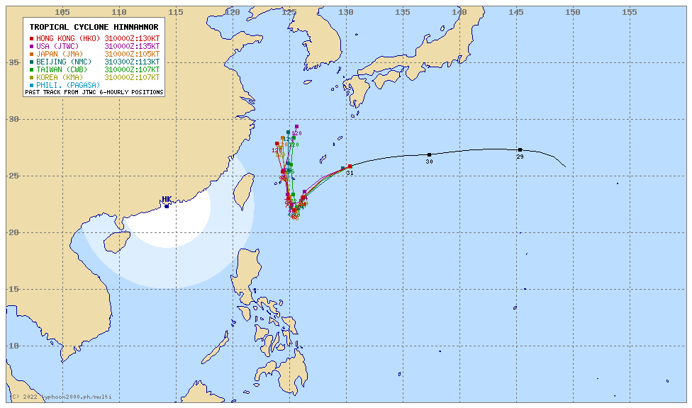
A small Super Typhoon with the global name “Hinnamnor” passing near Okinawa is about to enter the Northern Border of the Philippine Area of Responsibility (PAR). Meanwhile, alongside to its south a disorganized Tropical Depression with local name “Gardo” is having a binary interaction (aka. Fujiwhara Effect) and may eventually be absorbed into the circulation of Hinnamnor within the next 24 to 48 hours. Within the next 3 days (Sept 1-3), the presence of these two tropical cyclones will enhance the Southwest Monsoon (Habagat) across Luzon, MiMaRoPa and Western Visayas incl. Sulu Archipelago. Scattered to occasional rains with thunderstorms especially in the afternoon and evening will be expected across the above monsoon-affected areas. |
| Where is HINNAMNOR? | As of 11:00 AM PhT today, August 31…0300 GMT:
|
| Where is GARDO? | As of 11:00 AM PhT today, August 31…0300 GMT:
|
| How strong are they? | Hinnamnor’s Maximum Sustained Winds (1-min avg): 250 kph near the center…Gustiness: 305 kph. Gardo’s Maximum Sustained Winds (1-min avg): 55 kph near the center…Gustiness: 75 kph. |
| Past Movements (06 hrs) | Hinnamnor: West-Southwest @ 24 kph, across the North Philippine Sea. Gardo: North @ 09 kph, across the North Philippine Sea. |
| Forecast Highlights |
|
| This StormWatch is valid for the next 24 hours.
Information based on data collected by Typhoon2000 (T2k) shall not be taken as official data. Weather information broadcasted and distributed by PAGASA remains as official data. Typhoon2000 (T2k) shall not be responsible for the private use and reliance of its weather information. |
|
Issued by: David Michael V. Padua for Typhoon2000 (T2K)


