

TYPHOON HENRY (HINNAMNOR) STORMWATCH NO. 04Issued at: 2:00 PM PhT (06:00 GMT) Saturday, 03 September 2022
Next update: 2:00 PM PhT (06:00 GMT) Sunday, 04 September 2022 |
|
|---|---|
| Current Status and Outlook |
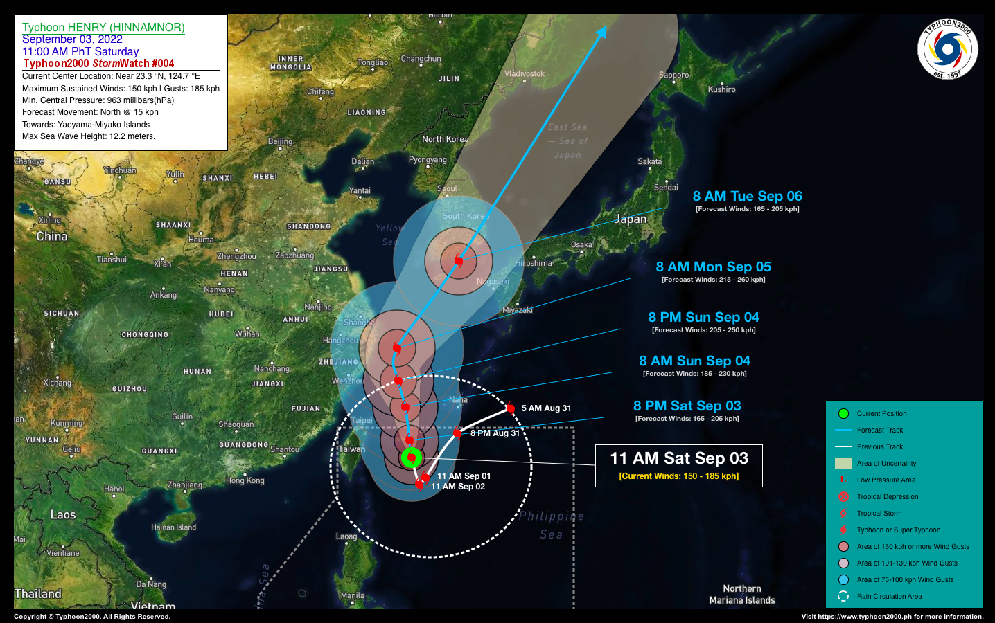
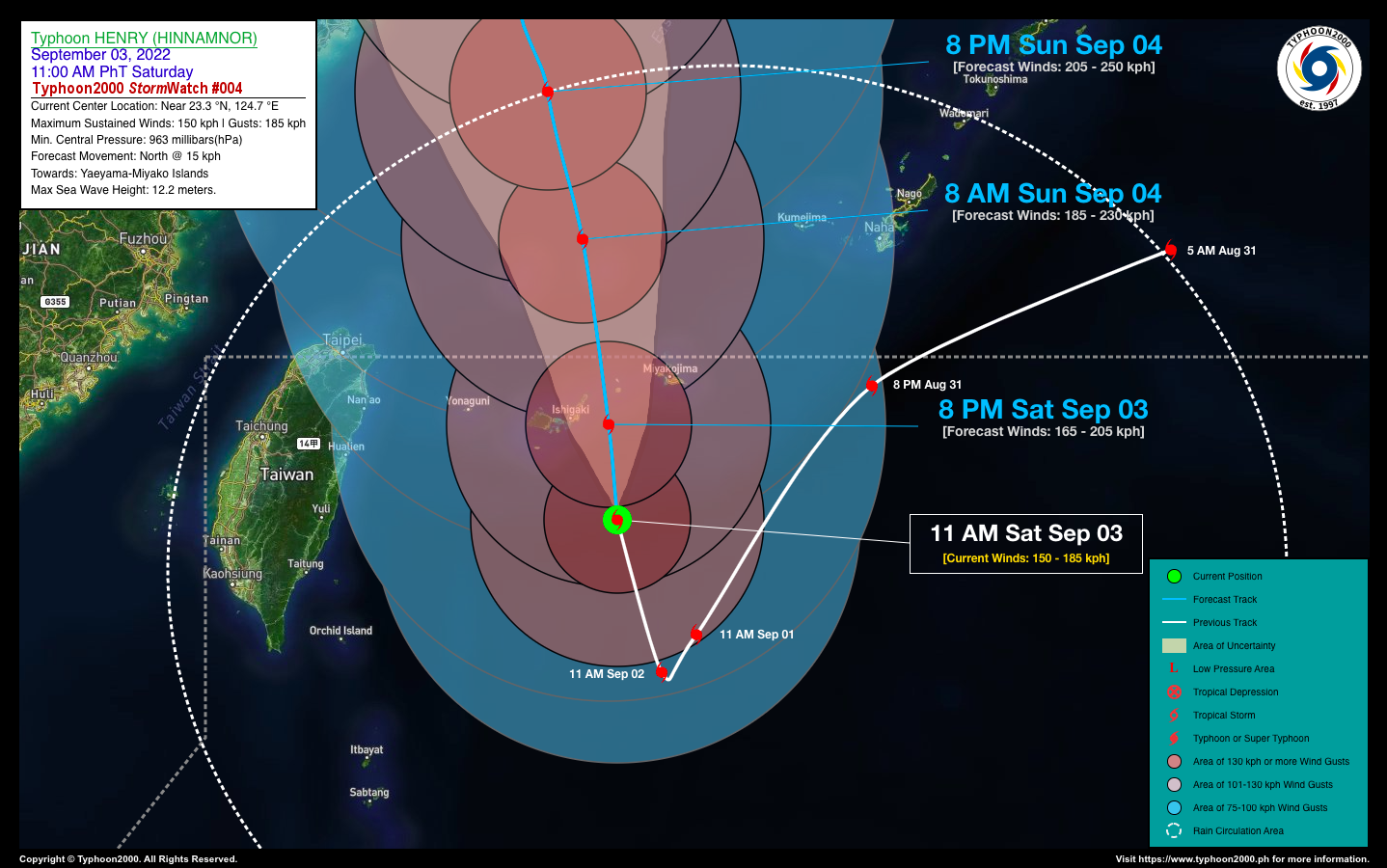
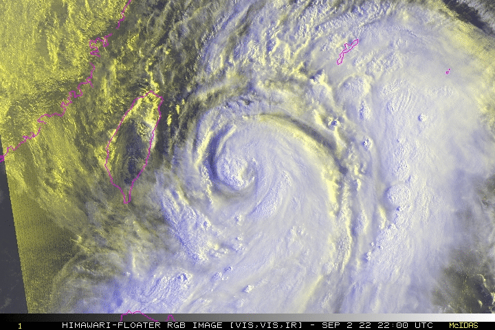
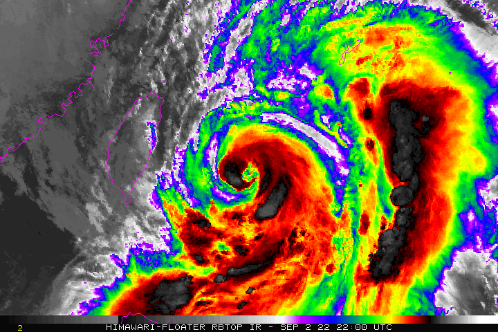
Typhoon HENRY (HINNAMNOR) approaching Yaeyama-Miyako Islands as it moves slowly north-northwest while re-intensifying across the East Taiwan Sea. Its outermost rainbands continues to spread across Batanes and Babuyan Island Group including the coastal waters of Northern Cagayan. For the next 24 hours, the presence of TY HENRY (HINNAMNOR) will continue to enhance the Southwest Monsoon (Habagat) across Ilocos & Cordillera Regions, Western Section of Central Luzon, National Capital Region, & MiMaRoPa. Scattered to occasional rains with thunderstorms and gusty winds of 30-60 kph will be expected across these areas. Risk of flooding and landslides will be High. |
| Where is HENRY (HINNAMNOR)? | As of 11:00 AM PhT today, September 03…0300 GMT:
|
| How strong is it? | Maximum Sustained Winds (1-min avg): 150 kph near the center…Gustiness: 185 kph. |
| Past Movement (06 hrs) | North-Northwest @ 13 kph, towards the Yaeyama-Miyako Islands. |
| Forecast Highlights |
|
| This StormWatch is valid for the next 24 hours.
Information based on data collected by Typhoon2000 (T2k) shall not be taken as official data. Weather information broadcasted and distributed by PAGASA remains as official data. Typhoon2000 (T2k) shall not be responsible for the private use and reliance of its weather information. |
|
Issued by: David Michael V. Padua for Typhoon2000 (T2K)
Typhoon2000 (T2K) Integrated Multi-Agency Tracks

PAGASA TROPICAL CYCLONE WIND SIGNAL
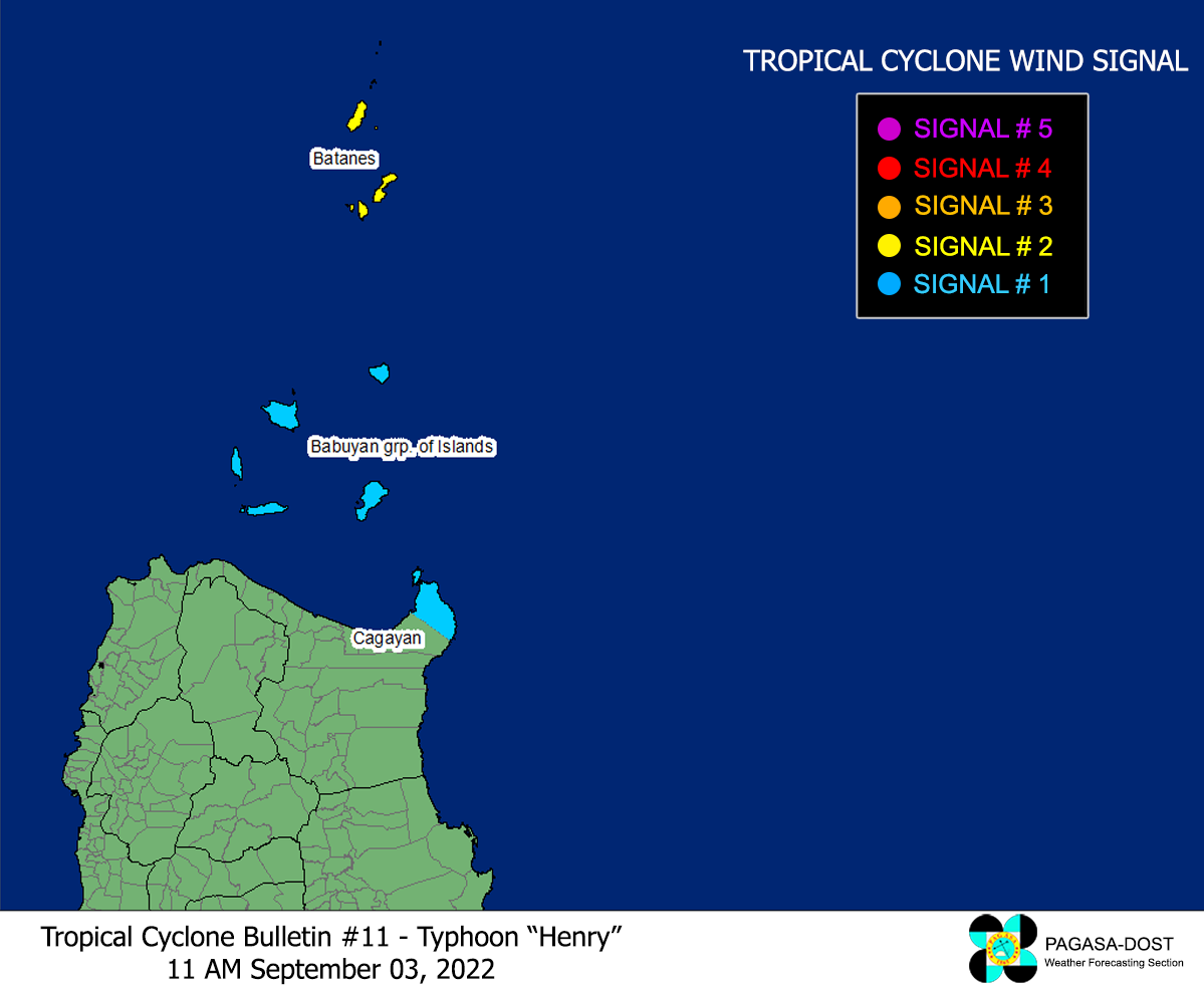
Image/Screenshot Source: DOST-PAGASA (https://bagong.pagasa.dost.gov.ph/tropical-cyclone/severe-weather-bulletin)


