
TROPICAL DEPRESSION STORMWATCH NO. 01Issued at: 11:00 PM PhT (15:00 GMT) Saturday, 20 August 2022
Next update: 11:00 PM PhT (15:00 GMT) Sunday, 21 August 2022 |
|
|---|---|
| Current Status and Outlook |
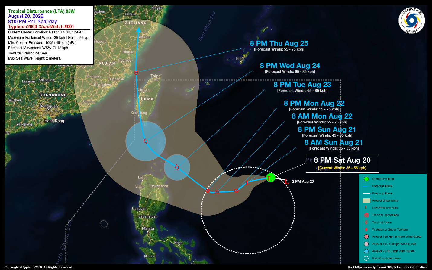
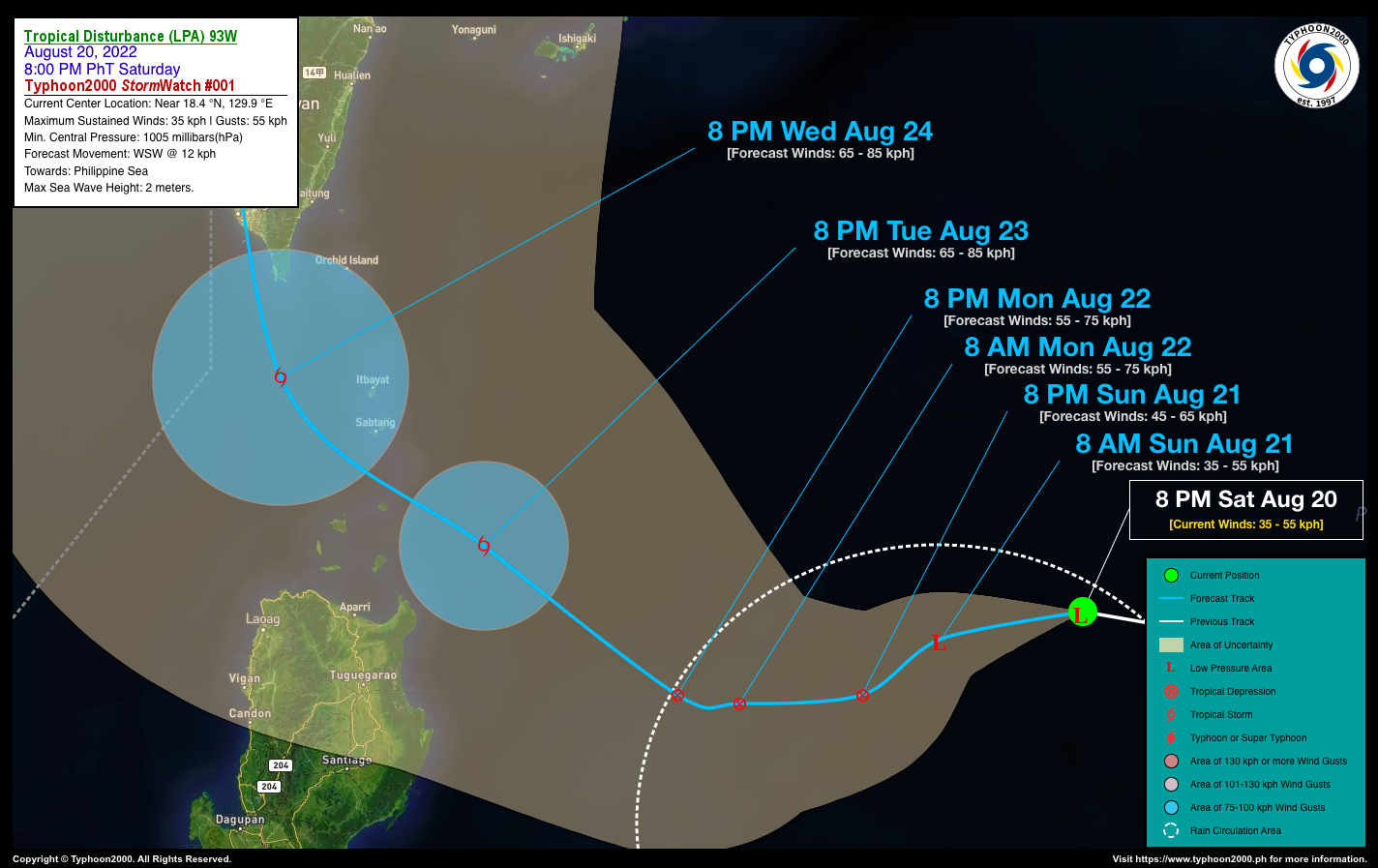
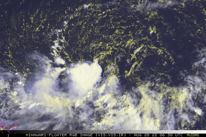
Tropical Disturbance 93W, a newly-formed Low Pressure Area (LPA) is slowly organizing over the Philippine Sea and could become a Tropical Depression (TD) within the next 12 to 24 hours. Its western trough (extension) will start to affect the eastern sections of Northern and Central Luzon including Bicol and Samar Provinces beginning tomorrow Sunday. Isolated to widespread rains and thunderstorms especially in the afternoon and evening will be expected. |
| Where is the LPA 93W? | As of 8:00 PM PhT today, August 20…1200 GMT:
|
| How strong is it? | Maximum Sustained Winds (1-min avg): 35 kph near the center…Gustiness: 55 kph. |
| Past Movement (06 hrs) | Northwest @ 06 kph, across the North Philippine Sea. |
| Forecast Highlights |
|
| This StormWatch is valid for the next 24 hours.
Information based on data collected by Typhoon2000 (T2k) shall not be taken as official data. Weather information broadcasted and distributed by PAGASA remains as official data. Typhoon2000 (T2k) shall not be responsible for the private use and reliance of its weather information. |
|
Issued by: David Michael V. Padua for Typhoon2000 (T2K)


