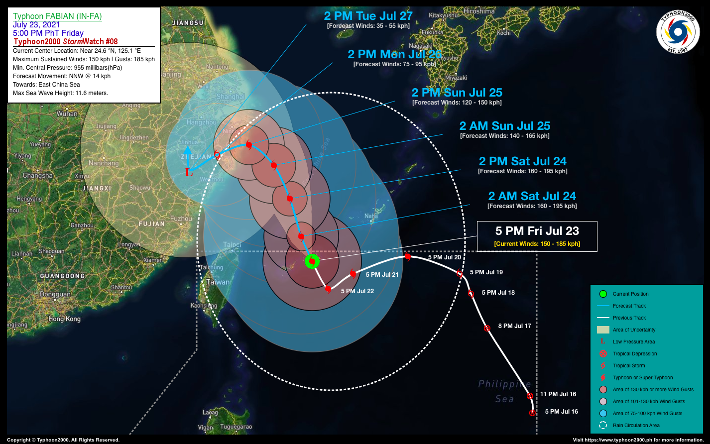
TYPHOON FABIAN (IN-FA) STORMWATCH NO. 08Issued at: 7:00 PM PhT (11:00 GMT) Friday, 23 July 2021
Next update: 7:00 PM PhT (11:00 GMT) Saturday, 24 July 2021 |
|
|---|---|
| Current Status and Outlook |
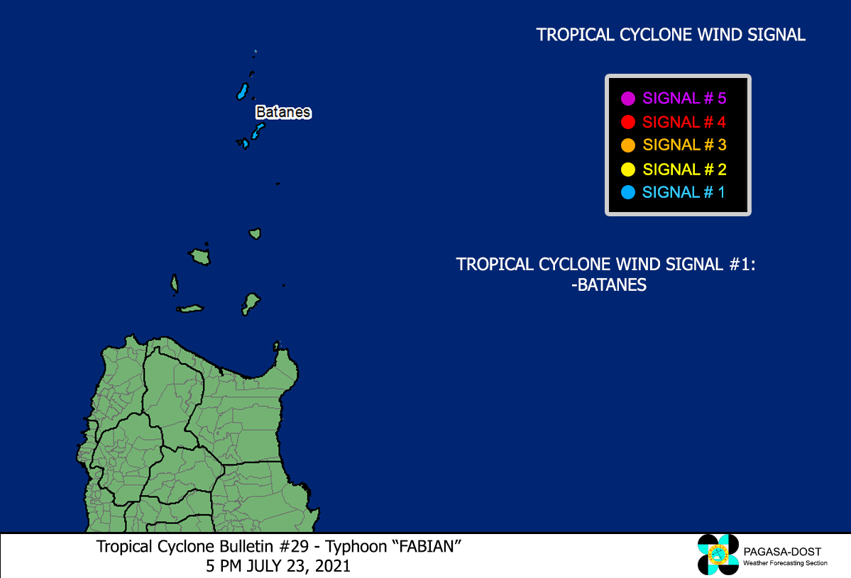
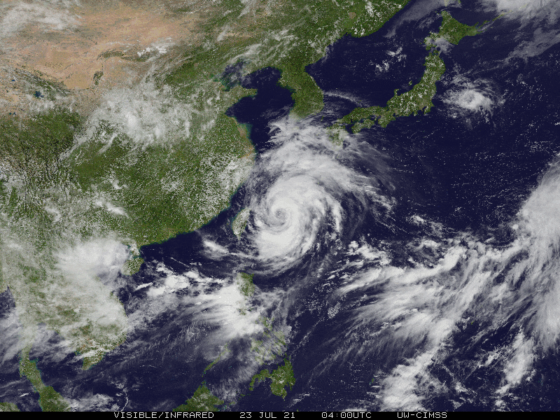
Typhoon FABIAN (IN-FA) has started to move slowly north-northwest towards the East China Sea, after weakening slightly and remaining almost stationary during the past 24 hours. Its core (eye & eyewall) is now over Miyakojima and Tarama Islands…will move out of the Philippine Area of Responsibility (PAR) tonight. Meanwhile, due to the slow movement of this typhoon – it will continue to enhance the Southwest Monsoon (Habagat) Rains across Ilocos Region & Central Luzon incl. Metro Manila, CaLaBaRZon, and Mindoro through tomorrow. TY FABIAN (IN-FA) is forecast to re-intensify slightly within the next 12 to 24 hours and will begin to accelerate slightly north-northwestward at 14 km/hr, across the open waters of the East China Sea by tomorrow afternoon (Jul 24). |
| Where is FABIAN (IN-FA)? | As of 5:00 PM PhT today, July 23…0900 GMT:
|
| How strong is it? | Maximum Sustained Winds (1-min avg): 150 kph near the center…Gustiness: 185 kph. |
| Past Movement (06 hrs) | North-Northwest @ 04 kph, towards the East China Sea. |
| Forecast Highlights |
|
| Information based on data collected by Typhoon2000 (T2k) shall not be taken as official data. Weather information broadcasted and distributed by PAGASA remains as official data. Typhoon2000 (T2k) shall not be responsible for the private use and reliance of its weather information. | |
Issued by: David Michael V. Padua for Typhoon2000 (T2k)
PAGASA TROPICAL CYCLONE WIND SIGNAL