TYPHOON FABIAN (IN-FA) STORMWATCH NO. 07

Issued at: 7:00 PM PhT (11:00 GMT) Thursday, 22 July 2021
Next update: 7:00 PM PhT (11:00 GMT) Friday, 23 July 2021
Current Status and Outlook

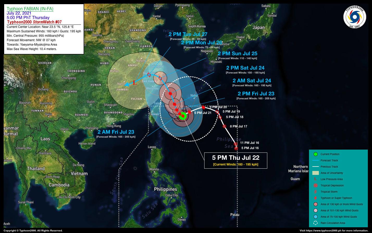
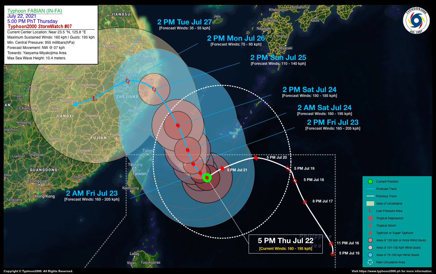
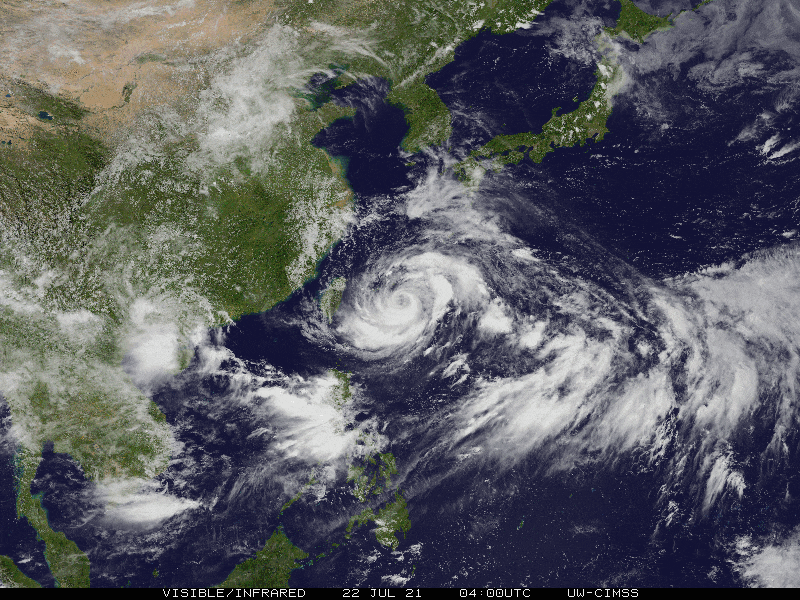
Typhoon FABIAN (IN-FA) has weakened slightly while remaining quasi-stationary over the East Taiwan Sea…will continue to enhance the Southwest Monsoon (Habagat) Rains across Ilocos Region & Central Luzon incl. Metro Manila, CaLaBaRZon, and Mindoro.

TY FABIAN (IN-FA) is forecast to re-intensify slightly within the next 12 to 24 hours and will begin to move slowly northwestward at 07 km/hr, passing between the islands of Miyakojima & Ishigakijima by tomorrow afternoon (Jul 23). 

Where is FABIAN (IN-FA)? As of 5:00 PM PhT today, July 22…0900 GMT:

  • Location of Center: Over the eastern part of the East Taiwan Sea (near 23.5°N 125.8°E)
  • Distance 1: 508 km northeast of Itbayat, Batanes
  • Distance 2: 154 km south-southeast of Miyakojima, Japan
  • Distance 3: 462 km east-southeast of Taipei, Taiwan
How strong is it? Maximum Sustained Winds (1-min avg): 160 kph near the center…Gustiness: 195 kph.
Past Movement (06 hrs) West @ 03 kph (Quasi-Stationary), towards Miyakojima-Yaeyama Islands.
Forecast Highlights
  • TY IN-FA (FABIAN) remains far away from the Philippine Landmass, with no direct effect (except for the Batanes & Babuyan Group of Islands which is under PAGASA Wind Signal No. 01). However, the presence of this system will continue to enhance the Southwest Monsoon (Habagat) bringing scattered to widespread “on-&-off” to at times continuous rain showers and thunderstorms with squalls carrying 30-60 kph wind gust across the western sections of the country through Saturday, July 24.
  • For the next two (2) to three (3) days, TY FABIAN (IN-FA) is forecast to accelerate northwest to north-northwestward across the East China Sea on Saturday (July 24) with decreased wind speeds of 150 km/hr. Then on Sunday afternoon (Jul 25), it shall be making landfall along the Eastern Zhejiang Province of China (near Ningbo City) as a downgraded Severe Tropical Storm (STS). The probability of this forecast is medium to low confidence and was based on the latest (8AM) Typhoon Global Models.
  • It may exit the northern border of the Philippine Area of Responsibility (PAR) by late tomorrow evening (Jul 23) or early Saturday morning (Jul 24).
  • This StormWatch is valid for the next 24 hours.
Information based on data collected by Typhoon2000 (T2k) shall not be taken as official data. Weather information broadcasted and distributed by PAGASA remains as official data. Typhoon2000 (T2k) shall not be responsible for the private use and reliance of its weather information.

Issued by: David Michael V. Padua for Typhoon2000 (T2k)

o

PAGASA TROPICAL CYCLONE WIND SIGNAL


CONTACT US

We're not around right now. But you can send us an email and we'll get back to you, asap.

Sending

©2024 Typhoon2000.

Log in with your credentials

Forgot your details?