

TYPHOON FABIAN (IN-FA) STORMWATCH NO. 06Issued at: 7:00 PM PhT (11:00 GMT) Wednesday, 21 July 2021
Next update: 7:00 PM PhT (11:00 GMT) Thursday, 22 July 2021 |
|
|---|---|
| Current Status and Outlook |
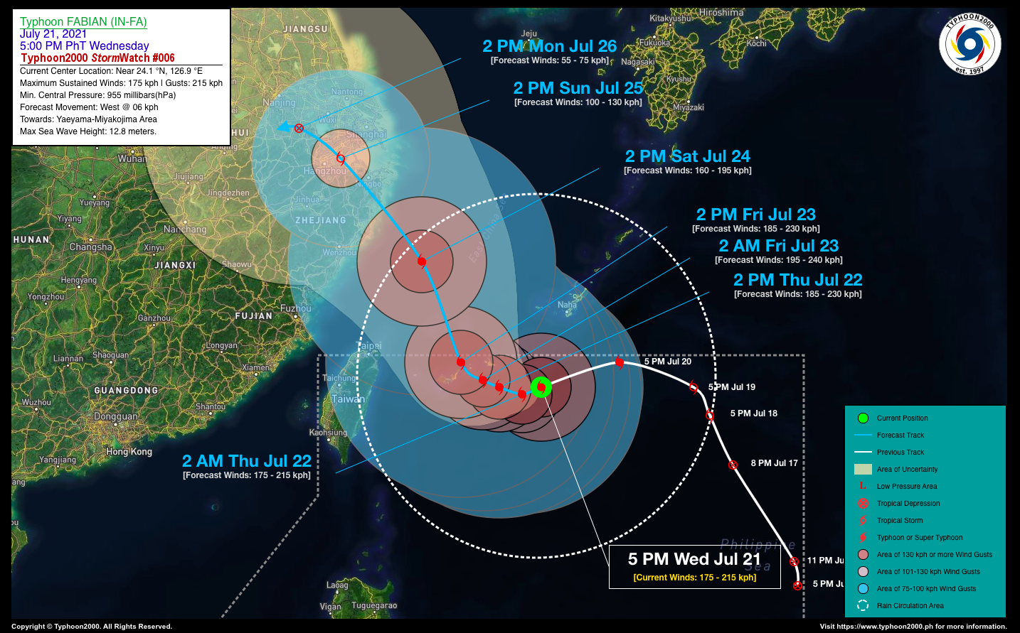
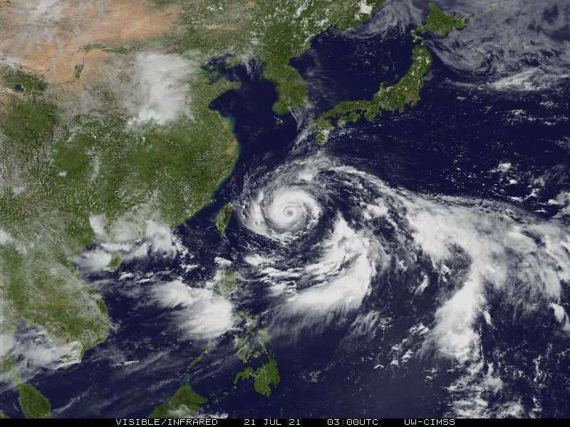
Typhoon FABIAN (IN-FA) has maintained its intensification process while it tracks westward slowly towards Miyakojima. Even though it will not directly affect the country, the Southwest Monsoon (Habagat) Rains will continue to be enhanced by this system, affecting Western Luzon incl. Metro Manila and Mindoro. TY FABIAN (IN-FA) is forecast to intensify further within the next 12 to 24 hours and could become a Category 3 Typhoon (TY) by tomorrow afternoon with winds of 185 km/hr with higher gusts. It shall then continue to move very slowly westward at 06 km/hr, nearing the Miyakojima & Yaeyama Island Chain. |
| Where is FABIAN (IN-FA)? | As of 5:00 PM PhT today, July 21…0900 GMT:
|
| How strong is it? | Maximum Sustained Winds (1-min avg): 175 kph near the center…Gustiness: 215 kph. |
| Past Movement (06 hrs) | West @ 12 kph, towards Miyakojima-Yaeyama Islands. |
| Forecast Highlights |
|
| Information based on data collected by Typhoon2000 (T2k) shall not be taken as official data. Weather information broadcasted and distributed by PAGASA remains as official data. Typhoon2000 (T2k) shall not be responsible for the private use and reliance of its weather information. | |
Issued by: David Michael V. Padua for Typhoon2000 (T2k)
o


