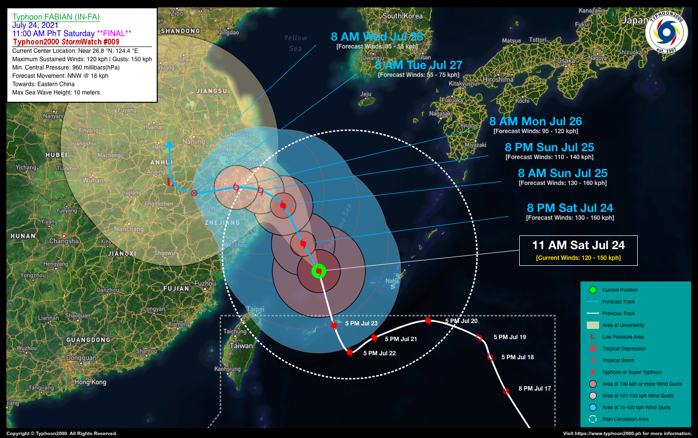
TYPHOON FABIAN (IN-FA) STORMWATCH NO. 09 [FINAL]Issued at: 2:00 PM PhT (06:00 GMT) Saturday, 24 July 2021
|
|
|---|---|
| Current Status and Outlook |
Typhoon FABIAN (IN-FA) continues to weaken as it accelerates north-northwest across the East China Sea and is already outside of the Philippine Area of Responsibility (PAR)…expected to make landfall over Eastern China within 24 to 36 hours. TY FABIAN (IN-FA) is forecast to re-intensify slightly and move north-northwest at a speed of 16 km/hr for the next 12 to 24 hours…approaching the eastern offshore and onshore areas of Zhejiang Province, China. Meanwhile, the presence of this typhoon will continue to enhance the Southwest Monsoon (Habagat) Rains across Ilocos Region & Central Luzon incl. Metro Manila, CaLaBaRZon, and Mindoro today. This rain system will start to weaken late tomorrow or Monday (Jul 26) once the typhoon makes landfall and decreases its pull on the monsoon system. *This is the Final Advisory on this Tropical Cyclone. |
| Where is FABIAN (IN-FA)? | As of 11:00 AM PhT today, July 24…0300 GMT:
|
| How strong is it? | Maximum Sustained Winds (1-min avg): 120 kph near the center…Gustiness: 150 kph. |
| Past Movement (06 hrs) | North-Northwest @ 18 kph, towards the Eastern China. |
| Forecast Highlights |
|
| Information based on data collected by Typhoon2000 (T2k) shall not be taken as official data. Weather information broadcasted and distributed by PAGASA remains as official data. Typhoon2000 (T2k) shall not be responsible for the private use and reliance of its weather information. | |
Issued by: David Michael V. Padua for Typhoon2000 (T2k)
PAGASA TROPICAL CYCLONE WIND SIGNAL