
TYPHOON ULYSSES (VAMCO) ADVISORY NO. 08Issued at: 7:00 PM PhT (11:00 GMT) Wednesday, 11 November 2020
Next update: 1:00 AM PhT (17:00 GMT) Thursday, 12 November 2020 |
|
|---|---|
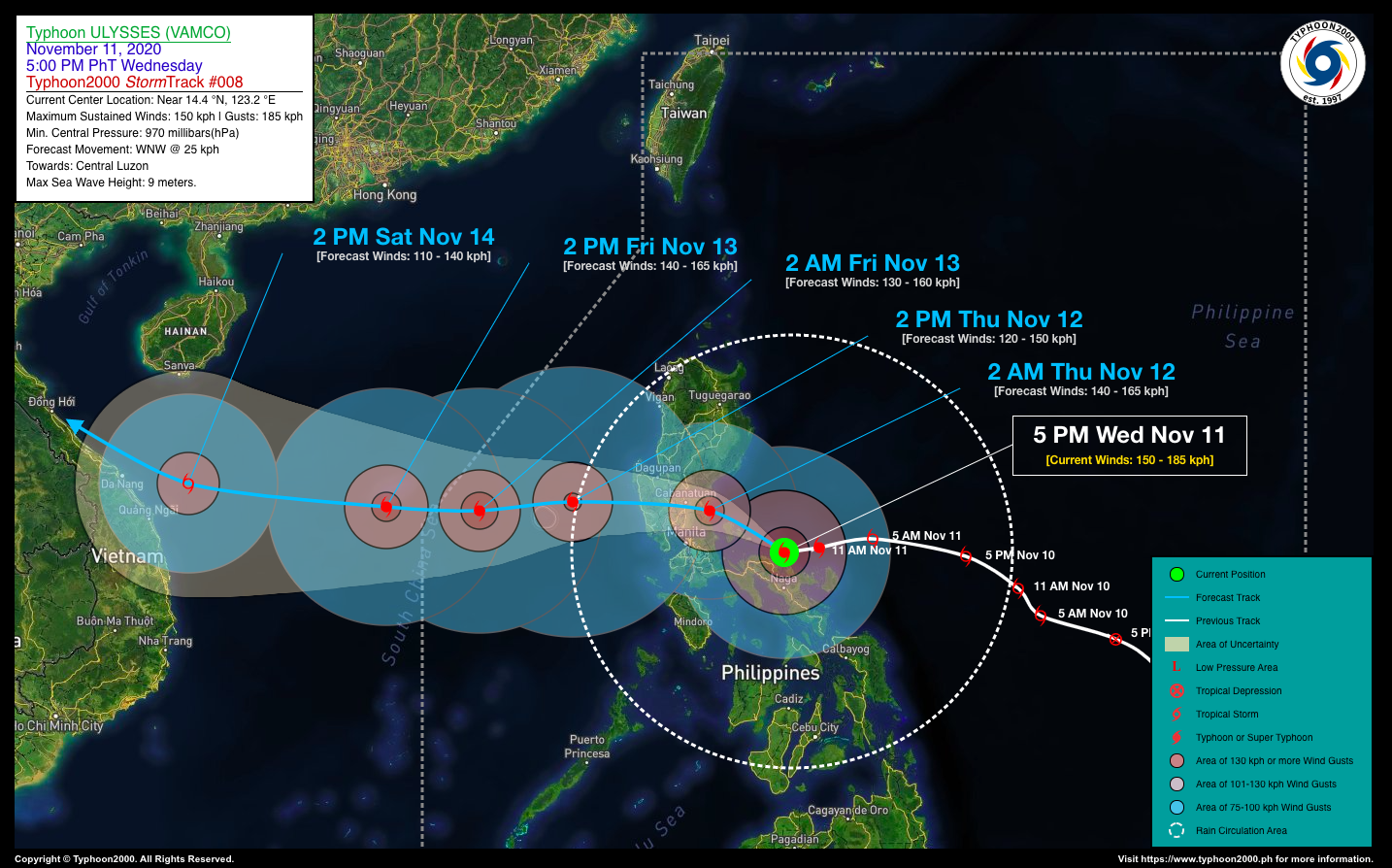
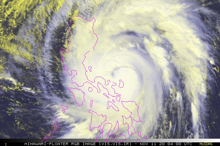
| Current Status & Outlook | Typhoon ULYSSES (VAMCO) has slightly gained strength as it lingers for a few hours near the coast of Siruma, Camarines Sur as the “Eye” grew larger to about 80 km in diameter as observed thru PAGASA’s Doppler Radar in Daet. Its wobbling track has send the expanding southern eyewall hitting Camarines Norte, Catanduanes and the first and fourth districts of Camarines Sur this afternoon.
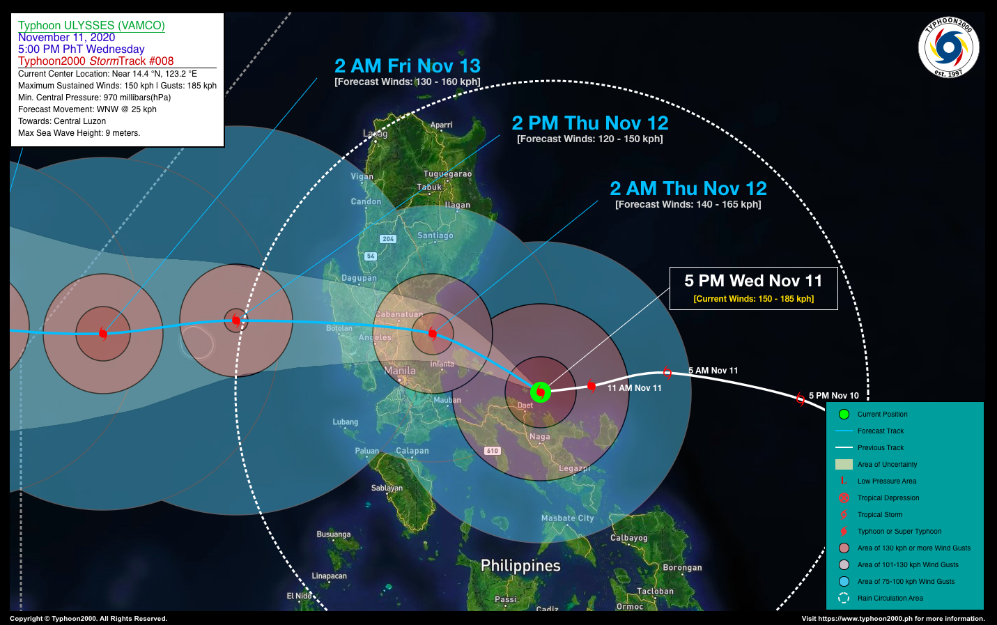
24-hr Outlook: TY ULYSSES (VAMCO) is forecast to turn west-northwestward with an increased forward speed of 25 km/hr, and could reach Category 2 strength prior in making landfall over Polillo Island & Northern Quezon later tonight. The CORE (Eye + Eyewall) is expected to make landfall over Polillo Island Group on or before midnight tonight, and will make another landfall over Northern Quezon via General Nakar during the early hours of Thursday. Between 2 to 8 AM Thursday, the CORE will cross Central Luzon, passing along the provinces of Nueva Ecija, Pampanga, and Zambales. It will then emerge over the coastal areas of Zambales before noontime Thursday. |
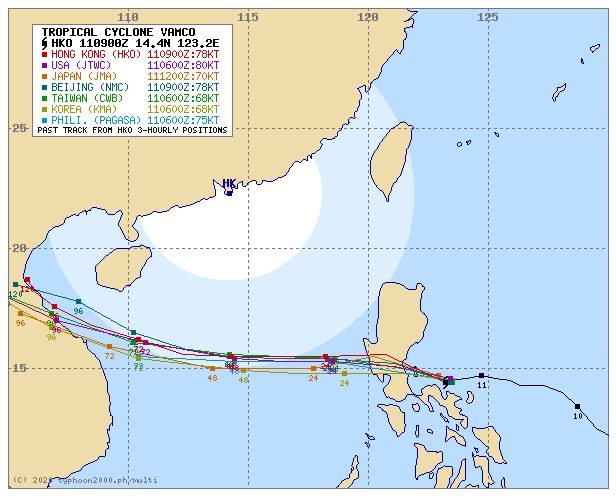
| Where is ULYSSES (VAMCO)? | As of 5:00 PM PhT today, November 11…0900 GMT:
|
| How strong is it? | Maximum Sustained Winds (1-min avg): 150 kph near the center…Gustiness: 185 kph. |
| Past Movement (06 hrs) | West @ 14 kph, towards Central Luzon |
| Potential Philippine Landfall Area(s) |
|
| What Philippine areas will be directly affected? | Heavy to Extreme Rainfall (50 mm to >100 mm expected for 24 hrs):
Damaging Winds (gusts of more than 100 km/hr expected):
|
| Potential Storm Surge/Coastal Flooding Areas+ |
+Waves of 3 meters in height is expected in storm surge-prone areas, particularly in coastal areas on where the Tropical Cyclone is headed. Kindly visit the PAGASA Storm Surge Updates for more details. |
| 2-Day Forecast Outlook Summary** |
**Important Note: Please be reminded that the Forecast Outlook changes every 6 hours, and the Day 2 and 3 Forecast Track have an average error of 100 and 250 km respectively… while the wind speed forecast error, averages 35 km/hr per day. Therefore, a turn to the left or right of its future track and changes in its wind speed must be anticipated from time to time. |
| Other Storm’s Meteorological Information |
|
| Information based on data collected by Typhoon2000 (T2k) shall not be taken as official data. Weather information broadcasted and distributed by PAGASA remains as official data. Typhoon2000 (T2k) shall not be responsible for the private use and reliance of its weather information. | |
Issued by: David Michael V. Padua for Typhoon2000 (T2K)
Typhoon2000 (T2K) Integrated Multi-Agency Tracks
For more info: http://www.typhoon2000.ph/multi/?name=VAMCO
PAGASA TROPICAL CYCLONE WIND SIGNAL
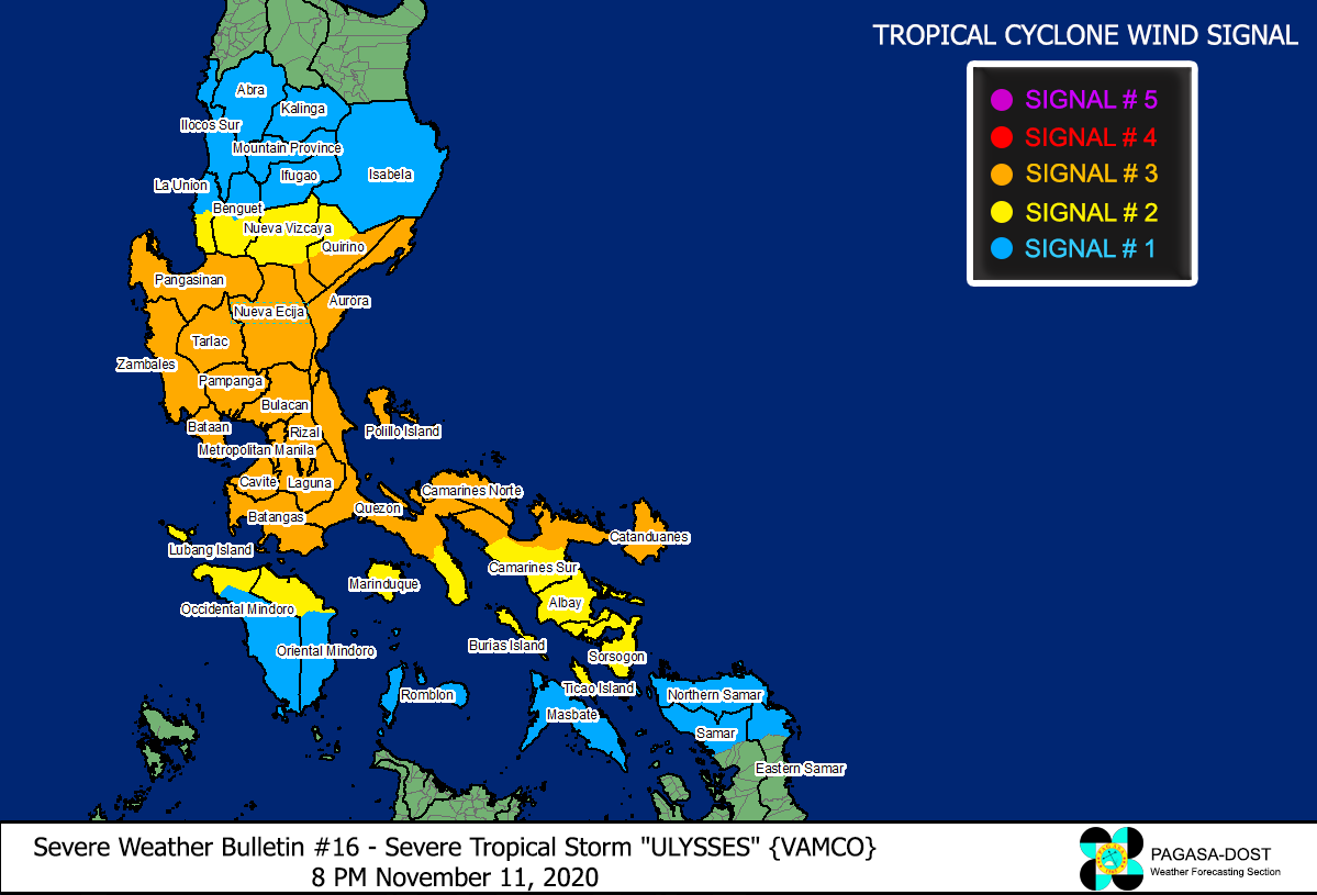
Image/Screenshot Source: DOST-PAGASA (http://pubfiles.pagasa.dost.


