
TROPICAL STORM ULYSSES (VAMCO) ADVISORY NO. 04Issued at: 1:00 PM PhT (05:00 GMT) Tuesday, 10 November 2020
Next update: 7:00 PM PhT (11:00 GMT) Tuesday, 10 November 2020 |
|
|---|---|
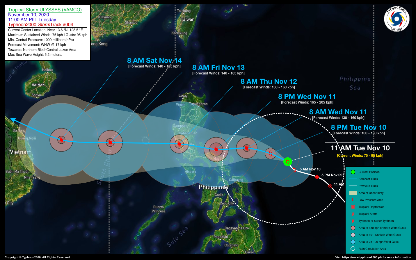
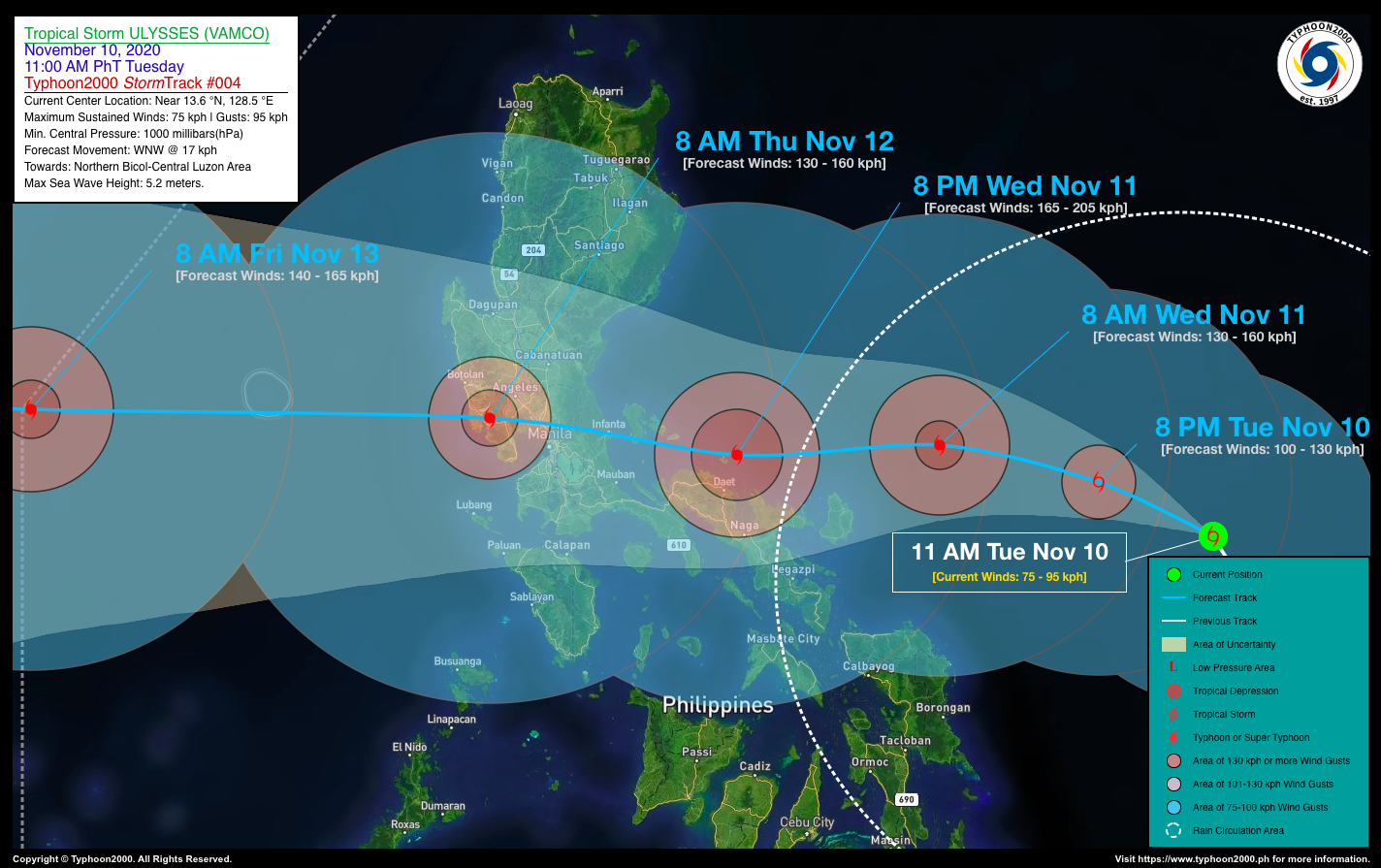
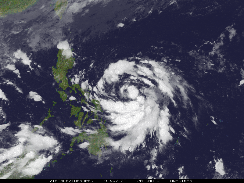
| Current Status & Outlook | Tropical Storm ULYSSES (VAMCO) gaining strength as it moved northwestward during the past 6 hours, remains a serious threat to Bicol Region and Central Luzon. Potential landfall areas will be somewhere along Southern Polillo and Real-Infanta Area by early Thursday morning (Nov 12).
Meanwhile, residents of Bicol Region must closely monitor and pay attention on the progress of this potential typhoon for possible changes in its track as it is still expected to bring strong winds with intense rainfall during its close passage on Wednesday afternoon through Thursday early morning. 24-hr Outlook: TS ULYSSES (VAMCO) is forecast to turn west-northwestward at a forward speed of 17 km/hr, and could become a Severe Tropical Storm (STS) later today. It is therefore expected reach Typhoon classification by tomorrow, Wednesday morning as it approaches the northern offshore areas of Catanduanes. |
| Where is ULYSSES (VAMCO)? | As of 11:00 AM PhT today, November 10…0300 GMT:
|
| How strong is it? | Maximum Sustained Winds (1-min avg): 75 kph near the center…Gustiness: 95 kph. |
| Past Movement (06 hrs) | Northwest @ 14 kph, across the Central Philippine Sea |
| Potential Philippine Landfall Area(s) |
|
| What Philippine areas will be directly affected? | Heavy to Extreme Rainfall (50 mm to >100 mm expected for 24 hrs):
Damaging Winds (gusts of more than 100 km/hr expected):
|
| Potential Storm Surge/Coastal Flooding Areas+ |
+Waves of 3 meters in height is expected in storm surge-prone areas, particularly in coastal areas on where the Tropical Cyclone is headed. Kindly visit the PAGASA Storm Surge Updates for more details. |
| 3-Day Forecast Outlook Summary** |
**Important Note: Please be reminded that the Forecast Outlook changes every 6 hours, and the Day 2 and 3 Forecast Track have an average error of 100 and 250 km respectively… while the wind speed forecast error, averages 35 km/hr per day. Therefore, a turn to the left or right of its future track and changes in its wind speed must be anticipated from time to time. |
| Other Storm’s Meteorological Information |
|
| Information based on data collected by Typhoon2000 (T2k) shall not be taken as official data. Weather information broadcasted and distributed by PAGASA remains as official data. Typhoon2000 (T2k) shall not be responsible for the private use and reliance of its weather information. | |
Issued by: David Michael V. Padua for Typhoon2000 (T2K)
Typhoon2000 (T2K) Integrated Multi-Agency Tracks

For more info: http://www.typhoon2000.ph/multi/?name=VAMCO
PAGASA TROPICAL CYCLONE WIND SIGNAL
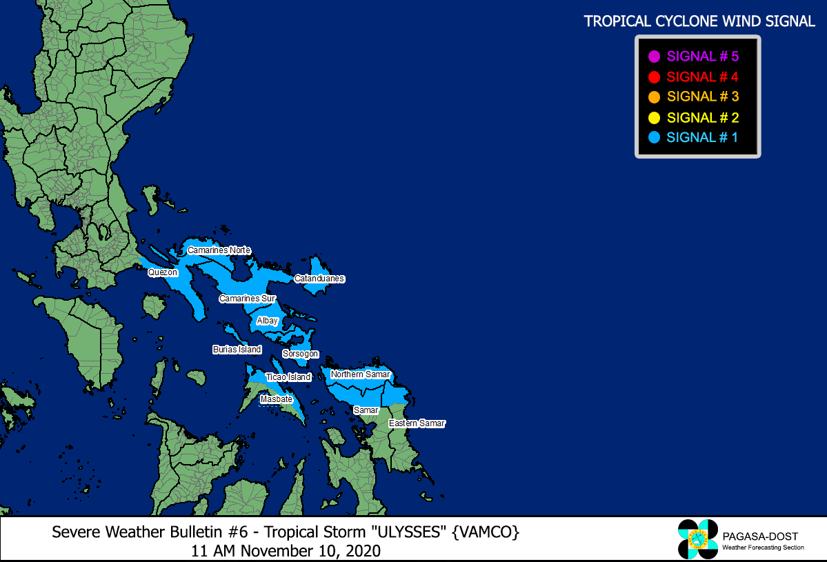
Image/Screenshot Source: DOST-PAGASA (http://pubfiles.pagasa.dost.


