
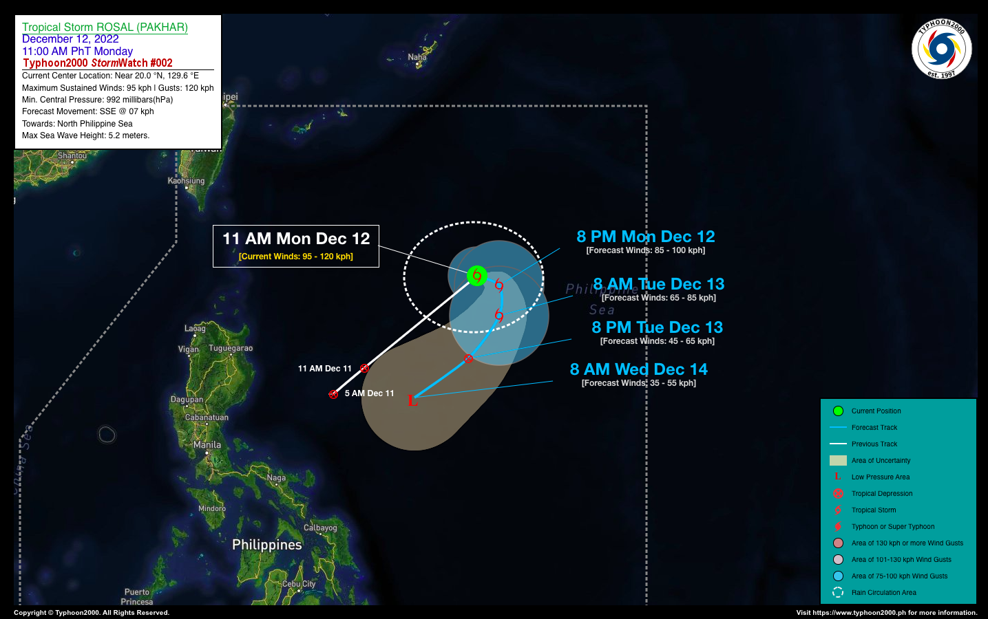
SEVERE TROPICAL STORM ROSAL (PAKHAR) STORMWATCH NO. 02Issued at: 2:00 PM PhT (06:00 GMT) Monday, 12 December 2022
Next update: 2:00 PM PhT (06:00 GMT) Tuesday, 13 December 2022 |
|
|---|---|
| Current Status and Outlook |
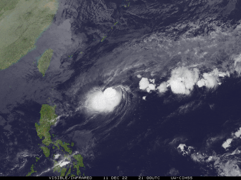
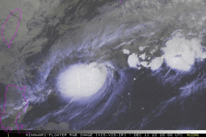
Tropical Depression ROSAL (PAKHAR) has rapidly intensified into a Severe Tropical Storm (STS) as it accelerates east-northeast across the North Philippine Sea. This system has already reached its peak intensity, and for the next couple of days a sharp weakening trend is expected with complete dissipation on Wednesday or Thursday (Dec. 14-15) as the storm turns south to southwestward. STS ROSAL’s circulation remains over the open waters of the North Philippine Sea with no direct effect to any part of the country. However, it will enhance the Northeast Monsoon (Amihan) and bring cloudy skies with isolated to scattered rain showers across Extreme Northern Luzon particularly Cagayan Valley. |
| Where is ROSAL (PAKHAR)? | As of 11:00 AM PhT today, December 12…0300 GMT:
|
| How strong is it? | Maximum Sustained Winds (1-min avg): 95 kph near the center…Gustiness: 120 kph. |
| Past Movement (06 hrs) | East-Northeast @ 12 kph, across the North Philippine Sea. |
| Forecast Highlights |
|
| This StormWatch is valid for the next 24 hours.
Information based on data collected by Typhoon2000 (T2k) shall not be taken as official data. Weather information broadcasted and distributed by PAGASA remains as official data. Typhoon2000 (T2k) shall not be responsible for the private use and reliance of its weather information. |
|
Issued by: David Michael V. Padua for Typhoon2000 (T2K)
Typhoon2000 (T2K) Integrated Multi-Agency Tracks
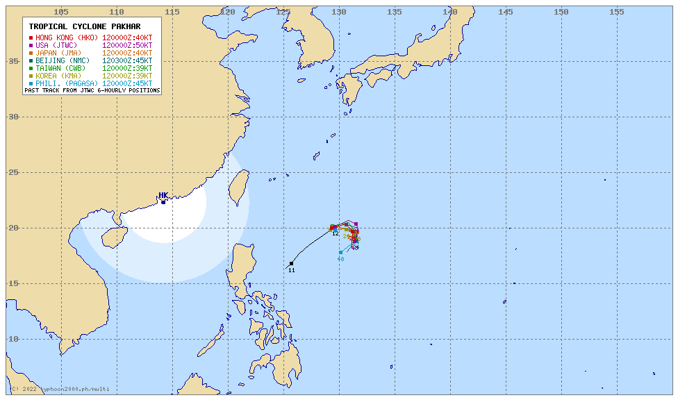
For more info visit: http://www.typhoon2000.ph/multi/?name=PAKHAR
PAGASA TROPICAL CYCLONE WIND SIGNAL
:: None ::
Image/Screenshot Source: DOST-PAGASA (https://bagong.pagasa.dost.gov.ph/tropical-cyclone/severe-weather-bulletin)


