
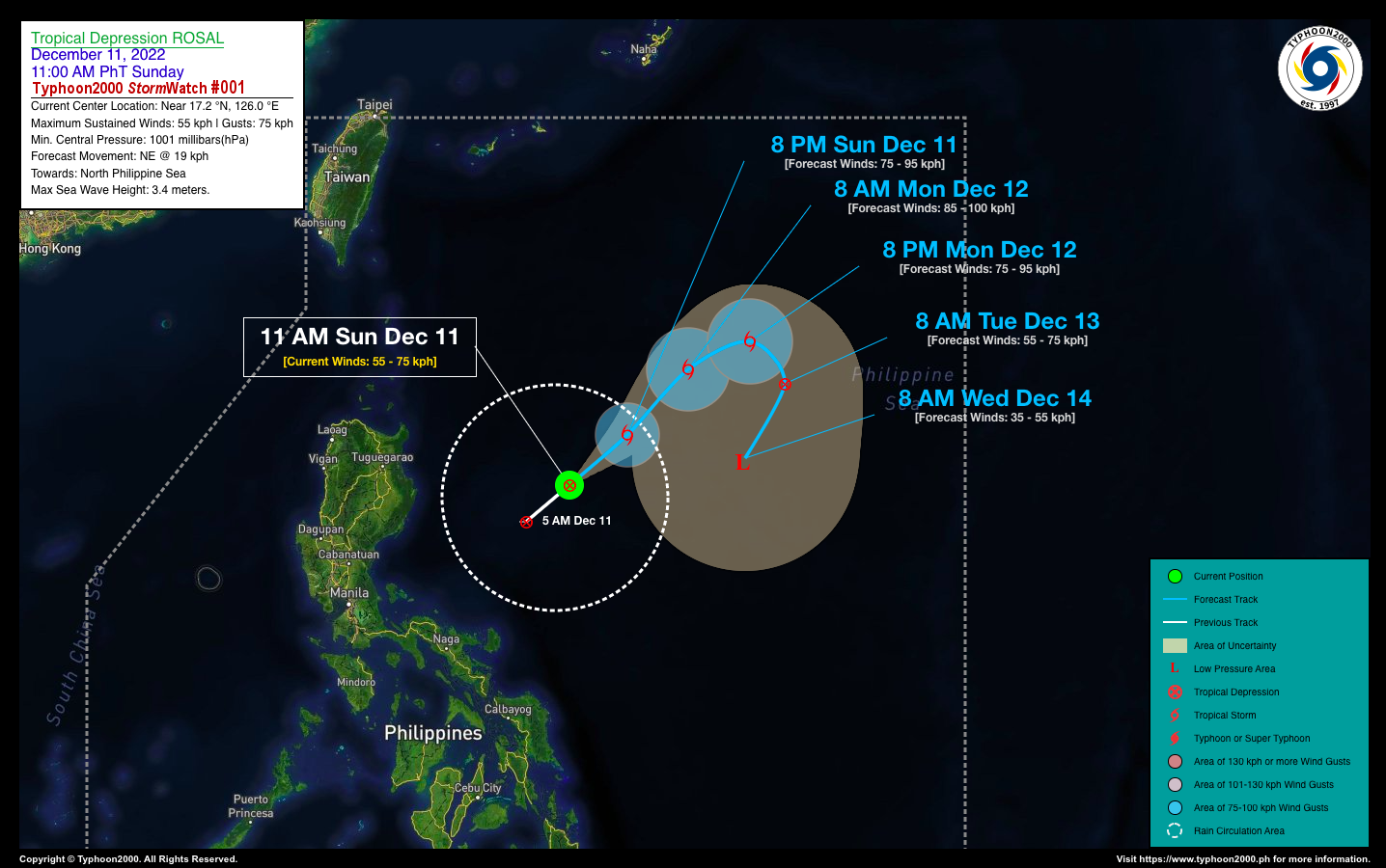
TROPICAL DEPRESSION ROSAL STORMWATCH NO. 01Issued at: 2:00 PM PhT (06:00 GMT) Sunday, 11 December 2022
Next update: 2:00 PM PhT (06:00 GMT) Monday, 12 December 2022 |
|
|---|---|
| Current Status and Outlook |
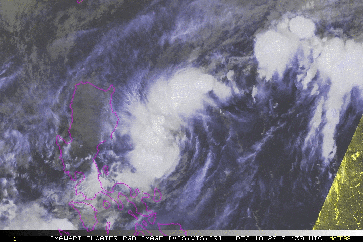
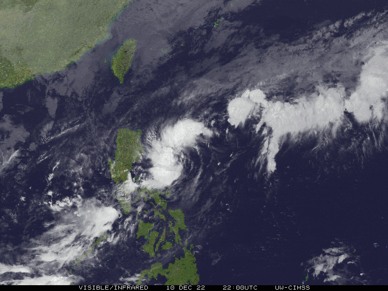
The Tropical Disturbance (LPA) [92W] which traversed the coastal waters of Bicol Region yesterday morning has developed into a Tropical Depression (TD) while roaming the Central Philippine Sea or near the coastal waters of Aurora Province twelve hours ago and has started to recurve towards the northeast, away from the country. The TD was already given the local name “ROSAL”. TD ROSAL’s circulation remains over the open waters of the Central Philippine Sea with no direct effects to any part of the country. However, its western trough (i.e. extension) will continue to bring cloudy skies with isolated to scattered rain showers & thunderstorms across Central & Southern Luzon, & MiMaRoPa. |
| Where is ROSAL? | As of 11:00 AM PhT today, December 11…0300 GMT:
|
| How strong is it? | Maximum Sustained Winds (1-min avg): 55 kph near the center…Gustiness: 75 kph. |
| Past Movement (06 hrs) | Northeast @ 23 kph, across the Central Philippine Sea. |
| Forecast Highlights |
|
| This StormWatch is valid for the next 24 hours.
Information based on data collected by Typhoon2000 (T2k) shall not be taken as official data. Weather information broadcasted and distributed by PAGASA remains as official data. Typhoon2000 (T2k) shall not be responsible for the private use and reliance of its weather information. |
|
Issued by: David Michael V. Padua for Typhoon2000 (T2K)
PAGASA TROPICAL CYCLONE WIND SIGNAL
:: All Wind Signals Now Lowered
Image/Screenshot Source: DOST-PAGASA (https://bagong.pagasa.dost.gov.ph/tropical-cyclone/severe-weather-bulletin)


