
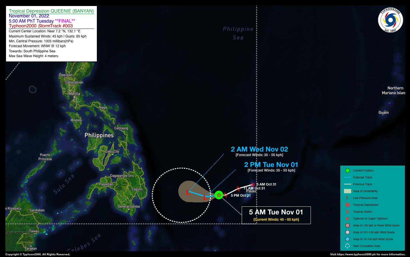
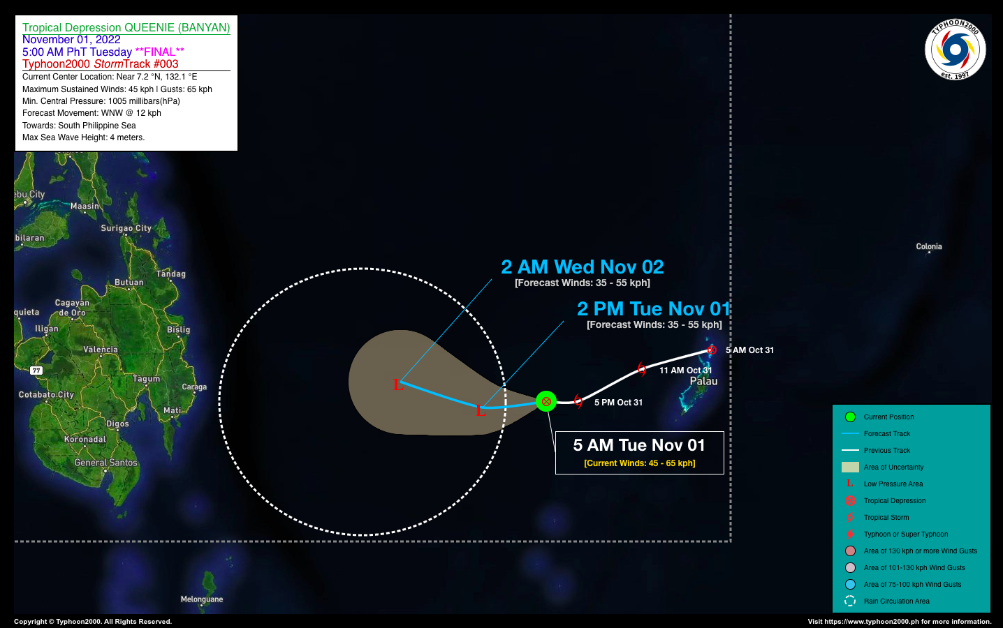
TROPICAL DEPRESSION QUEENIE (BANYAN) ADVISORY NO. 03 [FINAL]Issued at: 8:00 AM PhT (00:00 GMT) Tuesday, 01 November 2022
|
|
|---|---|
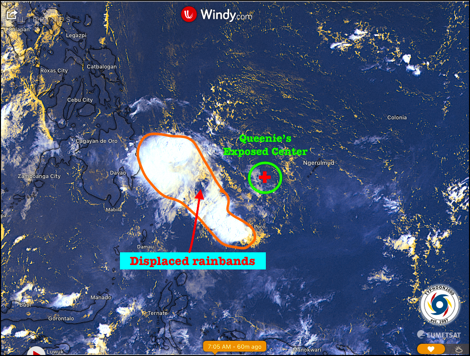
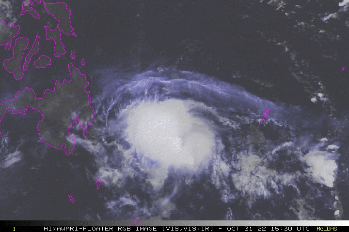
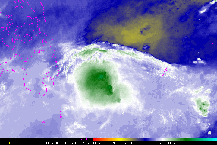
| Current Status & Outlook | QUEENIE (BANYAN) has weakened considerably into a Tropical Depression (TD) as its rainband convection was displaced some 200 km to the west, exposing a cloud-less low-level circulation center. Therefore, the dissipation of this cyclone will be earlier than previously forecasted, and its remnant rainbands will bring wet weather with heavy rains and severe thunderstorms across Eastern Mindanao today and tomorrow. The risk of flooding across the area will be high.
24-hr Outlook: TD QUEENIE is forecast to dissipate over the waters of the South Philippine Sea east of Davao Oriental, and will be just a remnant LPA within the next 24 hours as increased dry air over the area continues. *This will be the Final Advisory on TD QUEENIE. |
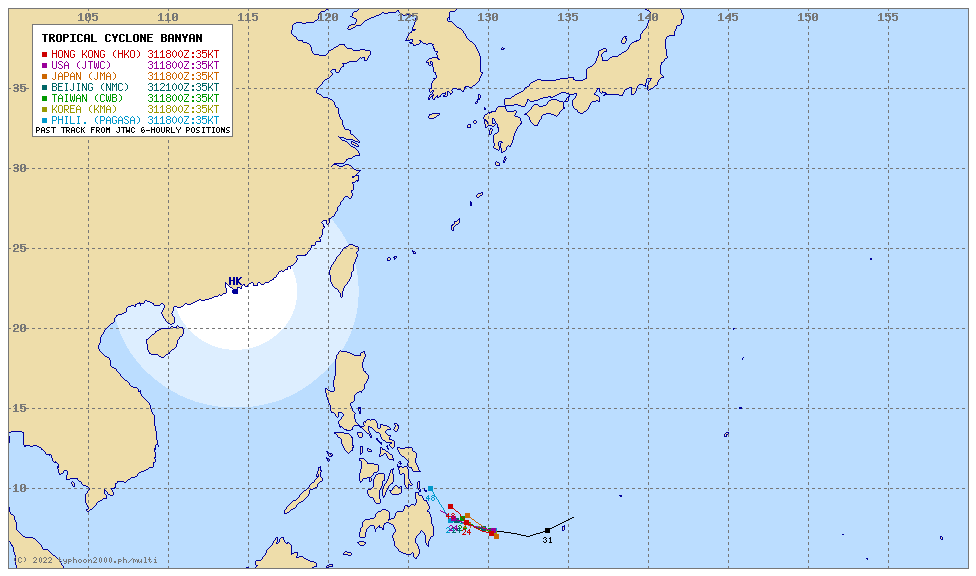
| Where is QUEENIE? | As of 7:00 AM PhT today, November 01…2300 GMT:
|
| How strong is it? | Maximum Sustained Winds (1-min avg): 45 kph near the center…Gustiness: 55 kph. |
| Past Movement (06 hrs) | West @ 12 kph, across the South Philippine Sea. |
| Potential Philippine Major Landfall Area(s) |
|
| What Philippine areas will be directly affected? | Heavy to Extreme Rainfall (50 mm to >100 mm expected for 24 hrs):
Damaging Winds (gusts of more than 100 km/hr expected):
|
| Potential Storm Surge/Coastal Flooding Areas+ |
+Waves of 3 meters in height are expected in storm surge-prone areas, particularly in coastal areas where the Tropical Cyclone is headed. Kindly visit the PAGASA Storm Surge Updates for more details. |
| 1-Day Forecast Outlook Summary** |
**Important Note: Please be reminded that the Forecast Outlook changes every 6 hours, and the Day 2 and 3 Forecast Track have an average error of 100 and 250 km respectively… while the wind speed forecast error, averages 35 km/hr per day. Therefore, a turn to the left or right of its future track and changes in its wind speed must be anticipated from time to time. |
| Other Storm’s Meteorological Information |
|
| Disclaimer: Information based on data collected by Typhoon2000 (T2k) shall not be taken as official data. Weather information broadcasted and distributed by PAGASA remains as official data. Typhoon2000 (T2k) shall not be responsible for the private use and reliance of its weather information. | |
Issued by: David Michael V. Padua for Typhoon2000 (T2k)
Typhoon2000 (T2K) Integrated Multi-Agency Tracks
PAGASA TROPICAL CYCLONE WIND SIGNAL
:: None
Image/Screenshot Source: DOST-PAGASA (https://bagong.pagasa.dost.gov.ph/tropical-cyclone/severe-weather-bulletin)


