
TROPICAL STORM PAENG (NALGAE) ADVISORY NO. 11. ***Final***Issued at: 9:00 PM PhT (13:00 GMT) Sunday, 30 October 2022
|
|
|---|---|
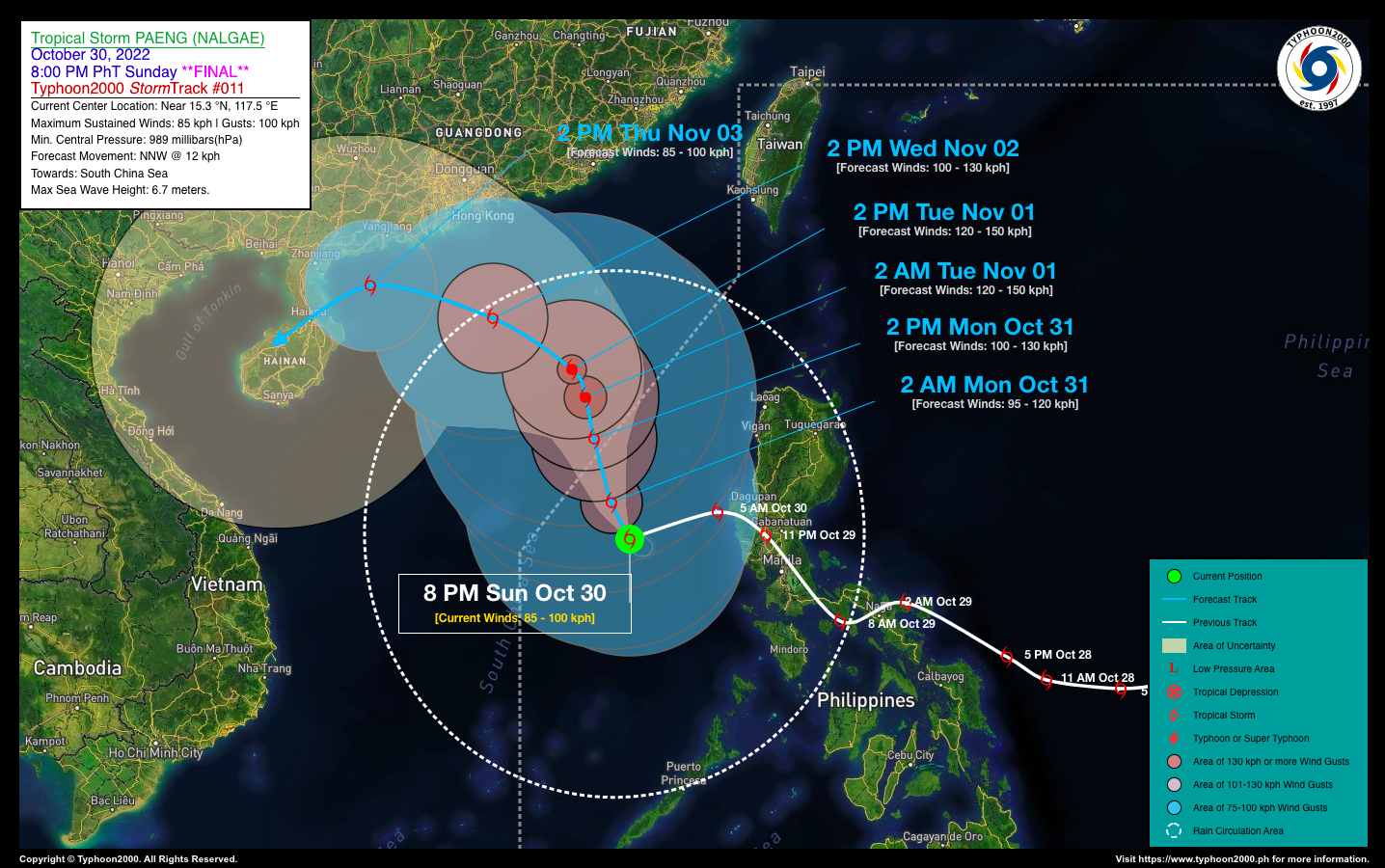
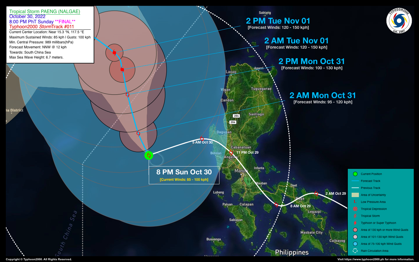
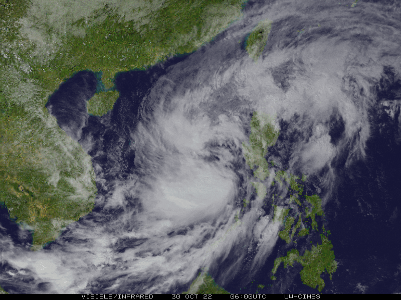
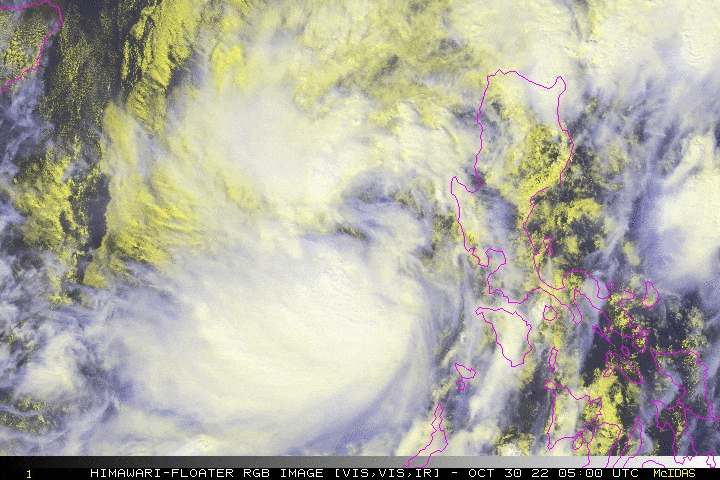
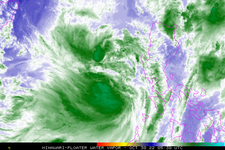
| Current Status & Outlook | Tropical Storm PAENG (NALGAE) has tracked west-southwestward during the past 6 hours while over the West Philippine Sea, trying to reorganize…expected to exit the Philippine Area of Responsibility (PAR) tomorrow afternoon.
*This is the Final Advisory on this Tropical Cyclone. 24-hr Outlook: TS PAENG is forecast to move north-northwest at a forward speed of 12 km/hr, and will re-intensify while over the West Philippine Sea, regaining Severe Tropical Storm (STS) classification by tomorrow afternoon. The storm’s large rainbands and trough will continue to bring isolated to occasional rains & thunderstorms with gusty winds (30-60 kph) across Luzon & Western Visayas tonight & tomorrow. The risk of floods and landslides is currently at medium to high. |
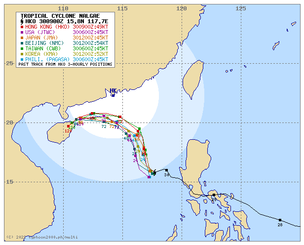
| Where is PAENG? | As of 8:00 PM PhT today, October 30…1200 GMT:
|
| How strong is it? | Maximum Sustained Winds (1-min avg): 85 kph near the center…Gustiness: 100 kph. |
| Past Movement (06 hrs) | Southwest @ 09 kph, across the West Philippine Sea. |
| Potential Philippine Major Landfall Area(s) |
|
| What Philippine areas will be directly affected? | Heavy to Extreme Rainfall (50 mm to >100 mm expected for 24 hrs):
Damaging Winds (gusts of more than 100 km/hr expected):
|
| Potential Storm Surge/Coastal Flooding Areas+ |
+Waves of 1 to 2 meters in height are expected in storm surge-prone areas, particularly in coastal areas where the Tropical Cyclone is headed. Kindly visit the PAGASA Storm Surge Updates for more details. |
| 2-Day Forecast Outlook Summary** |
**Important Note: Please be reminded that the Forecast Outlook changes every 6 hours, and the Day 2 and 3 Forecast Track have an average error of 100 and 250 km respectively… while the wind speed forecast error, averages 35 km/hr per day. Therefore, a turn to the left or right of its future track and changes in its wind speed must be anticipated from time to time. |
| Other Storm’s Meteorological Information |
|
| Disclaimer: Information based on data collected by Typhoon2000 (T2k) shall not be taken as official data. Weather information broadcasted and distributed by PAGASA remains as official data. Typhoon2000 (T2k) shall not be responsible for the private use and reliance of its weather information. | |
Issued by: David Michael V. Padua for Typhoon2000 (T2k)
Typhoon2000 (T2K) Integrated Multi-Agency Tracks
For more info visit: http://www.typhoon2000.ph/multi/?name=NALGAE
PAGASA TROPICAL CYCLONE WIND SIGNAL
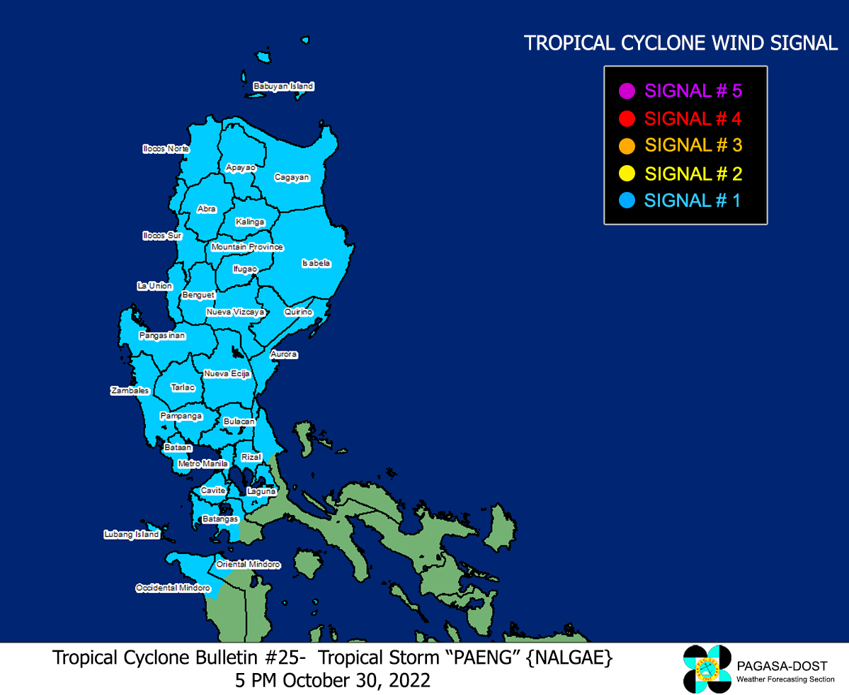
Image/Screenshot Source: DOST-PAGASA (https://bagong.pagasa.dost.gov.ph/tropical-cyclone/severe-weather-bulletin)


