
TROPICAL STORM QUEENIE ADVISORY NO. 01Issued at: 3:00 PM PhT (07:00 GMT) Monday, 31 October 2022
Next update: 8:00 PM PhT (12:00 GMT) Monday, 31 October 2022 |
|
|---|---|
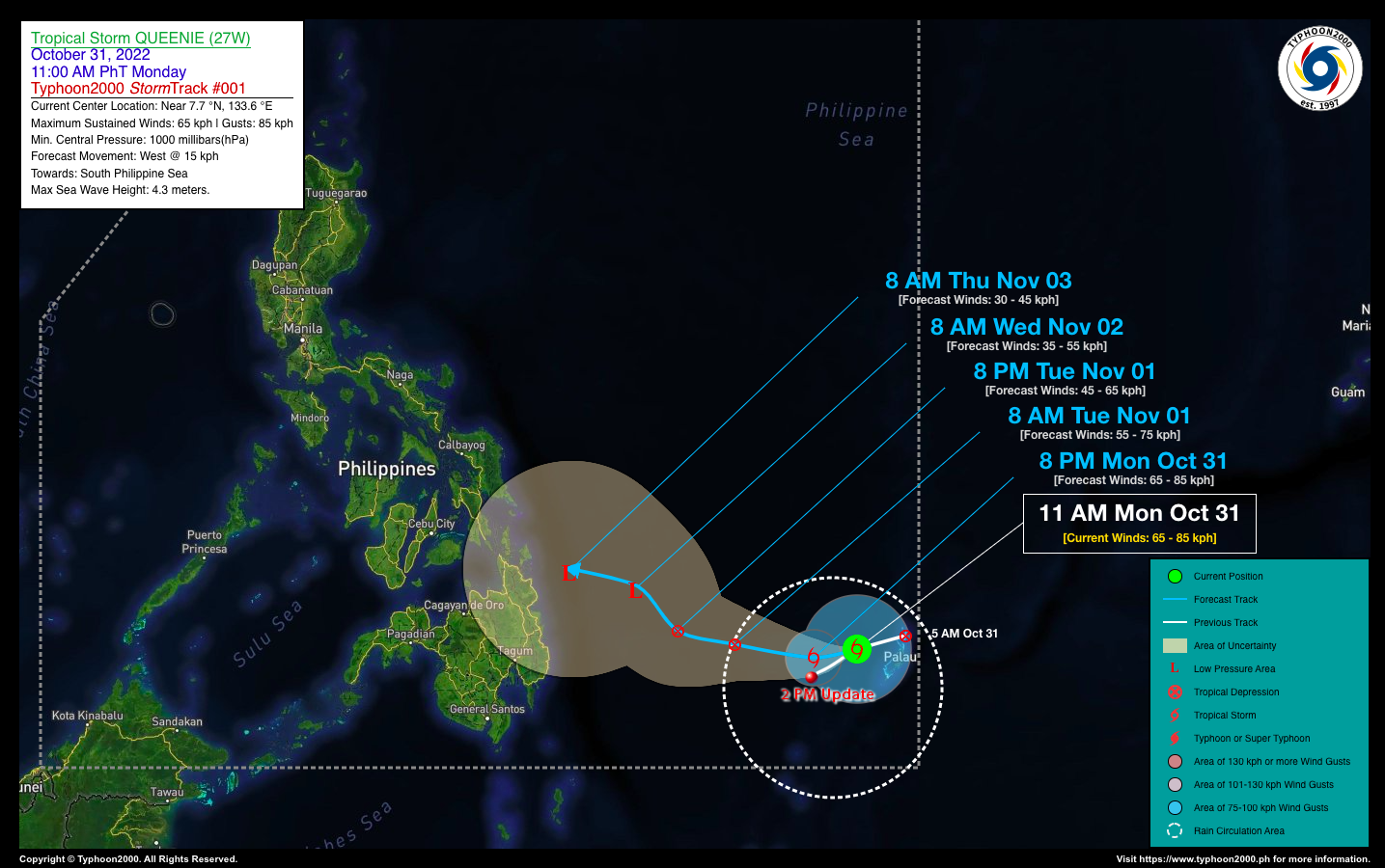
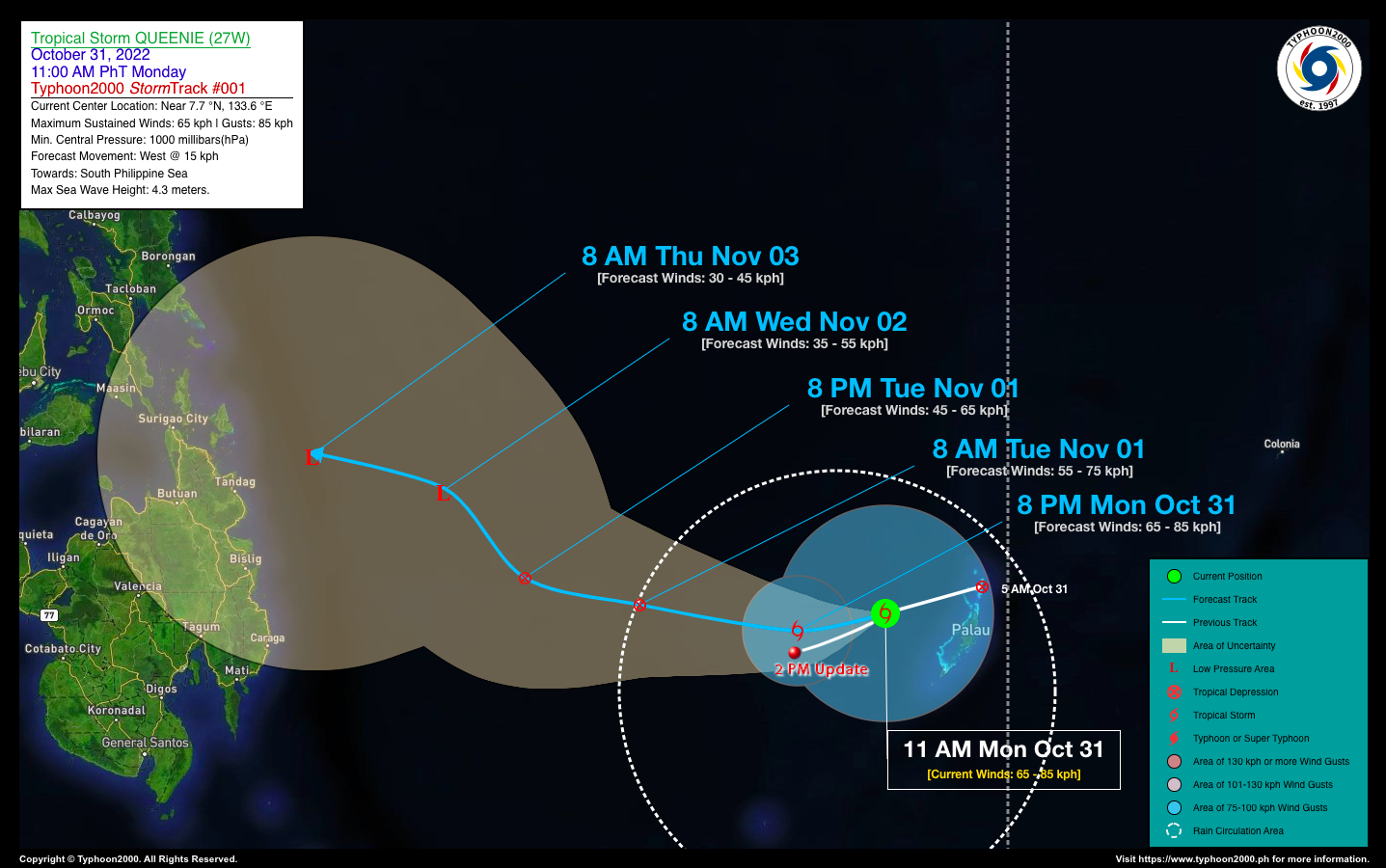
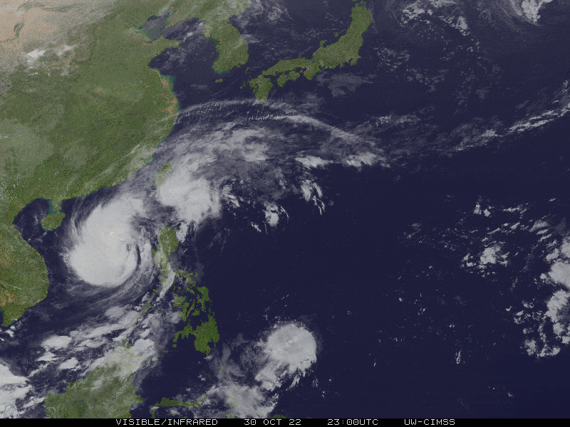
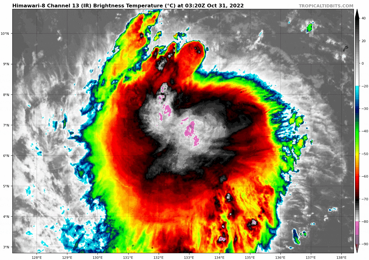
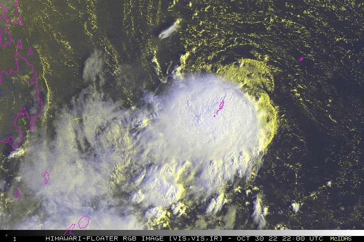
| Current Status & Outlook | Tropical Depression (TD) QUEENIE newly-formed over the South Philippine Sea has quickly intensified into a Tropical Storm (TS) upon crossing the Republic of Palau. Frequent lightning with severe thunderstorms, heavy rains and gusty winds were reported over the capital, Koror during its passage. The storm is now inside the Philippine Area of Responsibility (PAR).
48-hr Outlook: TS QUEENIE is forecast to maintain its strength during the next 12 hours, before weakening into a TD by tomorrow morning, and will continue to dissipate until its demise near the coastal waters of Surigao Provinces on Wednesday morning (Nov 02). The weakening is due to increased dry air and unfavorable upper-level conditions over the area. Its forecast forward speed will decrease from 22 kph to 15 kph while turning WNW for the next couple of days. Typhoon2000 will continue to monitor the progress of this storm for possible changes in its forecast track and intensity. |
| Where is QUEENIE? | As of 2:00 PM PhT today, October 31…0600 GMT:
|
| How strong is it? | Maximum Sustained Winds (1-min avg): 65 kph near the center…Gustiness: 85 kph. |
| Past Movement (06 hrs) | West-Southwest @ 22 kph, across the South Philippine Sea. |
| Potential Philippine Major Landfall Area(s) |
|
| What Philippine areas will be directly affected? | Heavy to Extreme Rainfall (50 mm to >100 mm expected for 24 hrs):
Damaging Winds (gusts of more than 100 km/hr expected):
|
| Potential Storm Surge/Coastal Flooding Areas+ |
+Waves of 3 meters in height are expected in storm surge-prone areas, particularly in coastal areas where the Tropical Cyclone is headed. Kindly visit the PAGASA Storm Surge Updates for more details. |
| 3-Day Forecast Outlook Summary** |
**Important Note: Please be reminded that the Forecast Outlook changes every 6 hours, and the Day 2 and 3 Forecast Track have an average error of 100 and 250 km respectively… while the wind speed forecast error, averages 35 km/hr per day. Therefore, a turn to the left or right of its future track and changes in its wind speed must be anticipated from time to time. |
| Other Storm’s Meteorological Information |
|
| Disclaimer: Information based on data collected by Typhoon2000 (T2k) shall not be taken as official data. Weather information broadcasted and distributed by PAGASA remains as official data. Typhoon2000 (T2k) shall not be responsible for the private use and reliance of its weather information. | |
Issued by: David Michael V. Padua for Typhoon2000 (T2k)
Typhoon2000 (T2K) Integrated Multi-Agency Tracks
:: Not Yet Available
PAGASA TROPICAL CYCLONE WIND SIGNAL
:: None
Image/Screenshot Source: DOST-PAGASA (https://bagong.pagasa.dost.gov.ph/tropical-cyclone/severe-weather-bulletin)


