

TROPICAL STORM PAENG (NALGAE) ADVISORY NO. 06Issued at: 8:00 PM PhT (12:00 GMT) Friday, 28 October 2022
Next update: 2:00 AM PhT (18:00 GMT) Saturday, 29 October 2022 |
|
|---|---|
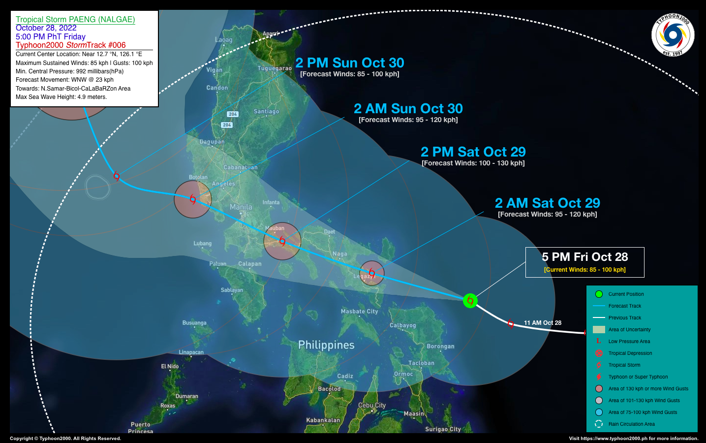
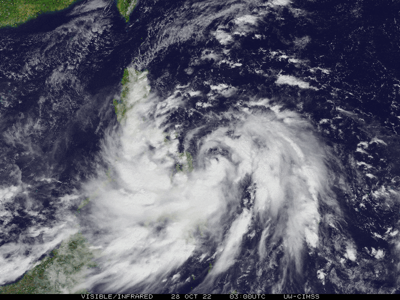
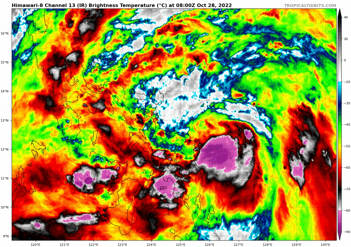
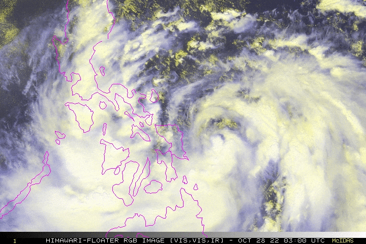
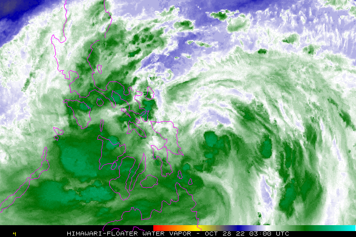
| Current Status & Outlook | Tropical Storm PAENG (NALGAE) has slowed down while turning west-northwest near the coastal waters of Northern Samar…intensifies slightly while heading towards Bicol Region. Strong winds & heavy rainbands associated with this storm are located along the eastern & southern portions of the circulation. Landfall is expected somewhere along the shorelines of Sorsogon, Albay, Cam Sur, or Catanduanes early tomorrow morning.
24-hr Outlook: TS PAENG is forecast to continue moving west-northwest with an increased forward speed of 23 km/hr, and could become a Severe Tropical Storm (STS) later tonight as it traverses the low-level terrain of Bicol Region. It is likely to make landfall over Albay early tomorrow morning, and then traverse Southern Cam Sur, passing over Rinconada District between 3 to 6 AM tomorrow. Then it will be in the vicinity of Pili-Minalabac-Pamplona Area, or about 10 km South of Naga City and 15 km ENE of Pasacao between 6-7 AM tomorrow. By 2 PM tomorrow afternoon, the center of Paeng will be in the vicinity of Atimonan, Quezon, heading towards Metro Manila. The storm’s rainbands and trough together with the enhanced Northeast Monsoon (Amihan) will continue to bring isolated to occasional rains & thunderstorms with gusty winds (30-60 kph) across Luzon, becoming more frequent and widespread across Bicol Region, Southern Tagalog Provinces, Visayas, MiMaRoPa, & Sulu Archipelago tonight & tomorrow. The risk of floods and landslides is currently at medium to high. |
| Where is PAENG? | As of 5:00 PM PhT today, October 28…0900 GMT:
|
| How strong is it? | Maximum Sustained Winds (1-min avg): 85 kph near the center…Gustiness: 100 kph. |
| Past Movement (06 hrs) | West-Northwest @ 19 kph, towards Bicol Region-CaLaBaRZon-Metro Manila Area. |
| Potential Philippine Major Landfall Area(s) |
|
| What Philippine areas will be directly affected? | Heavy to Extreme Rainfall (50 mm to >100 mm expected for 24 hrs):
Damaging Winds (gusts of more than 100 km/hr expected):
|
| Potential Storm Surge/Coastal Flooding Areas+ |
+Waves of 3 meters in height are expected in storm surge-prone areas, particularly in coastal areas where the Tropical Cyclone is headed. Kindly visit the PAGASA Storm Surge Updates for more details. |
| 2-Day Forecast Outlook Summary** |
**Important Note: Please be reminded that the Forecast Outlook changes every 6 hours, and the Day 2 and 3 Forecast Track have an average error of 100 and 250 km respectively… while the wind speed forecast error, averages 35 km/hr per day. Therefore, a turn to the left or right of its future track and changes in its wind speed must be anticipated from time to time. |
| Other Storm’s Meteorological Information |
|
| Disclaimer: Information based on data collected by Typhoon2000 (T2k) shall not be taken as official data. Weather information broadcasted and distributed by PAGASA remains as official data. Typhoon2000 (T2k) shall not be responsible for the private use and reliance of its weather information. | |
Issued by: David Michael V. Padua for Typhoon2000 (T2k)
Typhoon2000 (T2K) Integrated Multi-Agency Tracks
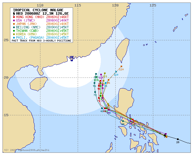
For more info visit: http://www.typhoon2000.ph/multi/?name=NALGAE
PAGASA TROPICAL CYCLONE WIND SIGNAL
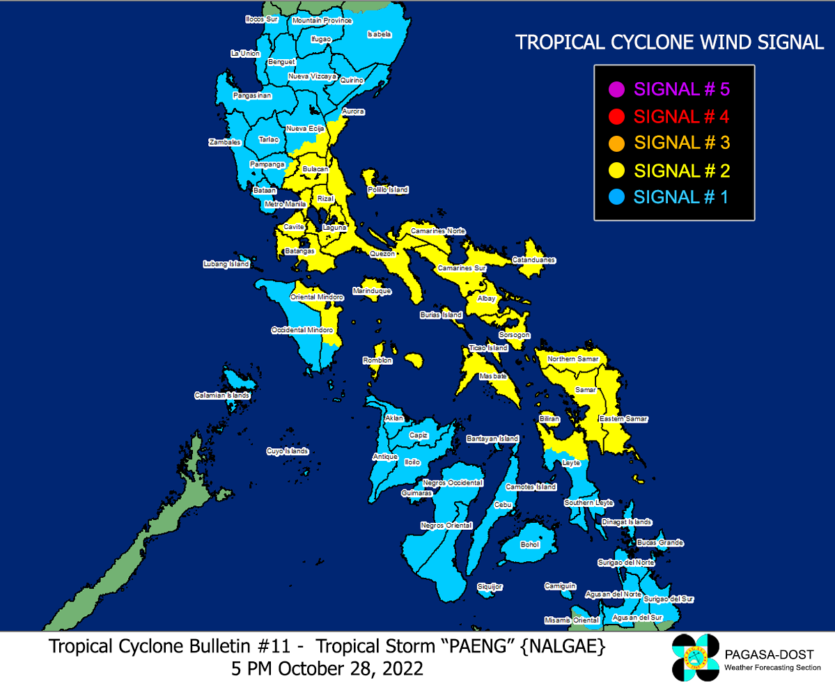
Image/Screenshot Source: DOST-PAGASA (https://bagong.pagasa.dost.gov.ph/tropical-cyclone/severe-weather-bulletin)


