


TROPICAL STORM PAENG (NALGAE) ADVISORY NO. 04Issued at: 8:00 AM PhT (00:00 GMT) Friday, 28 October 2022
Next update: 2:00 PM PhT (06:00 GMT) Friday, 28 October 2022 |
|
|---|---|
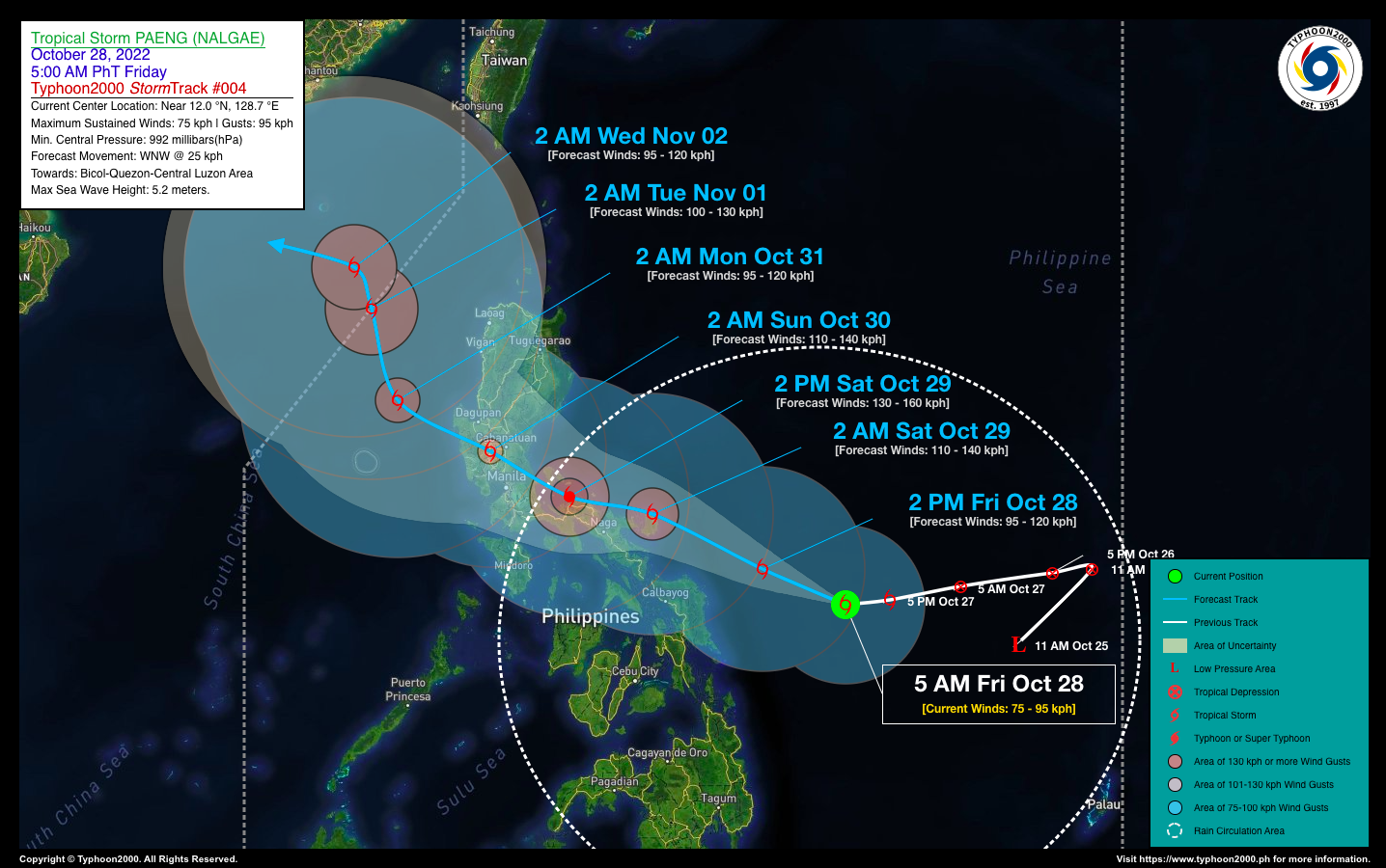
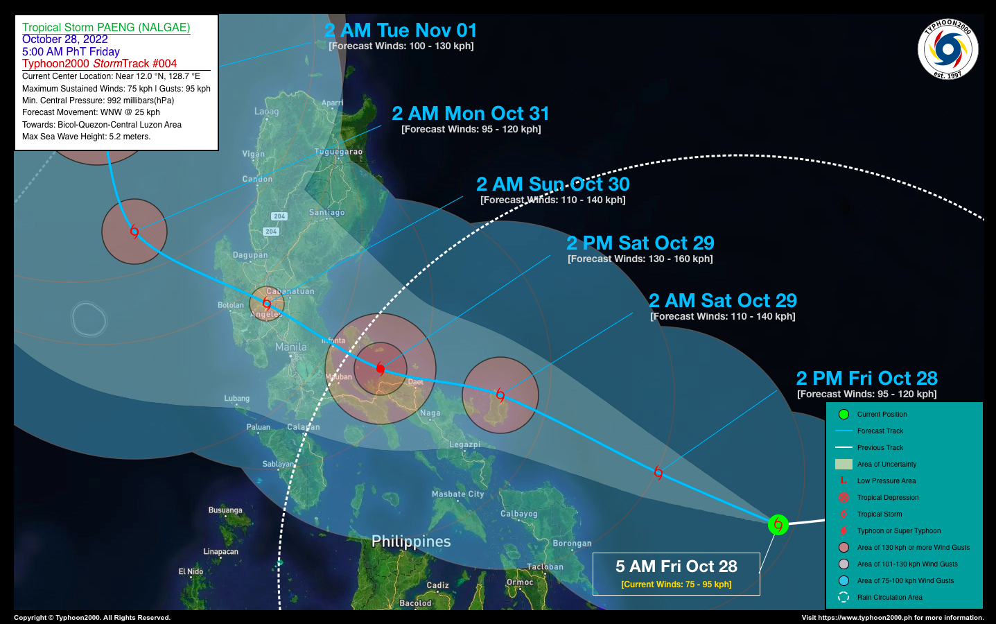
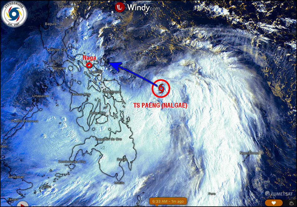
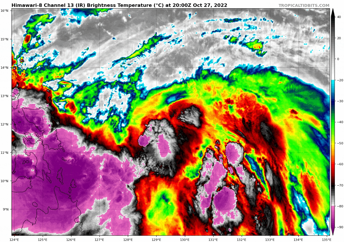
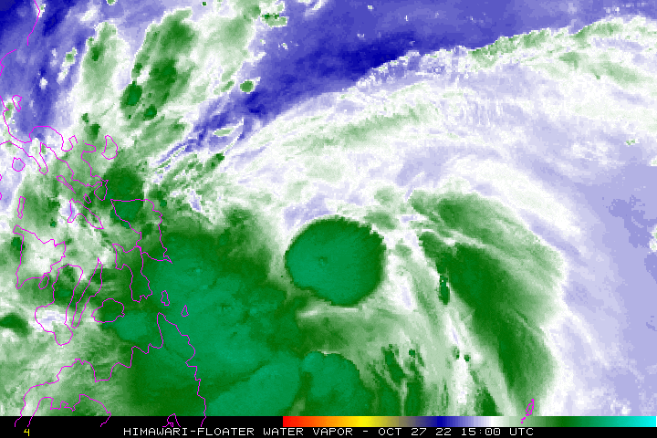
| Current Status & Outlook | Tropical Storm PAENG (NALGAE) is now a large Tropical Cyclone spanning more than 1,000 km across as it slightly intensified while moving westward across the Philippine Sea…continues to threaten Bicol Region and Luzon. Its outer rainbands are now spreading across the Visayas, Bicol Region, Quezon, Romblon, & Marinduque.
24-hr Outlook: TS PAENG is expected to move west-northwest across the Central Philippine Sea, with a faster forward speed of 25 km/hr, and could become a Severe Tropical Storm (STS) later today. It will make landfall or pass very close to Catanduanes by early tomorrow morning as it nears Typhoon strength. The storm’s rainbands and trough together with the enhanced Northeast Monsoon (Amihan) will continue to bring windy conditions (30-60 kph) across Luzon, becoming wet and rainy with severe thunderstorms & squally conditions across Bicol Region, Visayas, MiMaRoPa, Sulu Archipelago, & Mindanao today. The risk of floods and landslides is currently at medium to high. |
| Where is PAENG? | As of 5:00 AM PhT today, October 28…2100 GMT:
|
| How strong is it? | Maximum Sustained Winds (1-min avg): 75 kph near the center…Gustiness: 95 kph. |
| Past Movement (06 hrs) | West @ 20 kph, towards Bicol-Quezon-Central Luzon Area. |
| Potential Philippine Major Landfall Area(s) |
|
| What Philippine areas will be directly affected? | Heavy to Extreme Rainfall (50 mm to >100 mm expected for 24 hrs):
Damaging Winds (gusts of more than 100 km/hr expected):
|
| Potential Storm Surge/Coastal Flooding Areas+ |
+Waves of 3 meters in height are expected in storm surge-prone areas, particularly in coastal areas where the Tropical Cyclone is headed. Kindly visit the PAGASA Storm Surge Updates for more details. |
| 3-Day Forecast Outlook Summary** |
**Important Note: Please be reminded that the Forecast Outlook changes every 6 hours, and the Day 2 and 3 Forecast Track have an average error of 100 and 250 km respectively… while the wind speed forecast error, averages 35 km/hr per day. Therefore, a turn to the left or right of its future track and changes in its wind speed must be anticipated from time to time. |
| Other Storm’s Meteorological Information |
|
| Disclaimer: Information based on data collected by Typhoon2000 (T2k) shall not be taken as official data. Weather information broadcasted and distributed by PAGASA remains as official data. Typhoon2000 (T2k) shall not be responsible for the private use and reliance of its weather information. | |
Issued by: David Michael V. Padua for Typhoon2000 (T2k)
Typhoon2000 (T2K) Integrated Multi-Agency Tracks
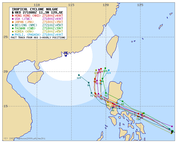
For more info visit: http://www.typhoon2000.ph/multi/?name=NALGAE
PAGASA TROPICAL CYCLONE WIND SIGNAL

Image/Screenshot Source: DOST-PAGASA (https://bagong.pagasa.dost.gov.ph/tropical-cyclone/severe-weather-bulletin)


