
TYPHOON ODETTE (RAI) ADVISORY NO. 11Issued at: 7:00 AM PhT (23:00 GMT) Saturday, 18 December 2021
Next update: 7:00 PM PhT (11:00 GMT) Saturday, 18 December 2021 |
|
|---|---|
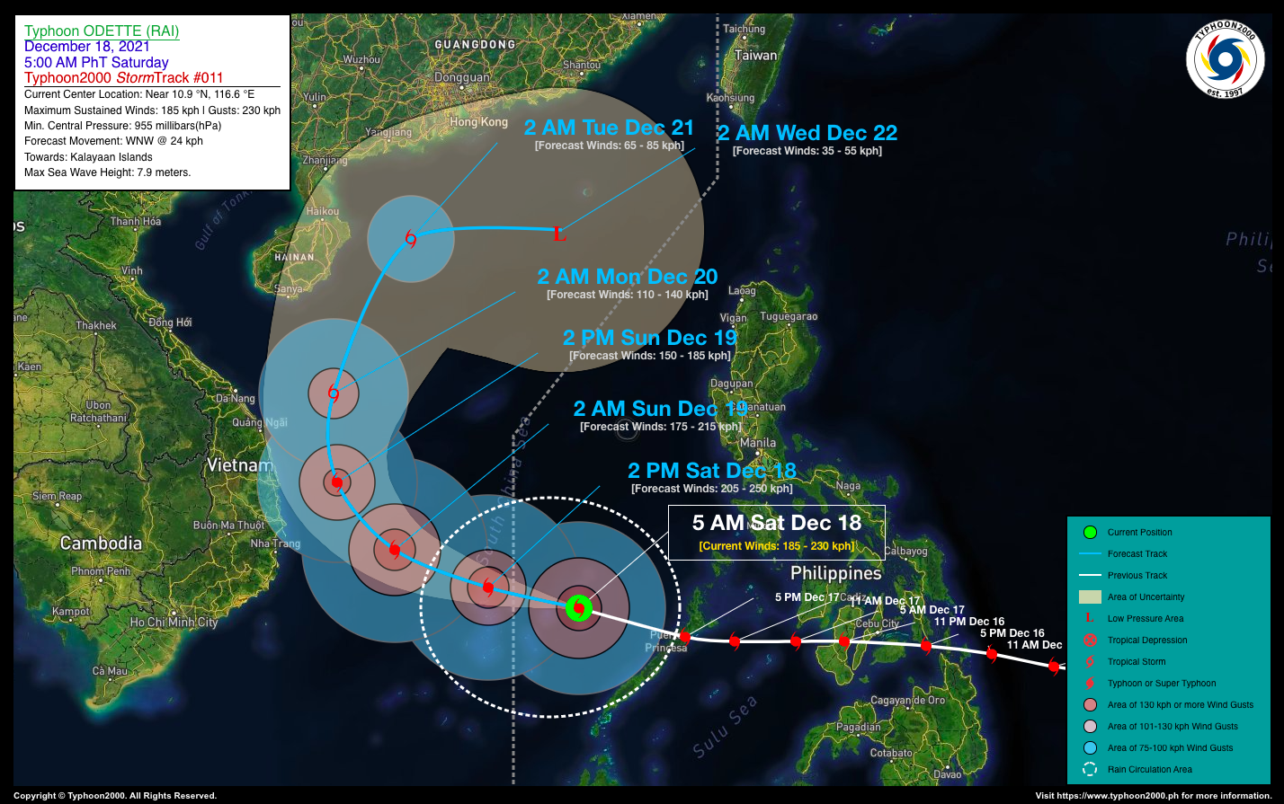
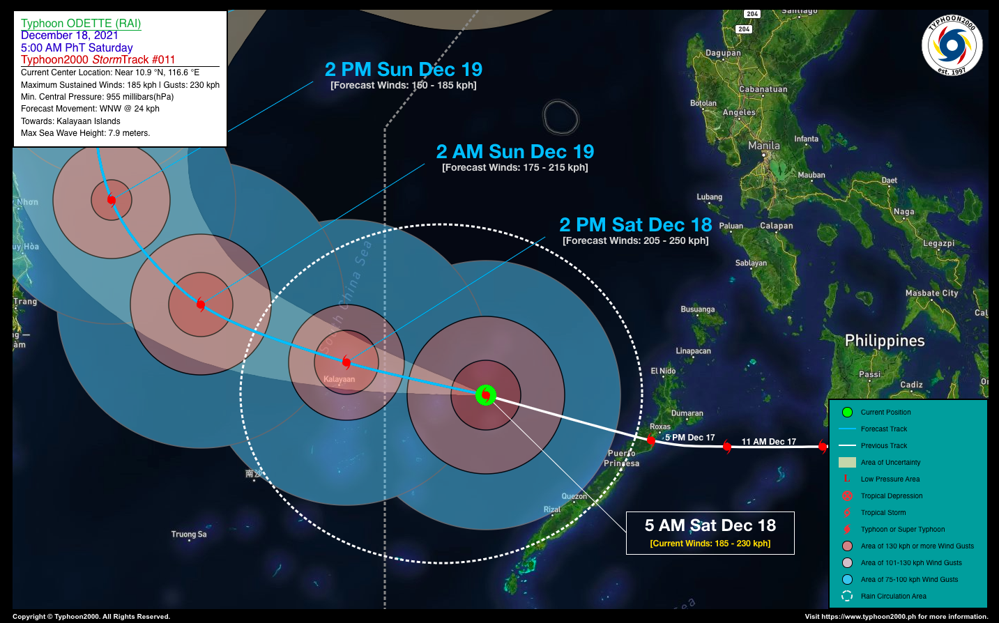
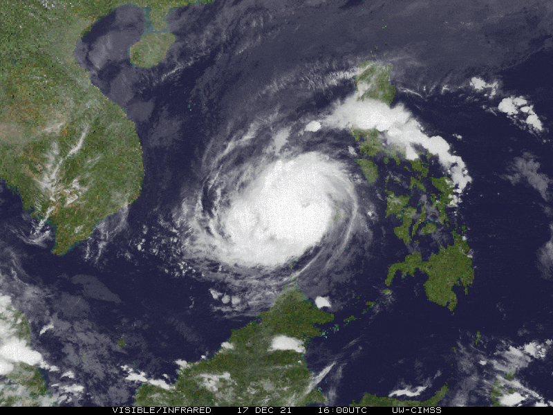
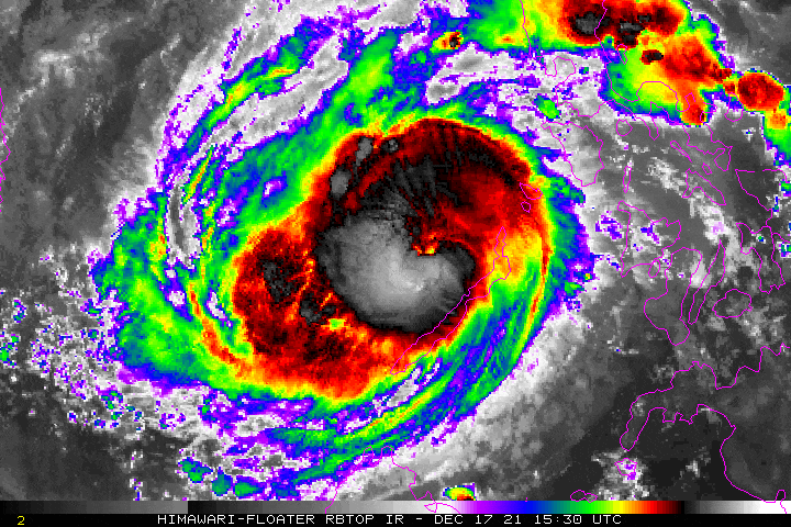
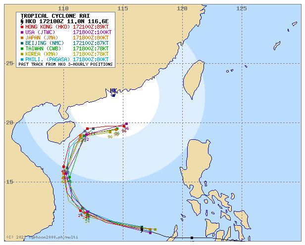
| Current Status & Outlook | Typhoon ODETTE (RAI) re-intensifies over the West Philippine Sea, as it approaches the Kalayaan Islands.
24-hr Outlook: The core of TY ODETTE (RAI) is forecast to continue re-intensifying and will pass very close to the north of Kalayaan Islands this afternoon (between 1 to 3 PM) while moving west-northwestward at a speed of 24 kph. Odette will then exit the Philippine Area of Responsibility (PAR) on or before 12 noon today, and will be approaching the coastal waters of Vietnam tomorrow. |
| Where is ODETTE (RAI)? | As of 5:00 AM PhT today, December 18…2100 GMT:
|
| How strong is it? | Maximum Sustained Winds (1-min avg): 185 kph near the center…Gustiness: 230 kph. |
| Past Movement (06 hrs) | West-Northwest @ 24 kph, towards Kalayaan Islands. |
| Potential Philippine Major Landfall Area(s) |
|
| What Philippine areas will be directly affected? | Heavy to Extreme Rainfall (50 mm to >100 mm expected for 24 hrs):
Damaging Winds (gusts of more than 100 km/hr expected):
|
| Potential Storm Surge/Coastal Flooding Areas+ |
+Waves of 3 to 5 meters in height are expected in storm surge-prone areas, particularly in coastal areas where the Tropical Cyclone is headed. Kindly visit the PAGASA Storm Surge Updates for more details. |
| 2-Day Forecast Outlook Summary** |
**Important Note: Please be reminded that the Forecast Outlook changes every 6 hours, and the Day 2 and 3 Forecast Track have an average error of 100 and 250 km respectively… while the wind speed forecast error, averages 35 km/hr per day. Therefore, a turn to the left or right of its future track and changes in its wind speed must be anticipated from time to time. |
| Other Storm’s Meteorological Information |
|
| Information based on data collected by Typhoon2000 (T2k) shall not be taken as official data. Weather information broadcasted and distributed by PAGASA remains as official data. Typhoon2000 (T2k) shall not be responsible for the private use and reliance of its weather information. | |
Issued by: David Michael V. Padua for Typhoon2000 (T2K)
Typhoon2000 (T2K) Integrated Multi-Agency Tracks
PAGASA TROPICAL CYCLONE WIND SIGNAL
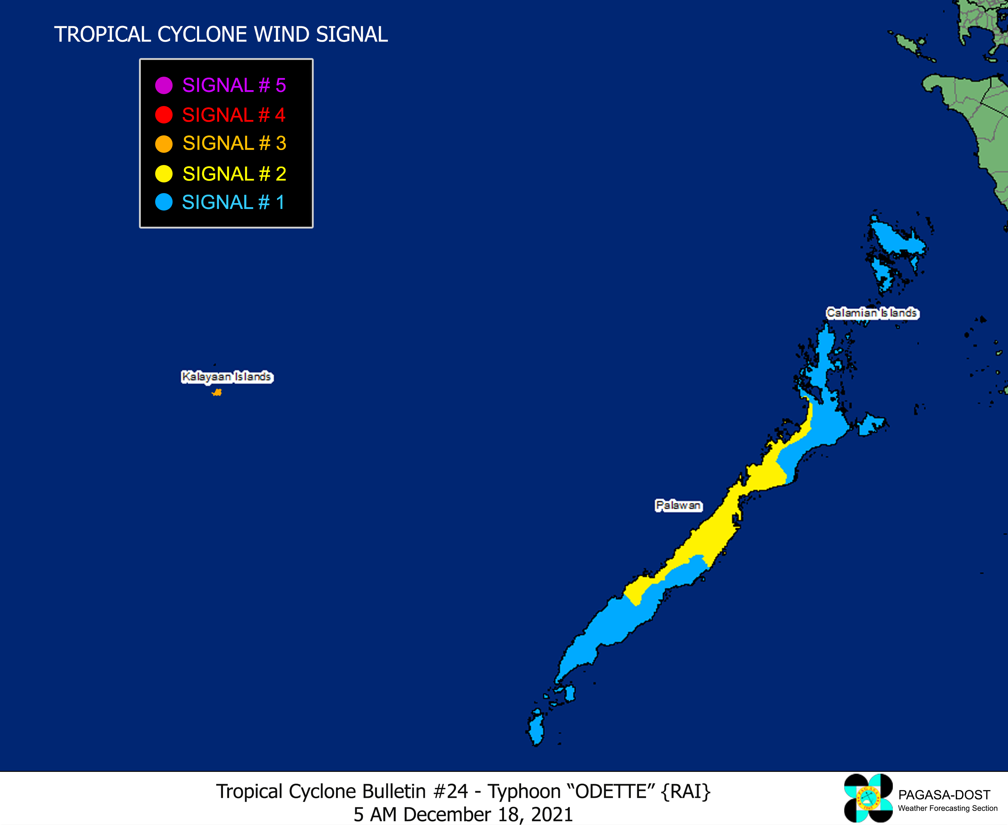
Image/Screenshot Source: DOST-PAGASA (http://bagong.pagasa.dost.gov.ph/tropical-cyclone-bulletin-iframe)


