
TYPHOON ODETTE (RAI) ADVISORY NO. 10Issued at: 7:00 PM PhT (11:00 GMT) Friday, 17 December 2021
Next update: 7:00 AM PhT (23:00 GMT) Saturday, 18 December 2021 |
|
|---|---|
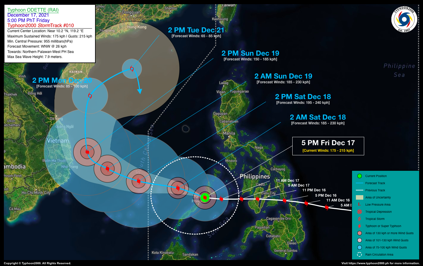
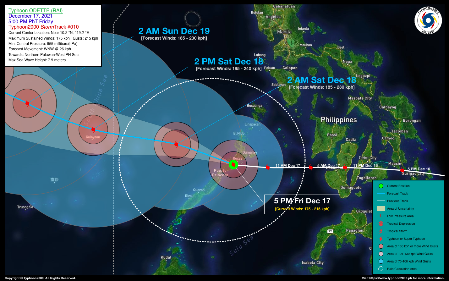
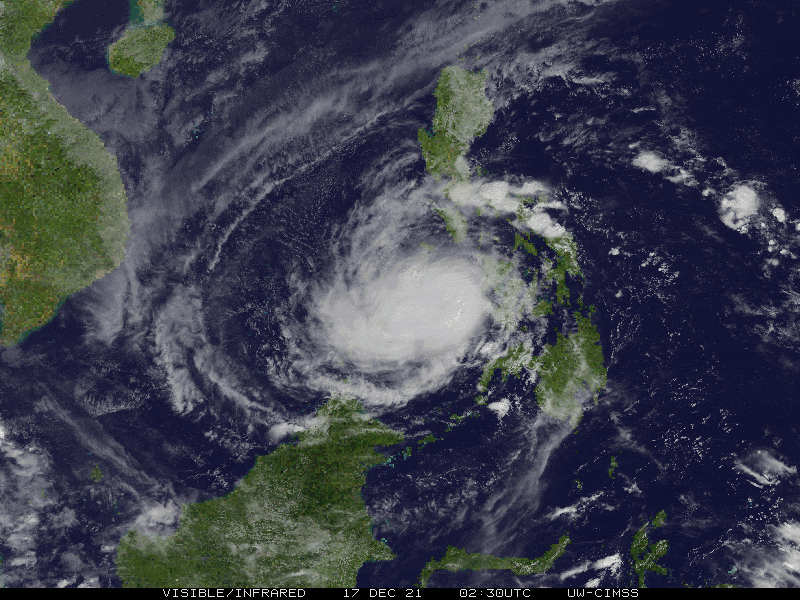
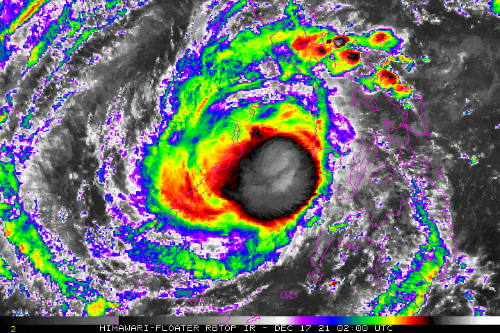
| Current Status & Outlook | Typhoon ODETTE (RAI) has slowed down and weakened slightly…now making landfall along the Municipality of Roxas (Palawan). Heavy rains with destructive winds will be felt across Northern Palawan tonight, with improving weather conditions tomorrow morning as the typhoon moves away.
24-hr Outlook: The core of TY ODETTE (RAI) is forecast to re-intensify tomorrow while moving across the warm waters of the West Philippine Sea, and will track west-northwestward at a speed of 26 kph. Odette will then be passing within the vicinity of Kalayaan Island Group tomorrow afternoon after exiting the Philippine Area of Responsibility (PAR) late tomorrow morning. |
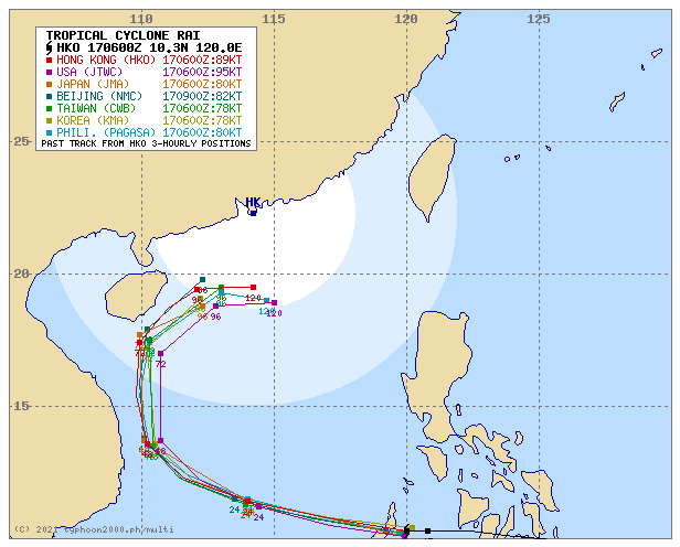
| Where is ODETTE (RAI)? | As of 5:00 PM PhT today, December 17…0900 GMT:
|
| How strong is it? | Maximum Sustained Winds (1-min avg): 175 kph near the center…Gustiness: 215 kph. |
| Past Movement (06 hrs) | West @ 22 kph, towards Northern Palawan-West Ph Sea-Kalayaan Is. Group. |
| Potential Philippine Major Landfall Area(s) |
|
| What Philippine areas will be directly affected? | Heavy to Extreme Rainfall (50 mm to >100 mm expected for 24 hrs):
Damaging Winds (gusts of more than 100 km/hr expected):
|
| Potential Storm Surge/Coastal Flooding Areas+ |
+Waves of 3 to 5 meters in height are expected in storm surge-prone areas, particularly in coastal areas where the Tropical Cyclone is headed. Kindly visit the PAGASA Storm Surge Updates for more details. |
| 2-Day Forecast Outlook Summary** |
**Important Note: Please be reminded that the Forecast Outlook changes every 6 hours, and the Day 2 and 3 Forecast Track have an average error of 100 and 250 km respectively… while the wind speed forecast error, averages 35 km/hr per day. Therefore, a turn to the left or right of its future track and changes in its wind speed must be anticipated from time to time. |
| Other Storm’s Meteorological Information |
|
| Information based on data collected by Typhoon2000 (T2k) shall not be taken as official data. Weather information broadcasted and distributed by PAGASA remains as official data. Typhoon2000 (T2k) shall not be responsible for the private use and reliance of its weather information. | |
Issued by: David Michael V. Padua for Typhoon2000 (T2K)
Typhoon2000 (T2K) Integrated Multi-Agency Tracks
PAGASA TROPICAL CYCLONE WIND SIGNAL
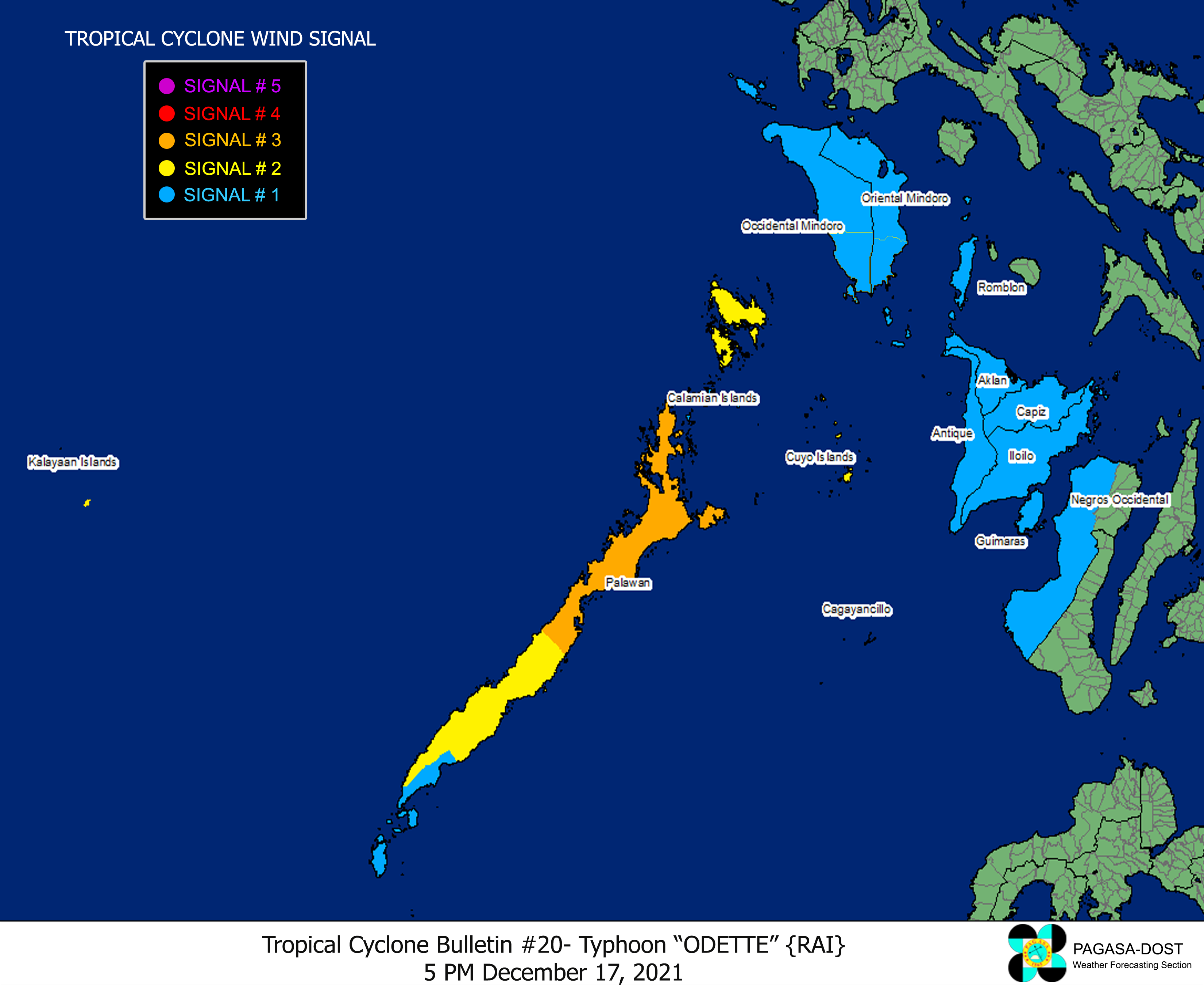
Image/Screenshot Source: DOST-PAGASA (http://bagong.pagasa.dost.gov.ph/tropical-cyclone-bulletin-iframe)


