
TYPHOON KIKO (CHANTHU) ADVISORY NO. 09Issued at: 7:00 PM PhT (11:00 GMT) Saturday, 11 September 2021
Next update: 7:00 AM PhT (23:00 GMT) Sunday, 12 September 2021 |
|
|---|---|
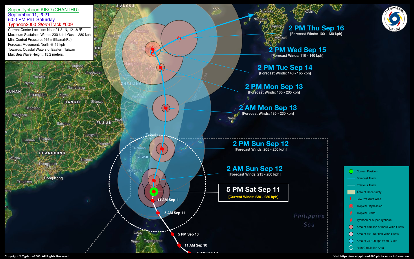
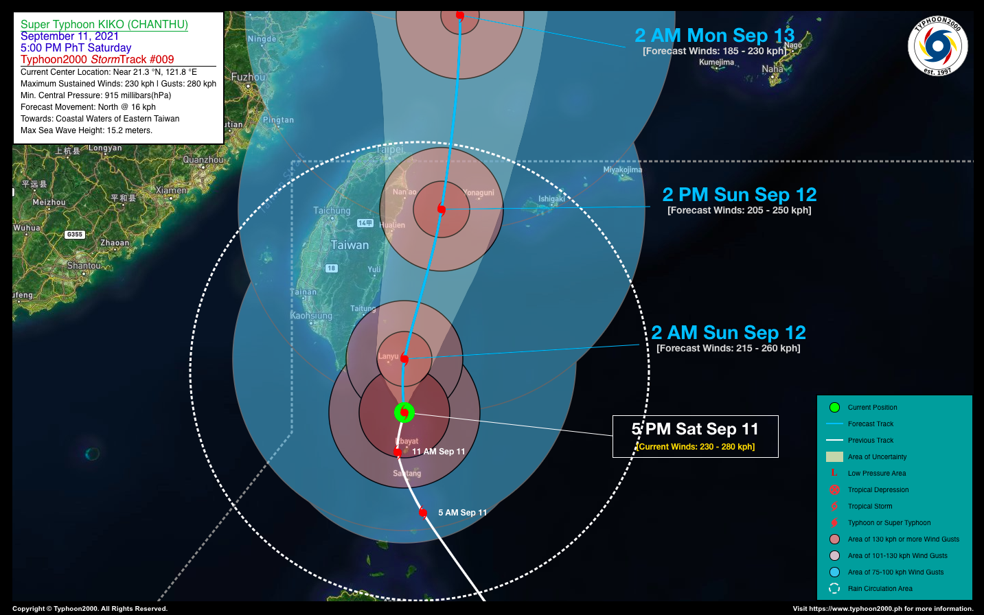
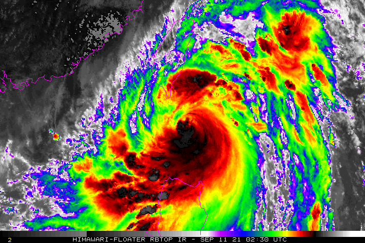
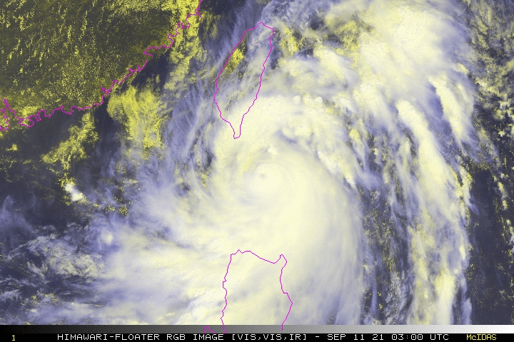
| Current Status & Outlook | KIKO (CHANTHU) is no longer a Super Typhoon as its core continues to deteriorate while moving slowly northward across the Bashi Channel, away from Itbayat Island…now approaching the Taiwanese Island of Lanyu. However, the Batanes Group of Islands will continue to experience stormy weather tonight with improving weather conditions by tomorrow.
24-hr Outlook: TY KIKO (CHANTHU) is forecast to accelerate slightly northward to north-northeastward for the next 24 hours, weakening to a Category 3 Typhoon. The decaying core (eye & eyewall) of this powerful typhoon will pass over or very close to Lanyu Island (Taiwan) tonight or early tomorrow morning, and will be over the coastal waters of Northeastern Taiwan tomorrow afternoon. Meanwhile, the presence of this tropical cyclone will continue to enhance the Southwest Monsoon Rains (Habagat) across Northern & Central Luzon including Occidental Mindoro, Panay, Romblon, Marinduque, Kalayaan Island Group, and Palawan this weekend. |
| Where is KIKO (CHANTHU)? | As of 5:00 PM PhT today, September 11…0900 GMT:
|
| How strong is it? | Maximum Sustained Winds (1-min avg): 230 kph near the center…Gustiness: 280 kph. |
| Past Movement (06 hrs) | North @ 11 kph, towards the Coastal Waters of Eastern Taiwan. |
| Potential Philippine Landfall Area(s) |
|
| What Philippine areas will be directly affected? | Heavy to Extreme Rainfall (50 mm to >100 mm expected for 24 hrs):
Damaging Winds (gusts of more than 100 km/hr expected):
|
| Potential Storm Surge/Coastal Flooding Areas+ |
+Waves of 2 to 6 meters in height are expected in storm surge-prone areas, particularly in coastal areas where the Tropical Cyclone is headed. Kindly visit the PAGASA Storm Surge Updates for more details. |
| 2-Day Forecast Outlook Summary** |
**Important Note: Please be reminded that the Forecast Outlook changes every 6 hours, and the Day 2 and 3 Forecast Track have an average error of 100 and 250 km respectively… while the wind speed forecast error, averages 35 km/hr per day. Therefore, a turn to the left or right of its future track and changes in its wind speed must be anticipated from time to time. |
| Other Storm’s Meteorological Information |
|
| Information based on data collected by Typhoon2000 (T2k) shall not be taken as official data. Weather information broadcasted and distributed by PAGASA remains as official data. Typhoon2000 (T2k) shall not be responsible for the private use and reliance of its weather information. | |
Issued by: David Michael V. Padua for Typhoon2000 (T2K)
Typhoon2000 (T2K) Integrated Multi-Agency Tracks

PAGASA TROPICAL CYCLONE WIND SIGNAL
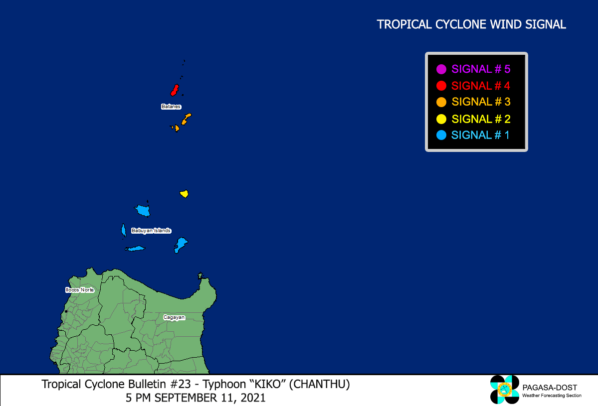
Image/Screenshot Source: DOST-PAGASA (http://bagong.pagasa.dost.gov.ph/tropical-cyclone-bulletin-iframe/)


