


TYPHOON KARDING (NORU) ADVISORY NO. 07Issued at: 2:00 AM PhT (18:00 GMT) Sunday, 25 September 2022
Next update: 8:00 AM PhT (00:00 GMT) Sunday, 25 September 2022 |
|
|---|---|
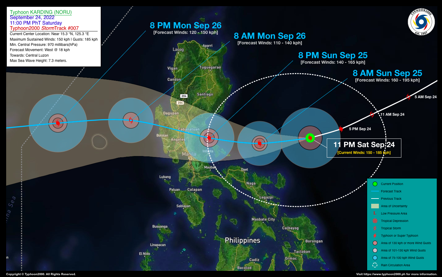
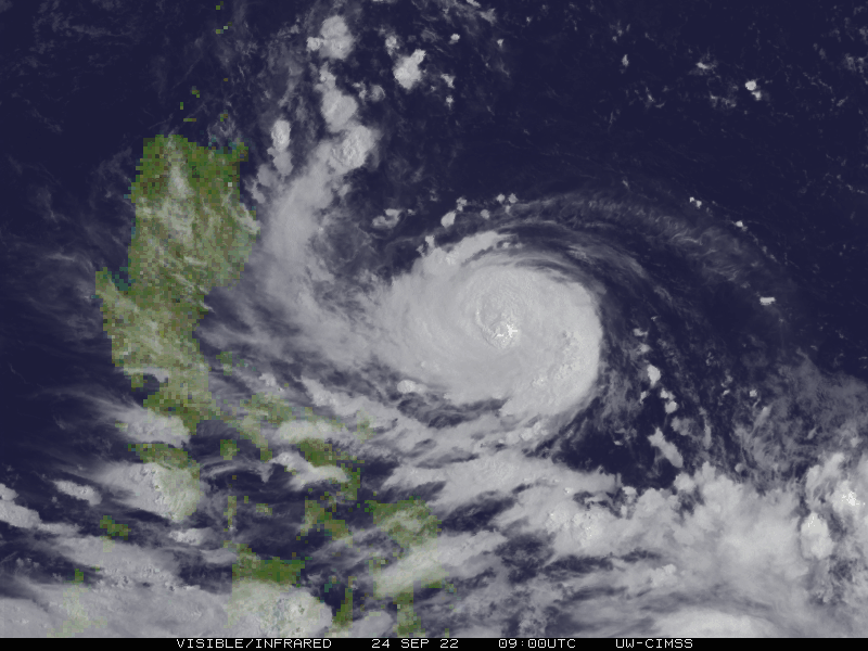
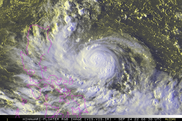
| Current Status & Outlook | Typhoon KARDING [NORU] has maintained its Rapid Intensification (RI) Process as it continues to move west-southwest towards Central Luzon during the past 6 hours. Its outer rain circulation has started to expand across Bicol & Quezon Provinces.
Based on current observations, there is a possibility that this typhoon may reach Category 3 strength (185-205 kph) prior to making landfall over Aurora or Northern Quezon – if its intensification process continues to take place. Residents living along the path must monitor the progress of this typhoon. Please take all necessary precautions. 24-hr Outlook: TY KARDING is forecast to continue intensifying becoming a Category 2 Typhoon by tomorrow morning, and will turn westward at a decreased forward speed of 18 km/hr. Its southern rainbands will begin to affect Northern Quezon, Aurora, and the northern portions of Bicol Region beginning tomorrow morning (while passing some 200 km north of Naga City, Cam Sur). By tomorrow afternoon, the core of the typhoon will pass along the northern coastal waters of Polillo Island Group, and will make landfall somewhere along Dingalan, Aurora tomorrow evening. Meanwhile, this typhoon will enhance the Southwest Monsoon (Habagat) and bring occasional rains and thunderstorms across the rest of Southern Luzon, MiMaRoPa, Sulu Archipelago, Visayas and Western Mindanao beginning tomorrow through Monday (Sept 26). |
| Where is KARDING (NORU)? | As of 11:00 PM PhT last night, September 24…1500 GMT:
|
| How strong is it? | Maximum Sustained Winds (1-min avg): 150 kph near the center…Gustiness: 185 kph. |
| Past Movement (06 hrs) | West-Southwest @ 20 kph, towards Polillo Island Group, Aurora & Central Luzon. |
| Potential Philippine Major Landfall Area(s) |
|
| What Philippine areas will be directly affected? | Heavy to Extreme Rainfall (50 mm to >100 mm expected for 24 hrs):
Damaging Winds (gusts of more than 100 km/hr expected):
|
| Potential Storm Surge/Coastal Flooding Areas+ |
+Waves of 2 to 4 meters in height are expected in storm surge-prone areas, particularly in coastal areas where the Tropical Cyclone is headed. Kindly visit the PAGASA Storm Surge Updates for more details. |
| 3-Day Forecast Outlook Summary** |
**Important Note: Please be reminded that the Forecast Outlook changes every 6 hours, and the Day 2 and 3 Forecast Track have an average error of 100 and 250 km respectively… while the wind speed forecast error, averages 35 km/hr per day. Therefore, a turn to the left or right of its future track and changes in its wind speed must be anticipated from time to time. |
| Other Storm’s Meteorological Information |
|
| Information based on data collected by Typhoon2000 (T2k) shall not be taken as official data. Weather information broadcasted and distributed by PAGASA remains as official data. Typhoon2000 (T2k) shall not be responsible for the private use and reliance of its weather information. | |
Issued by: David Michael V. Padua for Typhoon2000 (T2k)
Typhoon2000 (T2K) Integrated Multi-Agency Tracks

PAGASA TROPICAL CYCLONE WIND SIGNAL

Image/Screenshot Source: DOST-PAGASA (https://bagong.pagasa.dost.gov.ph/tropical-cyclone/severe-weather-bulletin)


