


SUPER TYPHOON GORING (SAOLA) ADVISORY NO. 13Issued at: 8:00 AM PhT (00:00 GMT) Wednesday, 30 Aug 2023
Next update: 8:00 PM PhT (12:00 GMT) Wednesday, 30 Aug 2023 |
|
|---|---|
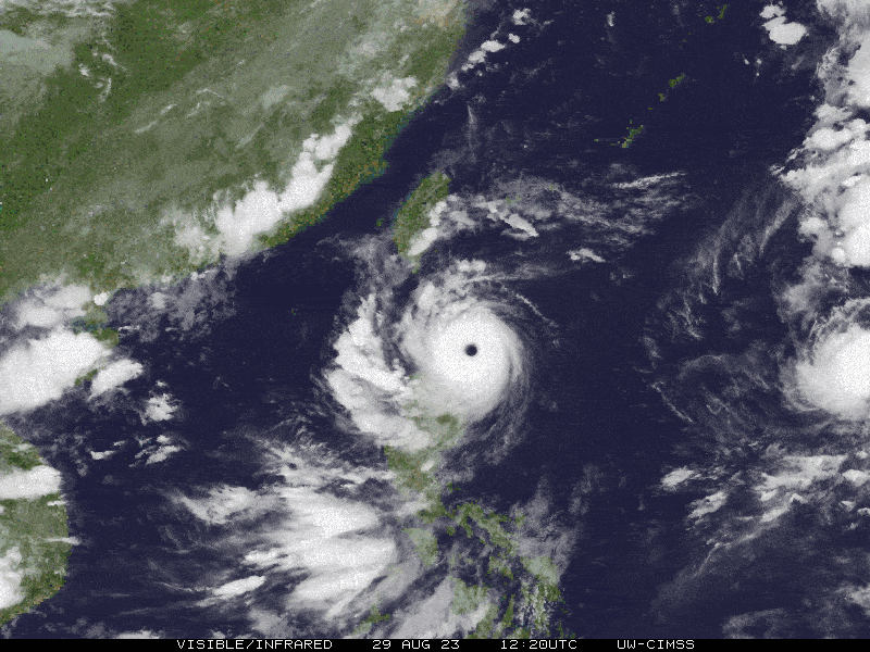
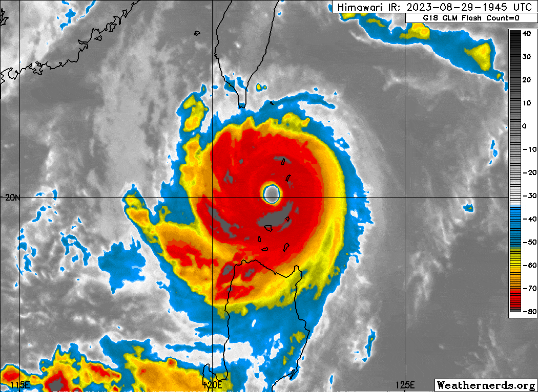
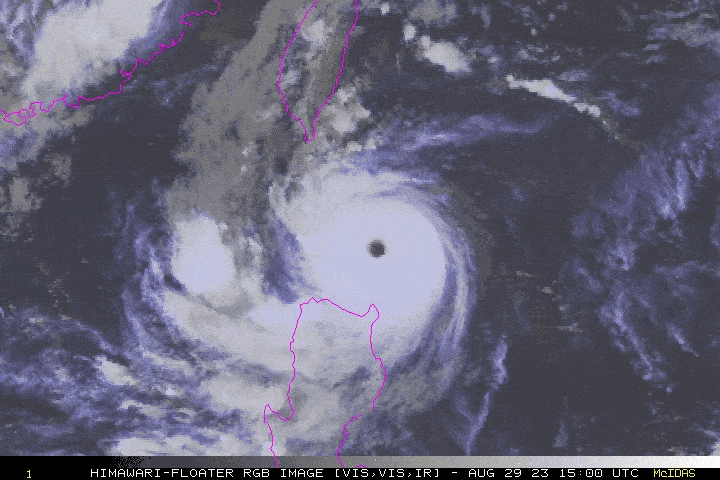
| Current Status & Outlook | GORING (SAOLA) became a Super Typhoon last night while crossing Luzon Strait. Its 43-km. wide clear “eye” has passed between the towns of Babuyan and Basco around 12 to 2AM. Catastrophic winds of more than 200 km/hr have likely been felt during the passage of its Eyewall.
48-hr Outlook: STY GORING is forecast to slightly weaken within the next 24 hours, as the system exits the Philippine Area of Responsibility (PAR) on a west-northwest track later tonight. By early Thursday morning (Sept 01), GORING is forecast to weaken just below Super Typhoon strength as it starts to move westward closer to the coastal waters of Hong Kong. The presence of TY GORING will continue to enhance the Southwest Monsoon (Habagat) across Western Visayas, MiMaRoPa, and Western Luzon this week. Isolated, Scattered to Occasional “On-&-Off” rain showers and Severe Thunderstorms with gusty winds will be expected along these areas especially during the afternoon and evening. Please take all necessary precautions against floods, landslides incl. lahars, storm surges, and high winds that will be brought about by these systems. |
| Where is GORIO (SAOLA)? | As of 5:00 AM PhT today, August 30…2100 GMT:
|
| How strong is it? | Maximum Sustained Winds (1-min avg): 250 kph near the center…Gustiness: 305 kph. |
| Past Movement (06 hrs) | West-Northwest @ 17 kph, towards the Western Part of the Bashi Channel. |
| Potential Philippine Major Landfall Area(s) |
|
| What Philippine areas will be directly affected? | Heavy to Extreme Rainfall (50 mm to >100 mm expected for 24 hrs):
Damaging Winds (gusts of more than 100 km/hr expected):
|
| Potential Storm Surge/Coastal Flooding Areas+ |
+Waves of 3 meters or more in height are expected in storm surge-prone areas, particularly in coastal areas where the Tropical Cyclone is headed. Kindly visit the PAGASA Storm Surge Updates for more details. |
| 3-Day Forecast Outlook Summary** |
**Important Note: Please be reminded that the Forecast Outlook changes every 6 hours, and the Day 2 and 3 Forecast Track have an average error of 100 and 250 km respectively… while the wind speed forecast error, averages 35 km/hr per day. Therefore, a turn to the left or right of its future track and changes in its wind speed must be anticipated from time to time. |
| Other Storm’s Meteorological Information |
|
| Disclaimer: Information based on data collected by Typhoon2000 (T2k) shall not be taken as official data. Weather information broadcasted and distributed by PAGASA remains as official data. Typhoon2000 (T2k) shall not be responsible for the private use and reliance of its weather information. | |
Issued by: David Michael V. Padua for Typhoon2000 (T2k)
Typhoon2000 (T2K) Integrated Multi-Agency Tracks

For more info visit: (http://www.typhoon2000.ph/multi/?name=SAOLA)
PAGASA TROPICAL CYCLONE WIND SIGNAL
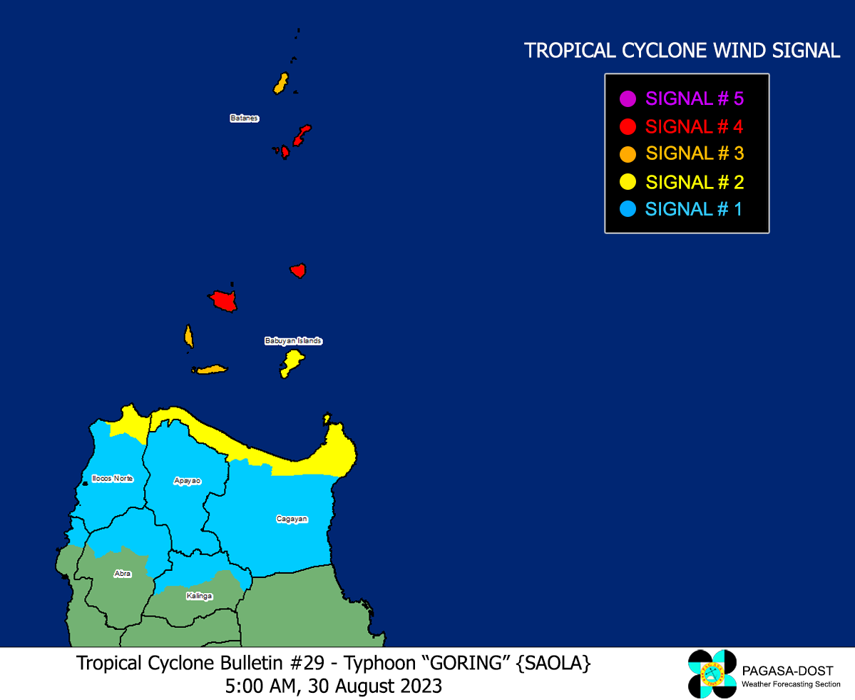
Image/Screenshot Source: DOST-PAGASA (https://bagong.pagasa.dost.gov.ph/tropical-cyclone/severe-weather-bulletin)


