


SEVERE TROPICAL STORM FLORITA (MA-ON) ADVISORY NO. 08Issued at: 2:00 AM PhT (18:00 GMT) Wednesday, 24 August 2022
Next update: 2:00 PM PhT (06:00 GMT) Wednesday, 24 August 2022 |
|
|---|---|
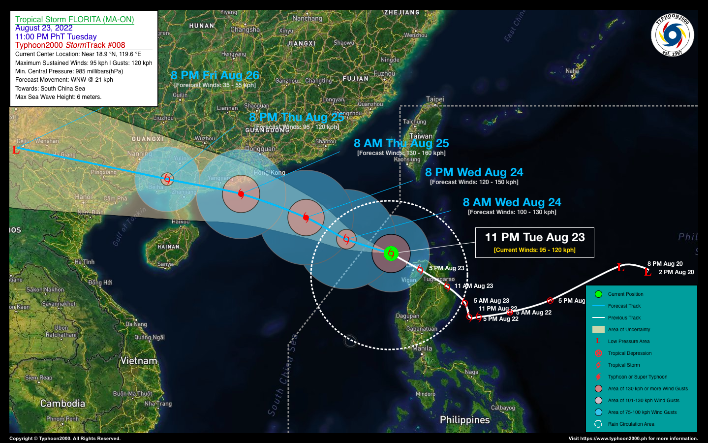
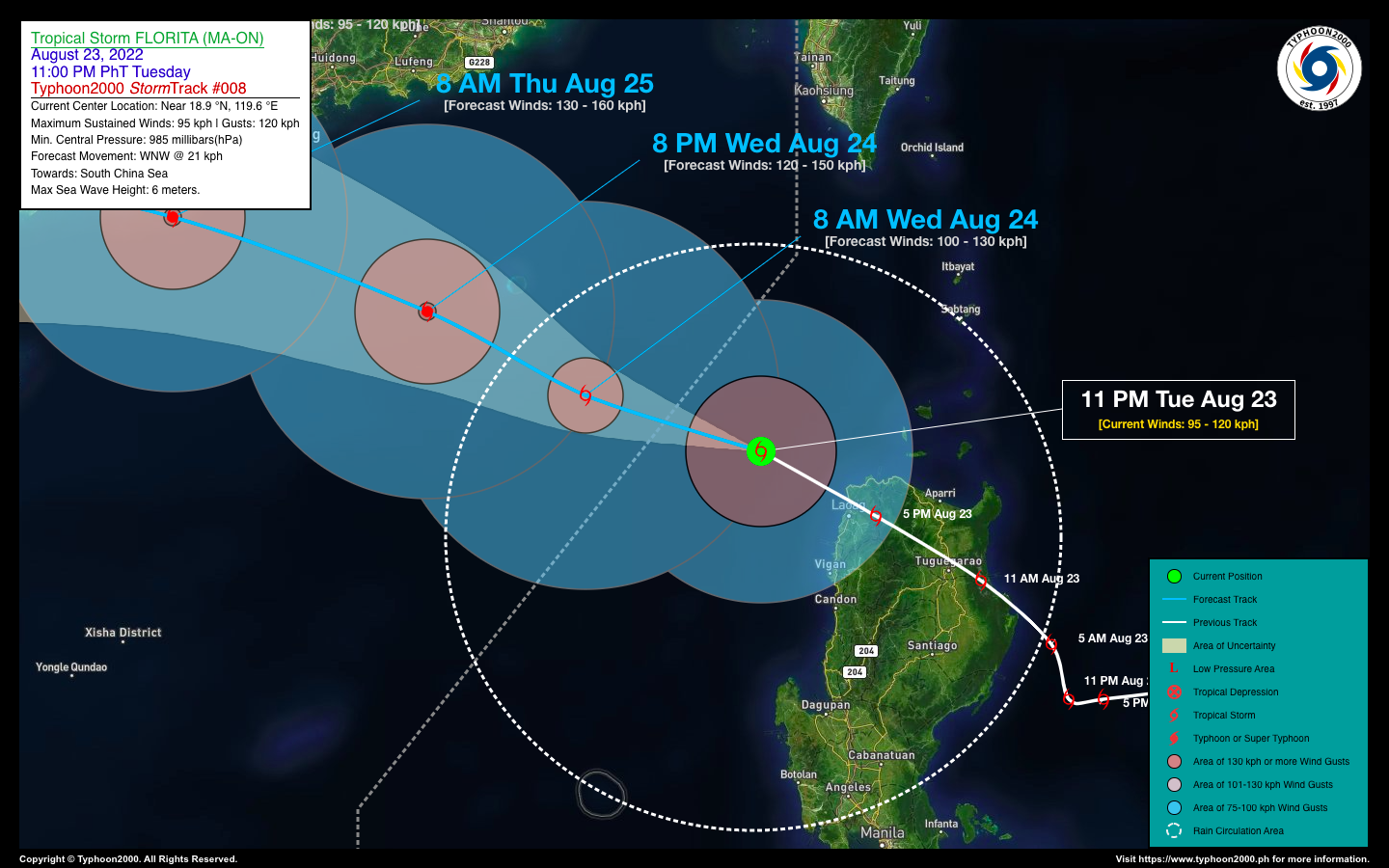
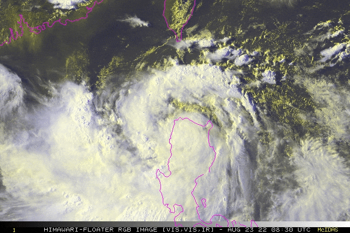
| Current Status & Outlook | Severe Tropical Storm FLORITA (MA-ON) continues to weaken while accelerating west-northwestward across the West Philippine Sea, and is about to exit the northwestern border of the Philippine Area of Responsibility (PAR). Improving weather conditions will be expected today across Northern Luzon as the system moves farther away.
24-hr Outlook: STS FLORITA (MA-ON) is forecast to reorganize while over the South China Sea this morning, and could become a Category 1 Typhoon with winds of 120 kph later tonight. Meanwhile, the enhanced Southwest Monsoon (Habagat) will continue to bring scattered to occasional rains with some severe thunderstorms across the western sections of Luzon including Metropolitan Manila, MiMaRoPa, Sulu Archipelago, & Western Visayas today. Risk of flooding and landslides will remain Medium to High. |
| Where is FLORITA (MA-ON)? | As of 11:00 PM PhT last night, August 23…1500 GMT:
|
| How strong is it? | Maximum Sustained Winds (1-min avg): 95 kph near the center…Gustiness: 120 kph. |
| Past Movement (06 hrs) | West-Northwest @ 26 kph, towards Southern China. |
| Potential Philippine Major Landfall Area(s) |
|
| What Philippine areas will be directly affected? | Heavy to Extreme Rainfall (50 mm to >100 mm expected for 24 hrs):
Damaging Winds (gusts of more than 100 km/hr expected):
|
| Potential Storm Surge/Coastal Flooding Areas+ |
+Waves of 1 to 3 meters in height are expected in storm surge-prone areas, particularly in coastal areas where the Tropical Cyclone is headed. Kindly visit the PAGASA Storm Surge Updates for more details. |
| 2-Day Forecast Outlook Summary** |
**Important Note: Please be reminded that the Forecast Outlook changes every 6 hours, and the Day 2 and 3 Forecast Track have an average error of 100 and 250 km respectively… while the wind speed forecast error, averages 35 km/hr per day. Therefore, a turn to the left or right of its future track and changes in its wind speed must be anticipated from time to time. |
| Other Storm’s Meteorological Information |
|
| Information based on data collected by Typhoon2000 (T2k) shall not be taken as official data. Weather information broadcasted and distributed by PAGASA remains as official data. Typhoon2000 (T2k) shall not be responsible for the private use and reliance of its weather information. | |
Issued by: David Michael V. Padua for Typhoon2000 (T2k)
Typhoon2000 (T2K) Integrated Multi-Agency Tracks

PAGASA TROPICAL CYCLONE WIND SIGNAL

Image/Screenshot Source: DOST-PAGASA (https://bagong.pagasa.dost.gov.ph/tropical-cyclone/severe-weather-bulletin)


