

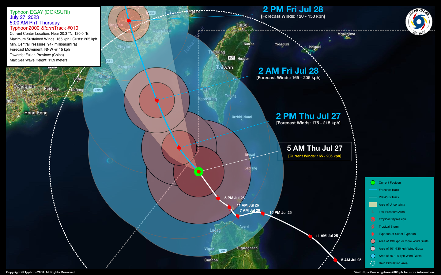

TYPHOON EGAY (DOKSURI) ADVISORY NO. 10Issued at: 8:00 AM PhT (00:00 GMT) Thursday, 27 July 2023
Next update: 8:00 PM PhT (12:00 GMT) Thursday, 27 July 2023 |
|
|---|---|
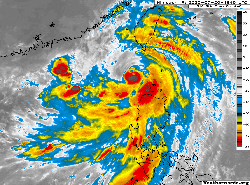
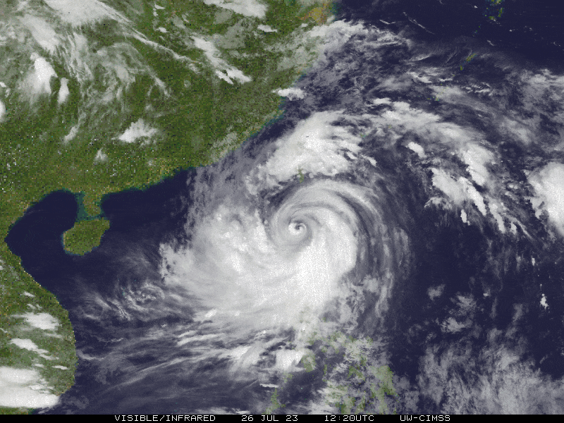
| Current Status & Outlook | Typhoon (TY) EGAY [DOKSURI] is about to exit the Philippine Area of Responsibility (PAR) as it continues losing strength over the western part of the Bashi Channel. However, its broad eastern rainbands will continue to bring rainfall across Ilocos Region and some portions of Cagayan Valley & the Cordillera Region today.
48-hr Outlook: TY EGAY (DOKSURI) will be outside Philippine Area of Responsibility (PAR) later today, as it tries to re-intensify while over the South China Sea. The core of EGAY is forecast to make landfall over Fujian Province on Friday morning (Jul 28) with estimated 1-min. wind speeds of 165 kph (Category 2). It will then start to decay rapidly as it moves across the rugged terrain of Southeastern China on Friday evening through Saturday (Jul 29). The presence of TY EGAY (DOKSURI) will continue to enhance the Southwest Monsoon (Habagat) across Western Visayas, MiMaRoPa, and Luzon today. Isolated to Occasional “On-&-Off” rain showers and thunderstorms will be expected across these areas especially during the afternoon and evening. Please take all necessary precautions against floods, landslides incl. lahars, storm surges, and high winds brought about by these systems. |
| Where is EGAY (DOKSURI)? | As of 5:00 AM PhT today, July 27…2100 GMT:
|
| How strong is it? | Maximum Sustained Winds (1-min avg): 165 kph near the center…Gustiness: 205 kph. |
| Past Movement (06 hrs) | Northwest @ 10 kph, towards Fujian Province (Southern China). |
| Potential Philippine Major Landfall Area(s) |
|
| What Philippine areas will be directly affected? | Heavy to Extreme Rainfall (50 mm to >100 mm expected for 24 hrs):
Damaging Winds (gusts of more than 100 km/hr expected):
|
| Potential Storm Surge/Coastal Flooding Areas+ |
+Waves of 2 to more than 3 meters in height are expected in storm surge-prone areas, particularly in coastal areas where the Tropical Cyclone is headed. Kindly visit the PAGASA Storm Surge Updates for more details. |
| 1-Day Forecast Outlook Summary** |
**Important Note: Please be reminded that the Forecast Outlook changes every 6 hours, and the Day 2 and 3 Forecast Track have an average error of 100 and 250 km respectively… while the wind speed forecast error, averages 35 km/hr per day. Therefore, a turn to the left or right of its future track and changes in its wind speed must be anticipated from time to time. |
| Other Storm’s Meteorological Information |
|
| Disclaimer: Information based on data collected by Typhoon2000 (T2k) shall not be taken as official data. Weather information broadcasted and distributed by PAGASA remains as official data. Typhoon2000 (T2k) shall not be responsible for the private use and reliance of its weather information. | |
Issued by: David Michael V. Padua for Typhoon2000 (T2k)
Typhoon2000 (T2K) Integrated Multi-Agency Tracks
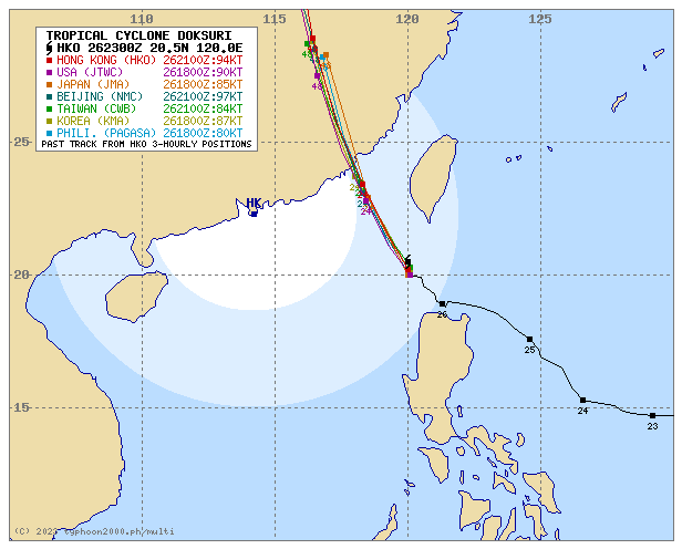
For more info visit: (http://www.typhoon2000.ph/multi/?name=DOKSURI)
PAGASA TROPICAL CYCLONE WIND SIGNAL
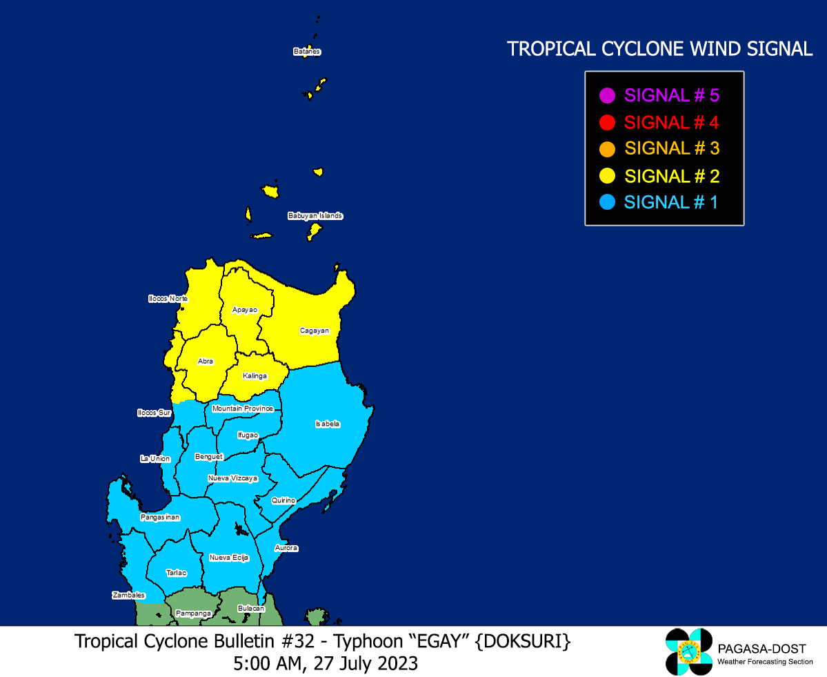
Image/Screenshot Source: DOST-PAGASA (https://bagong.pagasa.dost.gov.ph/tropical-cyclone/severe-weather-bulletin)


