

TYPHOON EGAY (DOKSURI) ADVISORY NO. 06Issued at: 11:45 PM PhT (15:45 GMT) Tuesday, 25 July 2023
Next update: 8:00 AM PhT (00:00 GMT) Wednesday, 26 July 2023 |
|
|---|---|
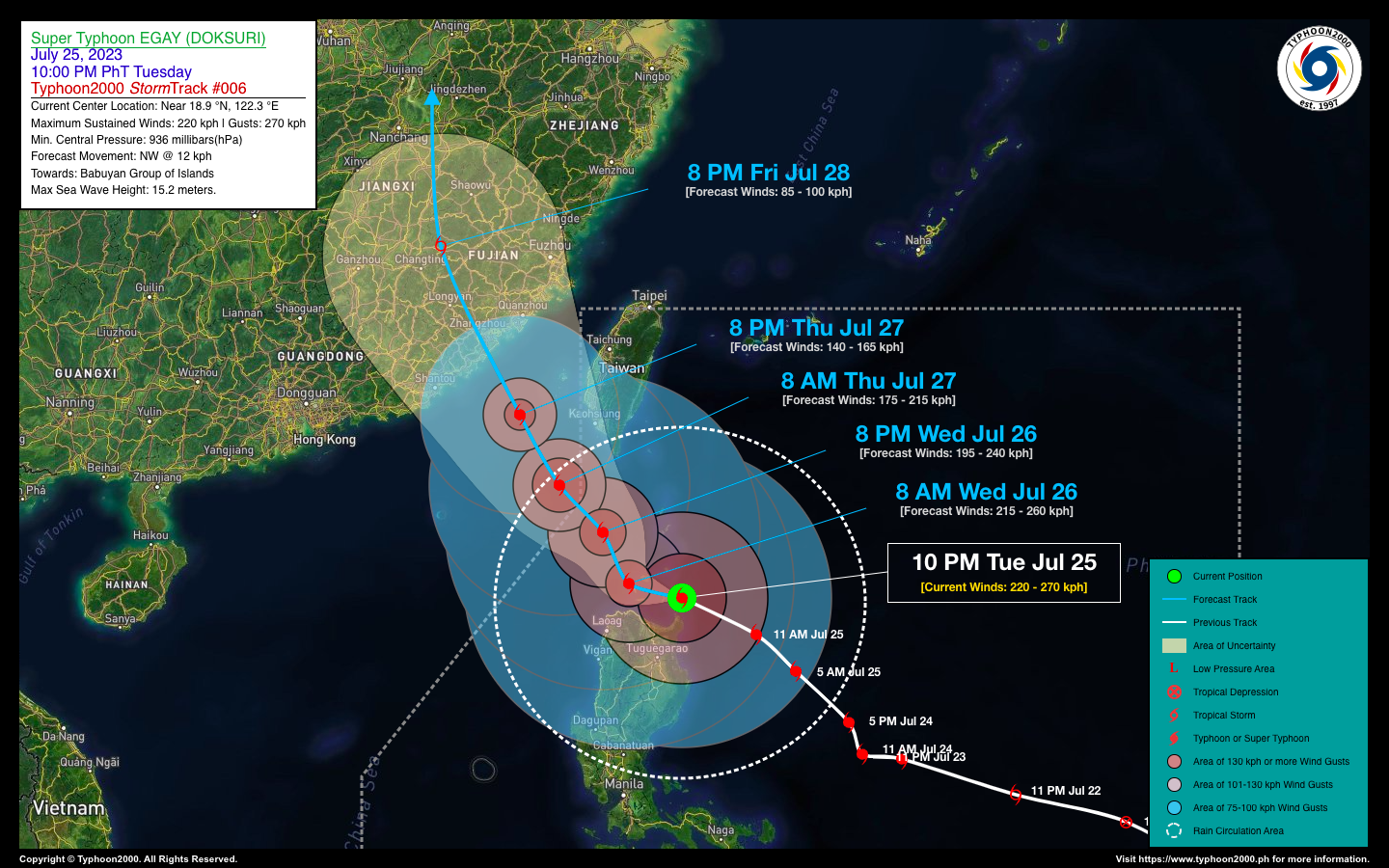
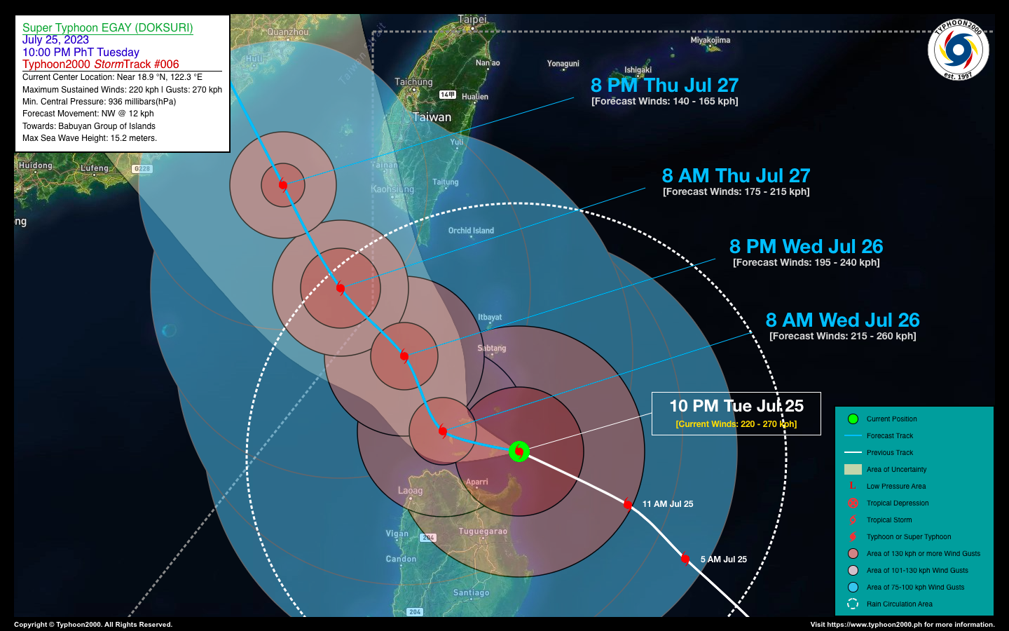
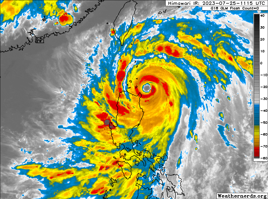
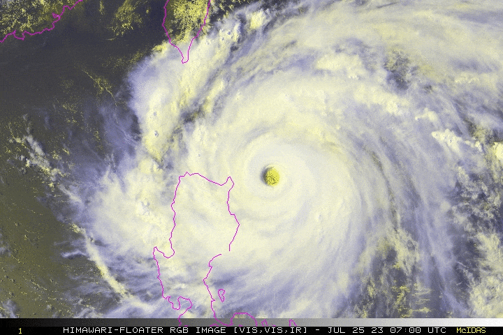
| Current Status & Outlook | EGAY (DOKSURI) has been downgraded from a Super Typhoon (STY) as it starts traversing the Balintang Channel. The core (eye & eyewall) is just a couple of hours of making “Islandfall” over Camiguin Island. Typhoon-force winds gusting to more than 200 kph with heavy torrential rains are now lashing Extreme Northern Luzon, while flood-threatening rainfall are now being felt in most parts of Northern Luzon.
48-hr Outlook: TY EGAY (DOKSURI) is expected to continue weakening as it crosses the Balintang Channel tonight until tomorrow morning. Its forecast track will bring the core (eye & eyewall) of EGAY over Dalupiri and Calayan Islands early tomorrow morning, between 5-8 AM. Then, at approximately 8 PM tomorrow, the core will moving away from the Babuyan Group, passing across the westernmost part of the Bashi Channel, and will be out of the Philippine Area of Responsibility (PAR) on Thursday morning (Jul 27). The presence of TY EGAY (DOKSURI) will continue to enhance the Southwest Monsoon (Habagat) across Western Visayas, MiMaRoPa, and Luzon tonight through Thursday (July 27). Scattered to Occasional “On-&-Off” rain showers and Severe Thunderstorms will be expected across these areas especially during the afternoon and evening. Please take all necessary precautions against floods, landslides incl. lahars, storm surges, and high winds brought about by these systems. |
| Where is EGAY (DOKSURI)? | As of 10:00 PM PhT today, July 25…1400 GMT:
|
| How strong is it? | Maximum Sustained Winds (1-min avg): 220 kph near the center…Gustiness: 270 kph. |
| Past Movement (06 hrs) | West-Northwest @ 22 kph, towards Babuyan Island Group. |
| Potential Philippine Major Landfall Area(s) |
|
| What Philippine areas will be directly affected? | Heavy to Extreme Rainfall (50 mm to >100 mm expected for 24 hrs):
Damaging Winds (gusts of more than 100 km/hr expected):
|
| Potential Storm Surge/Coastal Flooding Areas+ |
+Waves of 2 to more than 3 meters in height are expected in storm surge-prone areas, particularly in coastal areas where the Tropical Cyclone is headed. Kindly visit the PAGASA Storm Surge Updates for more details. |
| 3-Day Forecast Outlook Summary** |
**Important Note: Please be reminded that the Forecast Outlook changes every 6 hours, and the Day 2 and 3 Forecast Track have an average error of 100 and 250 km respectively… while the wind speed forecast error, averages 35 km/hr per day. Therefore, a turn to the left or right of its future track and changes in its wind speed must be anticipated from time to time. |
| Other Storm’s Meteorological Information |
|
| Disclaimer: Information based on data collected by Typhoon2000 (T2k) shall not be taken as official data. Weather information broadcasted and distributed by PAGASA remains as official data. Typhoon2000 (T2k) shall not be responsible for the private use and reliance of its weather information. | |
Issued by: David Michael V. Padua for Typhoon2000 (T2k)
Typhoon2000 (T2K) Integrated Multi-Agency Tracks
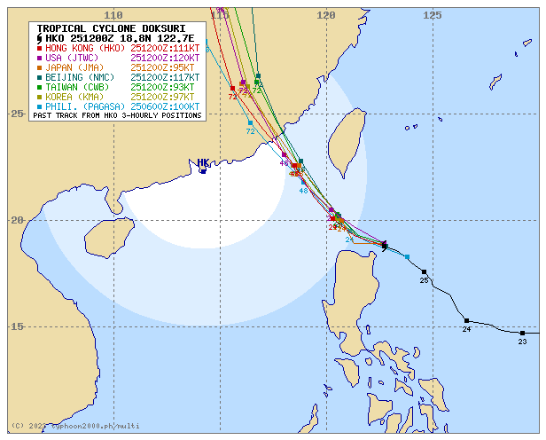
For more info visit: (http://www.typhoon2000.ph/multi/?name=DOKSURI)
PAGASA TROPICAL CYCLONE WIND SIGNAL
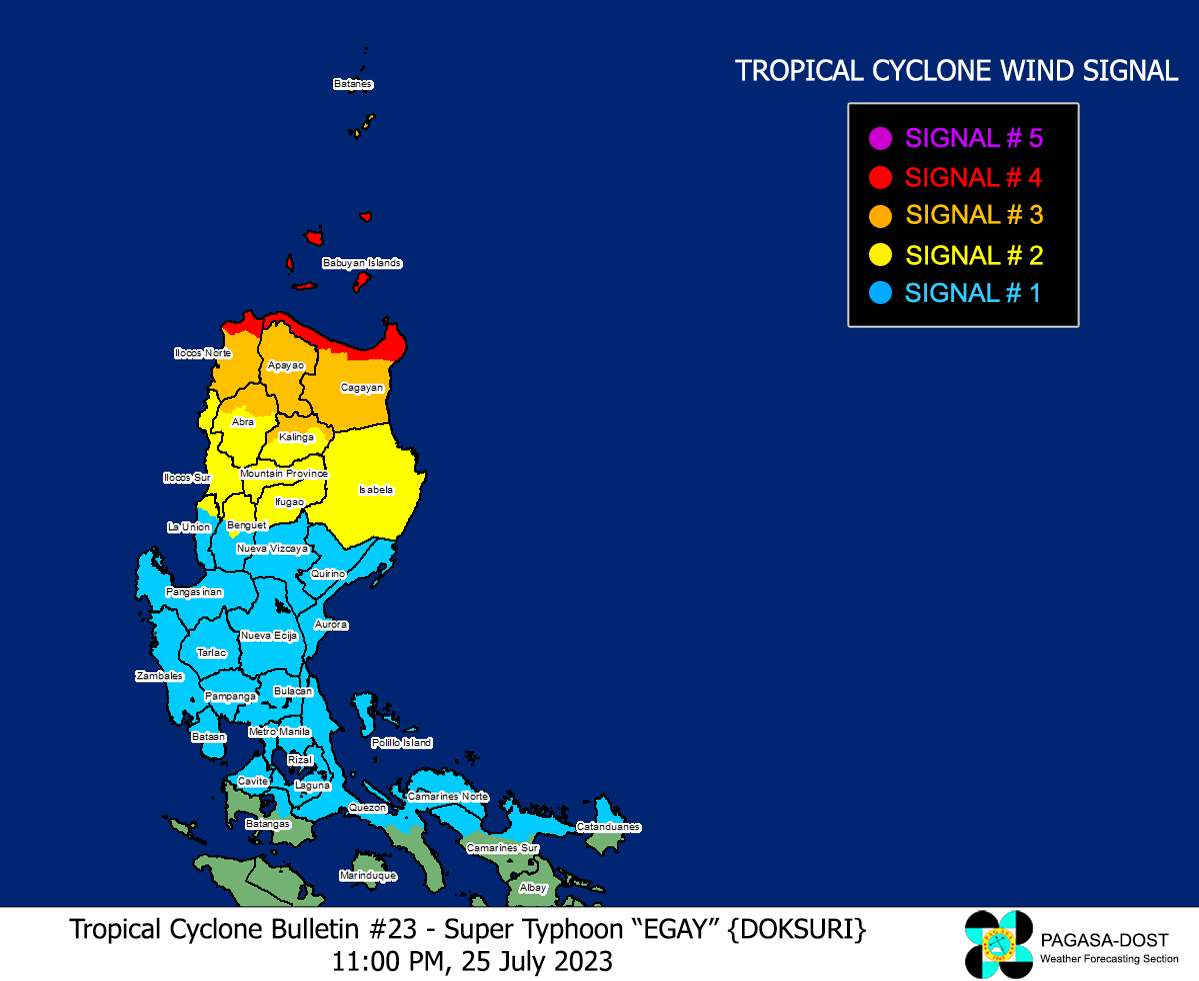
Image/Screenshot Source: DOST-PAGASA (https://bagong.pagasa.dost.gov.ph/tropical-cyclone/severe-weather-bulletin)


