
TROPICAL STORM DANTE (CHOI-WAN) ADVISORY NO. 12Issued at: 1:00 AM PhT (17:00 GMT) Thursday, 03 June 2021
Next update: 7:00 AM PhT (23:00 GMT) Thursday, 03 June 2021 |
|
|---|---|
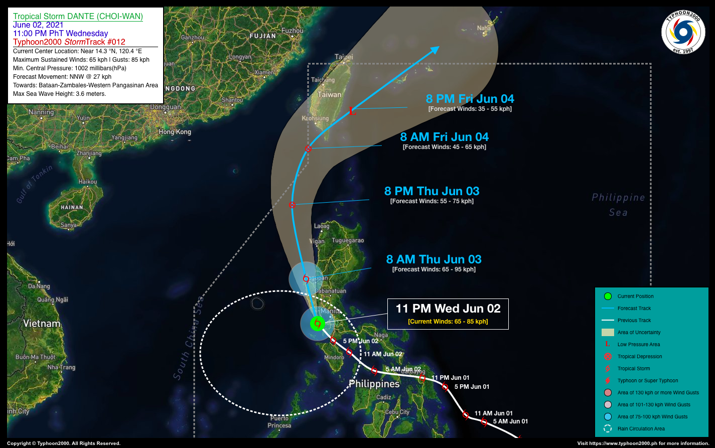
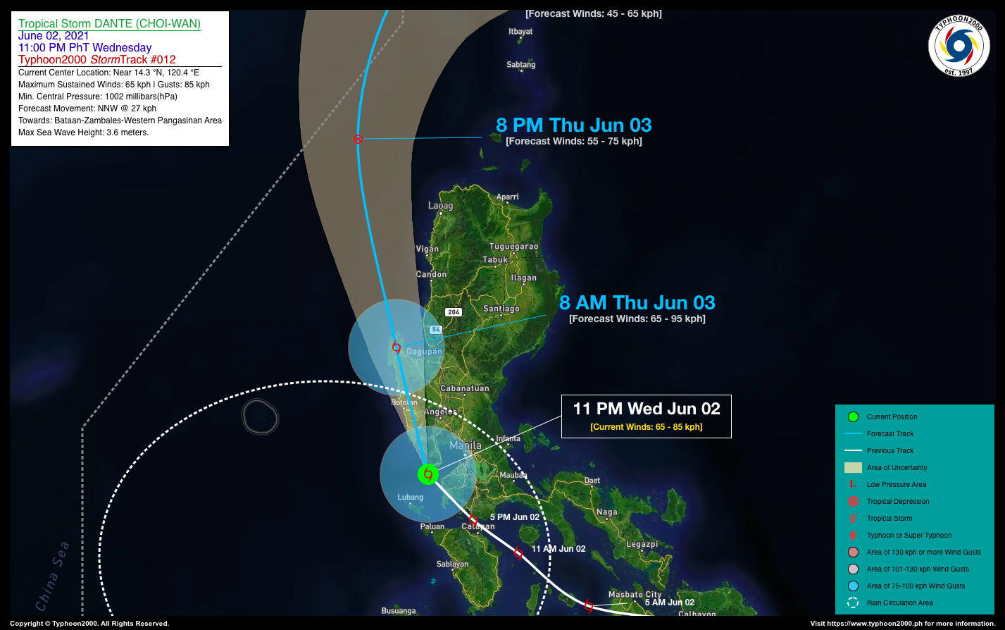
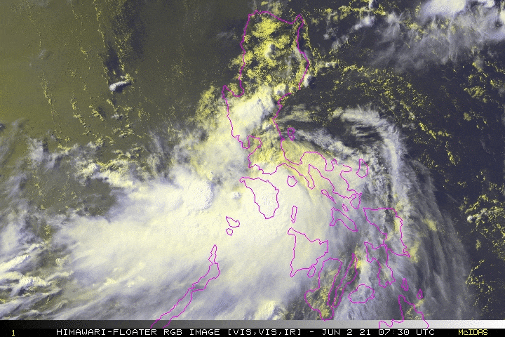
| Current Status & Outlook | The core of Tropical Storm DANTE (CHOI-WAN) is now very close to the coast of Southwestern Bataan after crossing Southwestern Batangas last night…expected to move across the western coastal areas of Bataan, Zambales, and Pangasinan early this morning.
Its rainbands together with its trough (extension) will continue to affect MiMaRoPa, CaLaBaRZon, Metro Manila, and the western portions of Central Luzon. Occasional rain showers with scattered Severe thunderstorms and gusty winds will be expected across these areas today. 24-hr Outlook: TS DANTE is expected to accelerate NNW @ 27 kph and will cross the western coastal areas of Bataan, Zambales, & Pangasinan between 12 to 8 AM, today. The storm is expected to weaken into a Tropical Depression (TD) after crossing the mountains of Zambales & Pangasinan, and by tomorrow evening, it will be in the vicinity of the West Philippine Sea or along the westernmost part of Balintang Channel. |
| Where is DANTE (CHOI-WAN)? | As of 11:00 PM PhT today, June 02…1500 GMT:
|
| How strong is it? | Maximum Sustained Winds (1-min avg): 65 kph near the center…Gustiness: 85 kph. |
| Past Movement (06 hrs) | Northwest @ 18 kph, towards Western Coasts of Bataan, Zambales, & Pangasinan |
| Potential Philippine Landfall Area(s) |
|
| What Philippine areas will be directly affected? | Heavy to Extreme Rainfall (50 mm to >100 mm expected for 24 hrs):
Damaging Winds (gusts of more than 100 km/hr expected):
|
| Potential Storm Surge/Coastal Flooding Areas+ |
+Waves of 3 meters in height is expected in storm surge-prone areas, particularly in coastal areas on where the Tropical Cyclone is headed. Kindly visit the PAGASA Storm Surge Updates for more details. |
| 2-Day Forecast Outlook Summary** |
**Important Note: Please be reminded that the Forecast Outlook changes every 6 hours, and the Day 2 and 3 Forecast Track have an average error of 100 and 250 km respectively… while the wind speed forecast error, averages 35 km/hr per day. Therefore, a turn to the left or right of its future track and changes in its wind speed must be anticipated from time to time. |
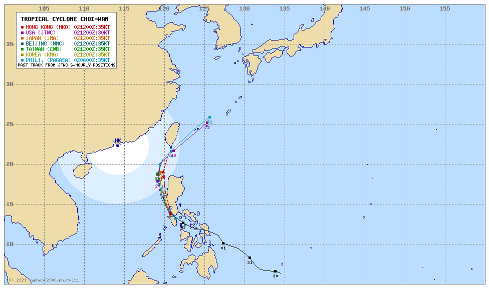
| Other Storm’s Meteorological Information |
|
| Information based on data collected by Typhoon2000 (T2k) shall not be taken as official data. Weather information broadcasted and distributed by PAGASA remains as official data. Typhoon2000 (T2k) shall not be responsible for the private use and reliance of its weather information. | |
Issued by: David Michael V. Padua for Typhoon2000 (T2K)
Typhoon2000 (T2K) Integrated Multi-Agency Tracks
 For more info: http://www.typhoon2000.ph/multi/?name=CHOI-WAN
PAGASA TROPICAL CYCLONE WIND SIGNAL
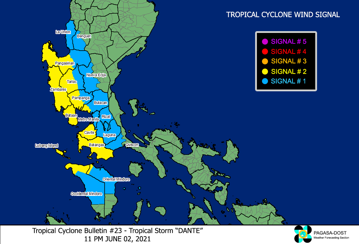
Image/Screenshot Source: DOST-PAGASA (http://pubfiles.pagasa.dost.


