


TROPICAL STORM DANTE (CHOI-WAN) ADVISORY NO. 04Issued at: 7:00 PM PhT (11:00 GMT) Monday, 31 May 2021
Next update: 7:00 AM PhT (23:00 GMT) Tuesday, 01 June 2021 |
|
|---|---|
| Current Status & Outlook | Tropical Storm DANTE (CHOI-WAN) struggling to organize due to moderate upper-level winds above its circulation…maintains its strength while moving northwestward across the Philippine Sea. Its threat to Samar and Bicol Provinces continues.
Its western trough (extension) will continue to affect Mindanao & Visayas – where isolated to scattered rain showers & thunderstorms today. 24-hr Outlook: TS DANTE is forecast to move northwestward across the southwestern portion of the Central Philippine Sea at a decreased forward speed of 13 km/hr…and is likely to become a Severe Tropical Storm (STS) tomorrow. |
| Where is DANTE (CHOI-WAN)? | As of 5:00 PM PhT today, May 31…0900 GMT:
|
| How strong is it? | Maximum Sustained Winds (1-min avg): 85 kph near the center…Gustiness: 100 kph. |
| Past Movement (06 hrs) | Northwest @ 18 kph, across the Central Philippine Sea |
| Potential Philippine Landfall Area(s) |
|
| What Philippine areas will be directly affected? | Heavy to Extreme Rainfall (50 mm to >100 mm expected for 24 hrs):
Damaging Winds (gusts of more than 100 km/hr expected):
|
| Potential Storm Surge/Coastal Flooding Areas+ |
+Waves of 3 meters in height is expected in storm surge-prone areas, particularly in coastal areas on where the Tropical Cyclone is headed. Kindly visit the PAGASA Storm Surge Updates for more details. |
| 3-Day Forecast Outlook Summary** |
**Important Note: Please be reminded that the Forecast Outlook changes every 6 hours, and the Day 2 and 3 Forecast Track have an average error of 100 and 250 km respectively… while the wind speed forecast error, averages 35 km/hr per day. Therefore, a turn to the left or right of its future track and changes in its wind speed must be anticipated from time to time. |
| Other Storm’s Meteorological Information |
|
| Information based on data collected by Typhoon2000 (T2k) shall not be taken as official data. Weather information broadcasted and distributed by PAGASA remains as official data. Typhoon2000 (T2k) shall not be responsible for the private use and reliance of its weather information. | |
Issued by: David Michael V. Padua for Typhoon2000 (T2K)
Typhoon2000 (T2K) Integrated Multi-Agency Tracks
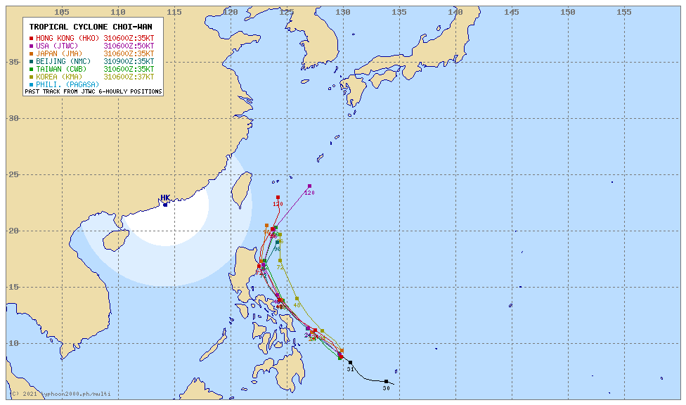 For more info: http://www.typhoon2000.ph/multi/?name=CHOI-WAN
PAGASA TROPICAL CYCLONE WIND SIGNAL
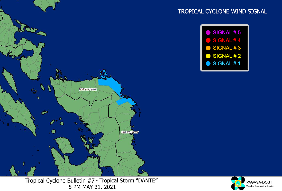
Image/Screenshot Source: DOST-PAGASA (http://pubfiles.pagasa.dost.


