

TYPHOON CHEDENG (GUCHOL) STORMWATCH NO. 03Issued at: 8:00 PM PhT (12:00 GMT) Friday, 09 June 2023
Next update: 8:00 PM PhT (12:00 GMT) Saturday, 10 June 2023 |
|
|---|---|
| Current Status and Outlook |
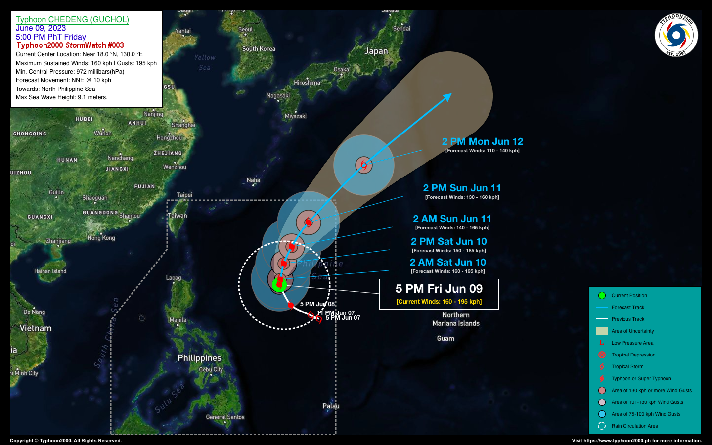
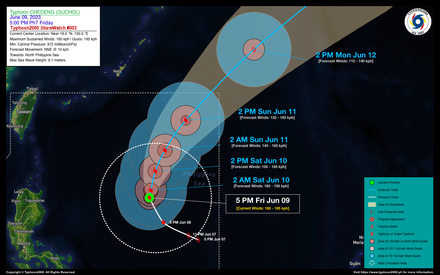
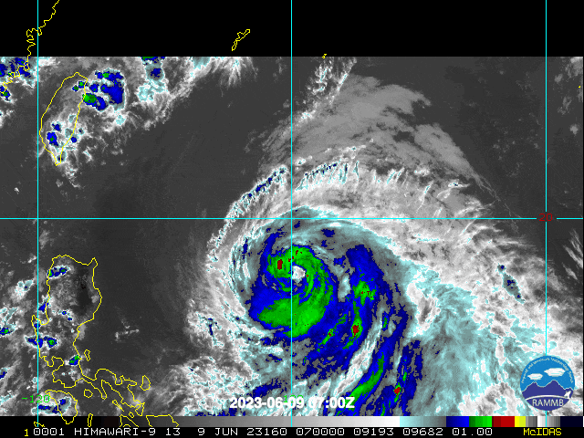
Typhoon (TY) CHEDENG [GUCHOL] has intensified slightly as it starts moving slowly on a north-northwest track while over the Philippine Sea. This typhoon remains a non-threat to our country, and its recurvature forecast towards the sea south of Japan continues. TY CHEDENG will slightly enhance the Southwest Monsoon (Habagat) and could bring scattered to occasional rain showers with severe thunderstorms across the western sections of the country this weekend. Please take all necessary precautions against floods and landslides. |
| Where is CHEDENG (GUCHOL)? | As of 5:00 PM PhT today, June 09…0900 GMT:
|
| How strong is it? | Maximum Sustained Winds (1-min avg): 160 kph near the center…Gustiness: 195 kph. |
| Past Movement (06 hrs) | North-Northwest @ 10 kph, towards the North Philippine Sea. |
| Forecast Highlights |
|
| This StormWatch is valid for the next 24 hours.
Information based on data collected by Typhoon2000 (T2k) shall not be taken as official data. Weather information broadcasted and distributed by PAGASA remains as official data. Typhoon2000 (T2k) shall not be responsible for the private use and reliance of its weather information. |
|
Issued by: David Michael V. Padua for Typhoon2000 (T2K)
Typhoon2000 (T2K) Integrated Multi-Agency Tracks
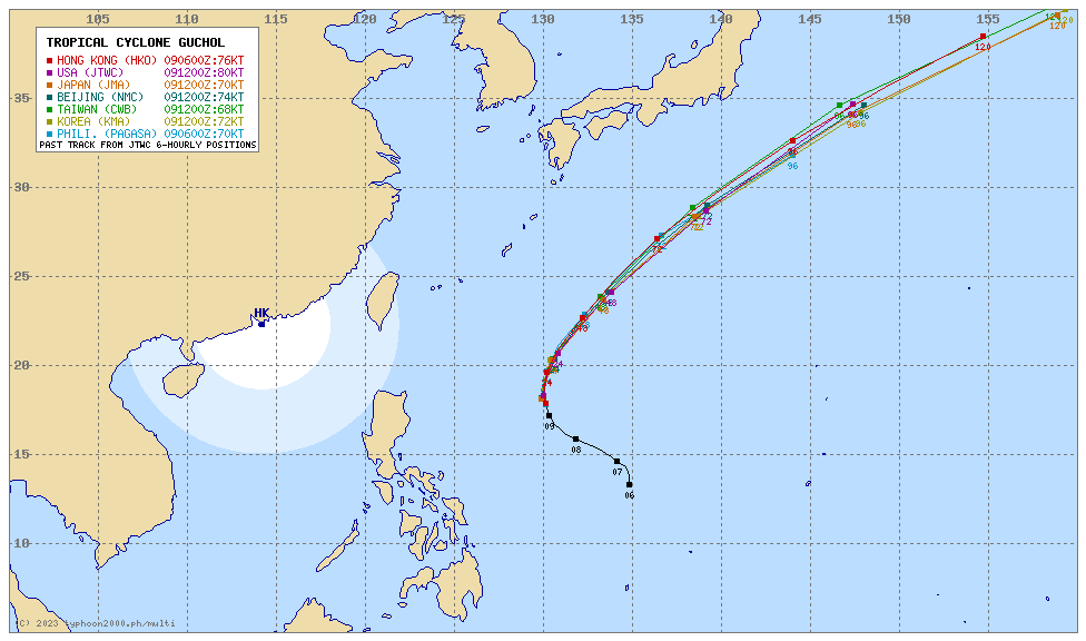
For more info visit: (http://www.typhoon2000.ph/multi/?name=GUCHOL)
PAGASA TROPICAL CYCLONE WIND SIGNAL
:: None.
Image/Screenshot Source: DOST-PAGASA ()


