
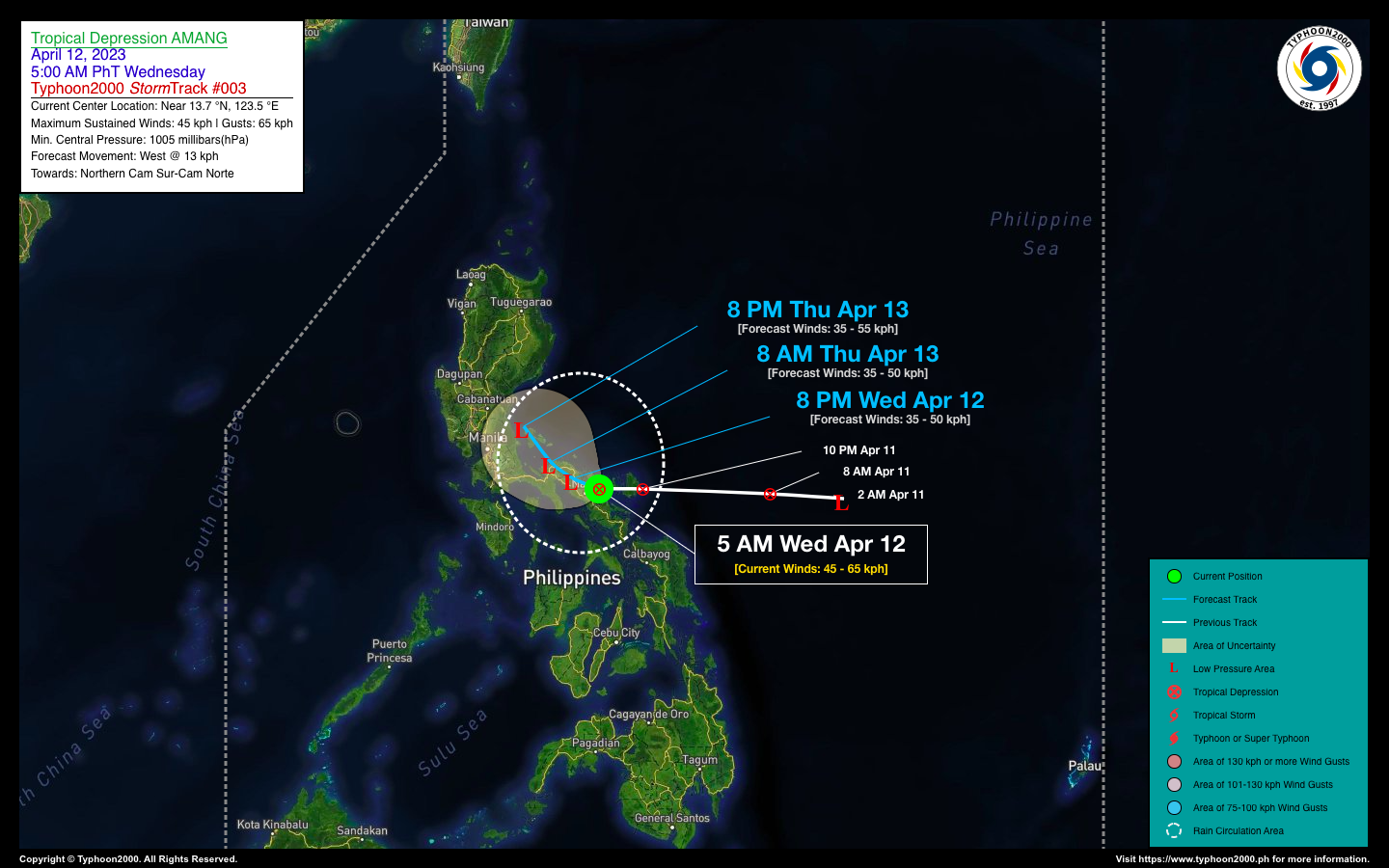
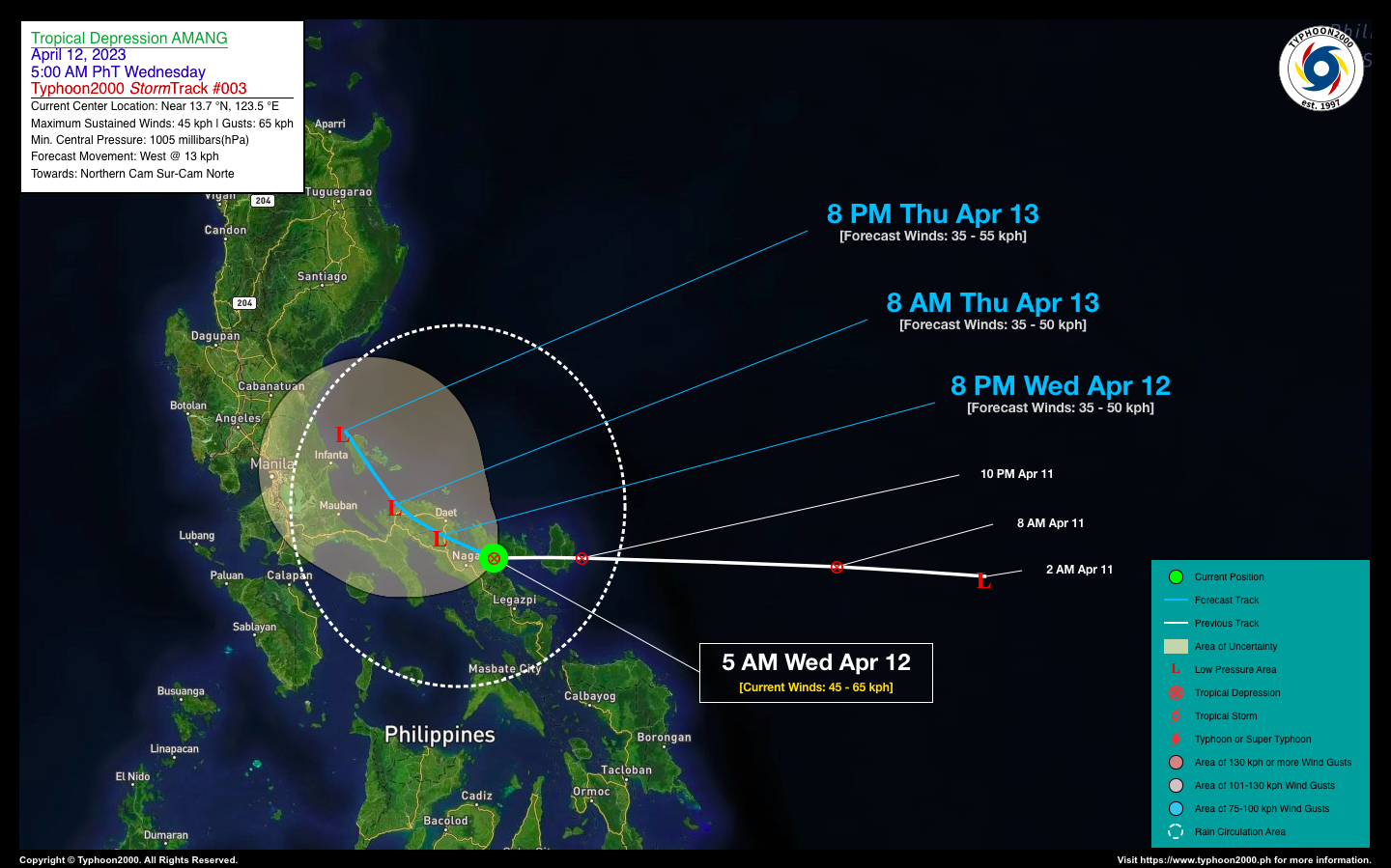
TROPICAL DEPRESSION AMANG ADVISORY NO. 03Issued at: 7:00 AM PhT (23:00 GMT) Wednesday, 12 April 2023
Next update: 8:00 PM PhT (12:00 GMT) Wednesday, 12 April 2023 |
|
|---|---|
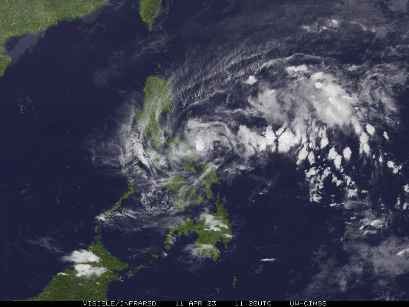
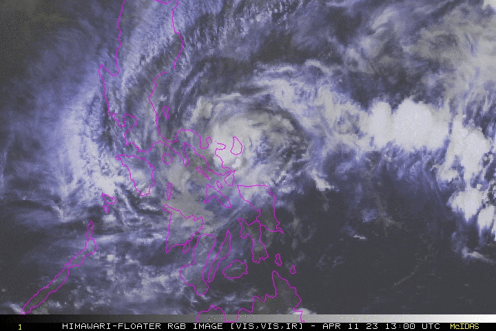
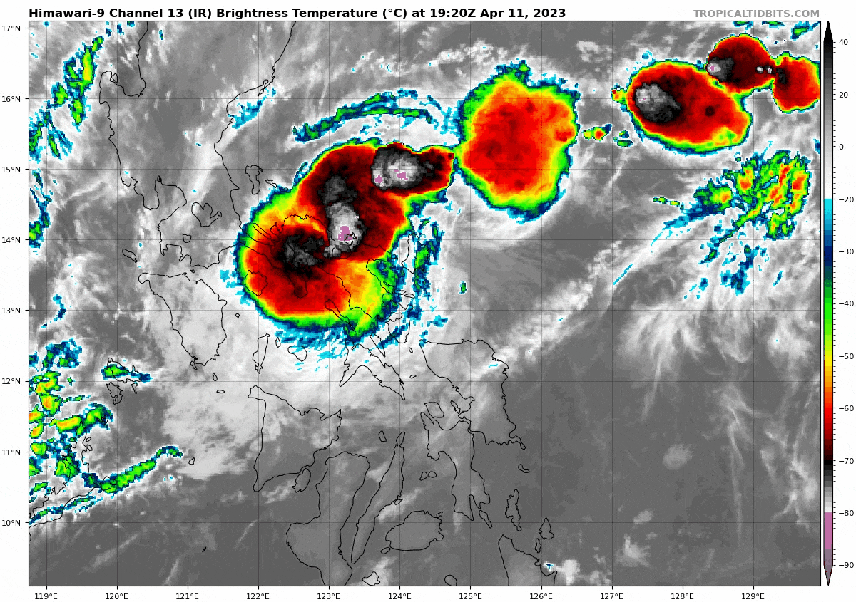
| Current Status & Outlook | Tropical Depression (TD) AMANG’s circulation has become disorganized after making landfall over Southern Catanduanes last night…and is now moving across Partido District (Cam Sur). A secondary vortex has been spotted just along the southern coast of Catanduanes or over Albay Gulf. Heavy to intense rains have been observed across Bicol Region with our T2k Weather Stations reporting overnight rains of up to 200 mm.
36-hr Outlook: TD AMANG is forecast to weaken into a remnant LPA as it traverses Camarines Sur this morning and will be moving across Camarines Norte late this afternoon and through the evening. Light to moderate to at times heavy/intense rains will continue to occur across Bicol Region & Southern Quezon today. By tomorrow evening, AMANG is forecast to be over the northern portion of Polillo Island as it continues to decay. |
| Where is AMANG? | As of 5:00 AM PhT today, April 12…2100 GMT:
|
| How strong is it? | Maximum Sustained Winds (1-min avg): 45 kph near the center…Gustiness: 65 kph. |
| Past Movement (06 hrs) | West @ 13 kph, towards Camarines Provinces. |
| Potential Philippine Major Landfall Area(s) |
|
| What Philippine areas will be directly affected? | Heavy to Extreme Rainfall (50 mm to >100 mm expected for 24 hrs):
Damaging Winds (gusts of more than 100 km/hr expected):
|
| Potential Storm Surge/Coastal Flooding Areas+ |
+Waves of 3 meters in height are expected in storm surge-prone areas, particularly in coastal areas where the Tropical Cyclone is headed. Kindly visit the PAGASA Storm Surge Updates for more details. |
| 1-Day Forecast Outlook Summary** |
**Important Note: Please be reminded that the Forecast Outlook changes every 6 hours, and the Day 2 and 3 Forecast Track have an average error of 100 and 250 km respectively… while the wind speed forecast error, averages 35 km/hr per day. Therefore, a turn to the left or right of its future track and changes in its wind speed must be anticipated from time to time. |
| Other Storm’s Meteorological Information |
|
| Disclaimer: Information based on data collected by Typhoon2000 (T2k) shall not be taken as official data. Weather information broadcasted and distributed by PAGASA remains as official data. Typhoon2000 (T2k) shall not be responsible for the private use and reliance of its weather information. | |
Issued by: David Michael V. Padua for Typhoon2000 (T2k)
Typhoon2000 (T2K) Integrated Multi-Agency Tracks
:: Not Yet Available
PAGASA TROPICAL CYCLONE WIND SIGNAL
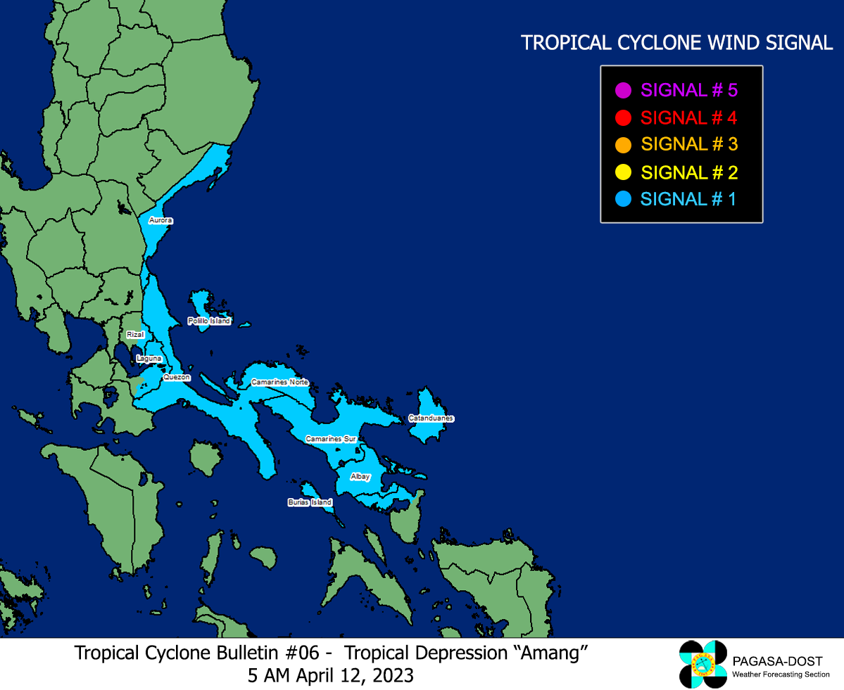
Image/Screenshot Source: DOST-PAGASA (https://bagong.pagasa.dost.gov.ph/tropical-cyclone/severe-weather-bulletin)


