


TROPICAL DEPRESSION AGATON (MEGI) ADVISORY NO. 05Issued at: 7:00 PM PhT (11:00 GMT) Monday, 11 April 2022
Next update: 7:00 AM PhT (23:00 GMT) Tuesday, 12 April 2022 |
|
|---|---|
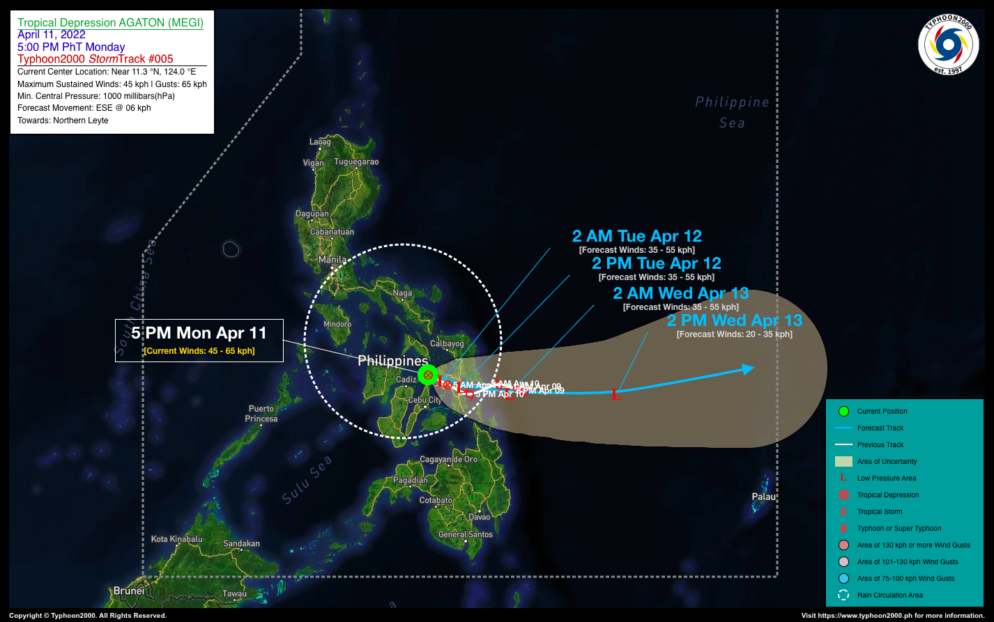
| Current Status & Outlook | Tropical Depression AGATON (MEGI) continues to decay, and is now along the coast of Daanbantayan, Cebu. Pulsating Central Dense Overcast (CDO) together with its disorganized rainbands associated with this cyclone will continue to dump heavy to torrential rains across the Visayas including Masbate through the evening.
24-hr Outlook: TD AGATON is forecast to weaken into a remnant LPA as it moves East to ESE-ward @ 6 kph and will be along the coastal waters of Tolosa, Leyte by tomorrow afternoon. Meanwhile, Severe Tropical Storm (STS) MALAKAS almost a Typhoon while moving closer to the Philippine Sea, expected to briefly enter the Philippine Area of Responsibility (PAR) by tomorrow (Apr 12). However, upon its entrance, STS MALAKAS is forecast to recurve north to NE-ward and exit PAR on Wednesday (Apr 13) as it pulls behind the soon-to-be remants of TD Agaton (Megi). |
| Where is AGATON (MEGI)? | As of 5:00 PM PhT today, April 11…0900 GMT:
|
| How strong is it? | Maximum Sustained Winds (1-min avg): 45 kph near the center…Gustiness: 65 kph. |
| Past Movement (06 hrs) | West-Northwest @ 04 kph, towards Northern Leyte. |
| Potential Philippine Major Landfall Area(s) |
|
| What Philippine areas will be directly affected? | Heavy to Extreme Rainfall (50 mm to >100 mm expected for 24 hrs):
Damaging Winds (gusts of more than 100 km/hr expected):
|
| Potential Storm Surge/Coastal Flooding Areas+ |
+Waves of 3 meters in height are expected in storm surge-prone areas, particularly in coastal areas where the Tropical Cyclone is headed. Kindly visit the PAGASA Storm Surge Updates for more details. |
| 2-Day Forecast Outlook Summary** |
**Important Note: Please be reminded that the Forecast Outlook changes every 6 hours, and the Day 2 and 3 Forecast Track have an average error of 100 and 250 km respectively… while the wind speed forecast error, averages 35 km/hr per day. Therefore, a turn to the left or right of its future track and changes in its wind speed must be anticipated from time to time. |
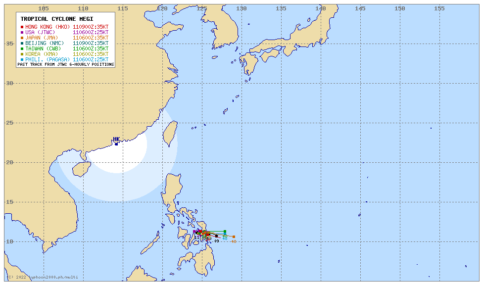
| Other Storm’s Meteorological Information |
|
| Information based on data collected by Typhoon2000 (T2k) shall not be taken as official data. Weather information broadcasted and distributed by PAGASA remains as official data. Typhoon2000 (T2k) shall not be responsible for the private use and reliance of its weather information. | |
Issued by: David Michael V. Padua for Typhoon2000 (T2k)
Typhoon2000 (T2K) Integrated Multi-Agency Tracks
PAGASA TROPICAL CYCLONE WIND SIGNAL

Image/Screenshot Source: DOST-PAGASA (http://bagong.pagasa.dost.gov.ph/tropical-cyclone-bulletin-iframe)


