
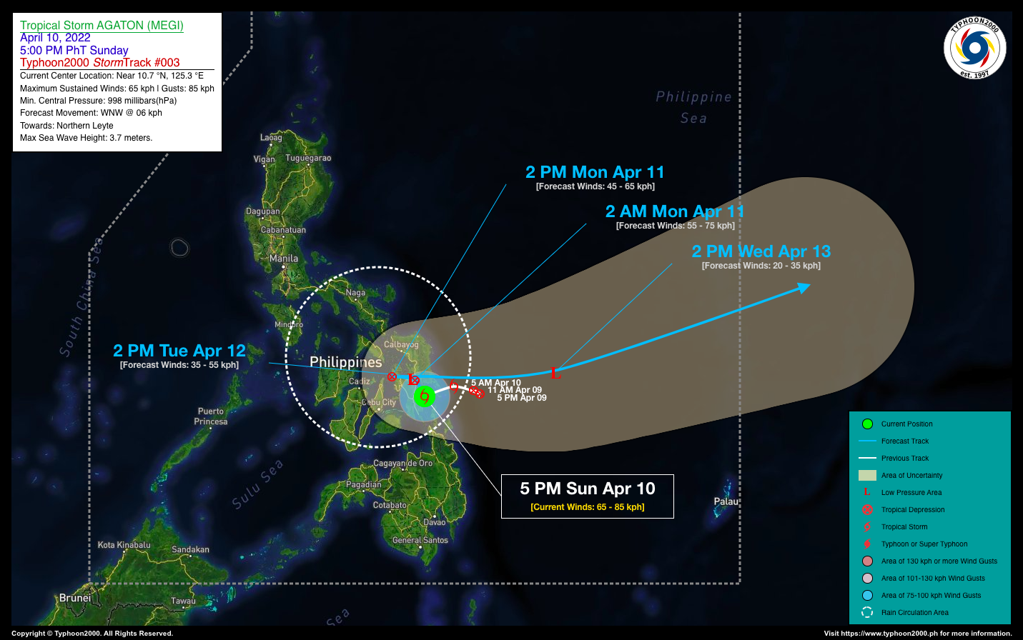
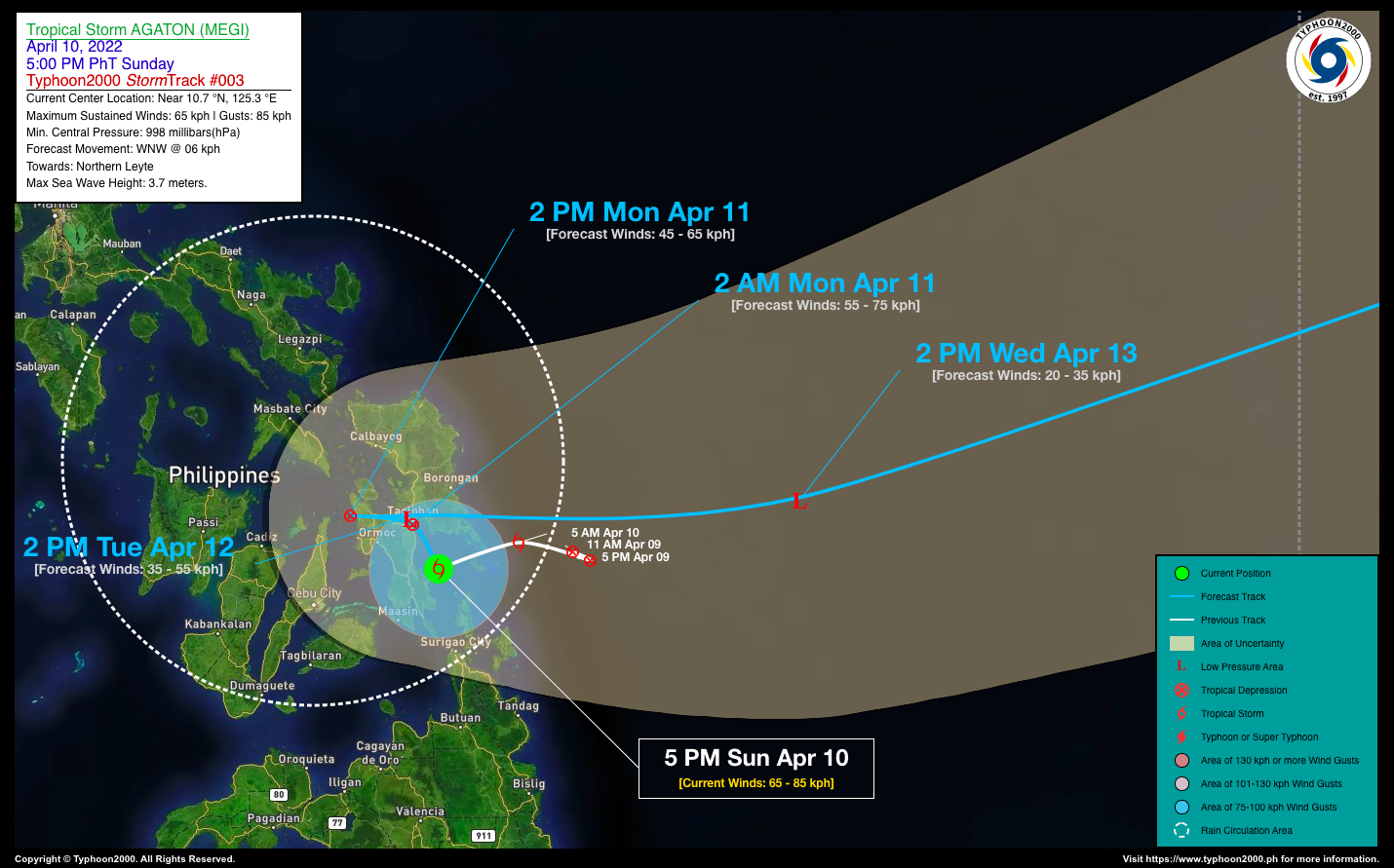
TROPICAL STORM AGATON (MEGI) ADVISORY NO. 03Issued at: 7:00 PM PhT (11:00 GMT) Sunday, 10 April 2022
Next update: 7:00 AM PhT (23:00 GMT) Monday, 11 April 2022 |
|
|---|---|
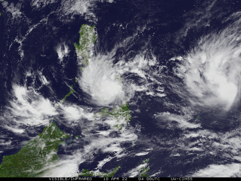
| Current Status & Outlook | Tropical Storm AGATON (MEGI) has moved slowly across Leyte Gulf, and after reaching its peak intensity of 75 km/hr this morning, its circulation has started to deteriorate…weakening slightly. The rain circulation of this storm has spread across the Visayas including Romblon.
24-hr Outlook: TS AGATON is forecast to drift slowly, NW to WNW @ 6 kph and will make landfall along Tacloban Area early tomorrow morning, weakening into a Tropical Depression as it will again stall over the area into the afternoon. Meanwhile, a much larger and stronger – Severe Tropical Storm (STS) MALAKAS has been racing towards the west-northwest and could become a Typhoon by tomorrow. This cyclone is forecast to enter the Philippine Area of Responsibility (PAR) on Tuesday (Apr 12) and will start assimilating TS AGATON (MEGI) before recurving towards the North. Therefore, STS MALAKAS is not a threat to any part of the country. |
| Where is AGATON (MEGI)? | As of 5:00 PM PhT today, April 10…0900 GMT:
|
| How strong is it? | Maximum Sustained Winds (1-min avg): 65 kph near the center…Gustiness: 85 kph. |
| Past Movement (06 hrs) | Southwest @ 07 kph, along Leyte Gulf. |
| Potential Philippine Major Landfall Area(s) |
|
| What Philippine areas will be directly affected? | Heavy to Extreme Rainfall (50 mm to >100 mm expected for 24 hrs):
Damaging Winds (gusts of more than 100 km/hr expected):
|
| Potential Storm Surge/Coastal Flooding Areas+ |
+Waves of 3 meters in height are expected in storm surge-prone areas, particularly in coastal areas where the Tropical Cyclone is headed. Kindly visit the PAGASA Storm Surge Updates for more details. |
| 3-Day Forecast Outlook Summary** |
**Important Note: Please be reminded that the Forecast Outlook changes every 6 hours, and the Day 2 and 3 Forecast Track have an average error of 100 and 250 km respectively… while the wind speed forecast error, averages 35 km/hr per day. Therefore, a turn to the left or right of its future track and changes in its wind speed must be anticipated from time to time. |
| Other Storm’s Meteorological Information |
|
| Information based on data collected by Typhoon2000 (T2k) shall not be taken as official data. Weather information broadcasted and distributed by PAGASA remains as official data. Typhoon2000 (T2k) shall not be responsible for the private use and reliance of its weather information. | |
Issued by: David Michael V. Padua for Typhoon2000 (T2k)
Typhoon2000 (T2K) Integrated Multi-Agency Tracks

PAGASA TROPICAL CYCLONE WIND SIGNAL
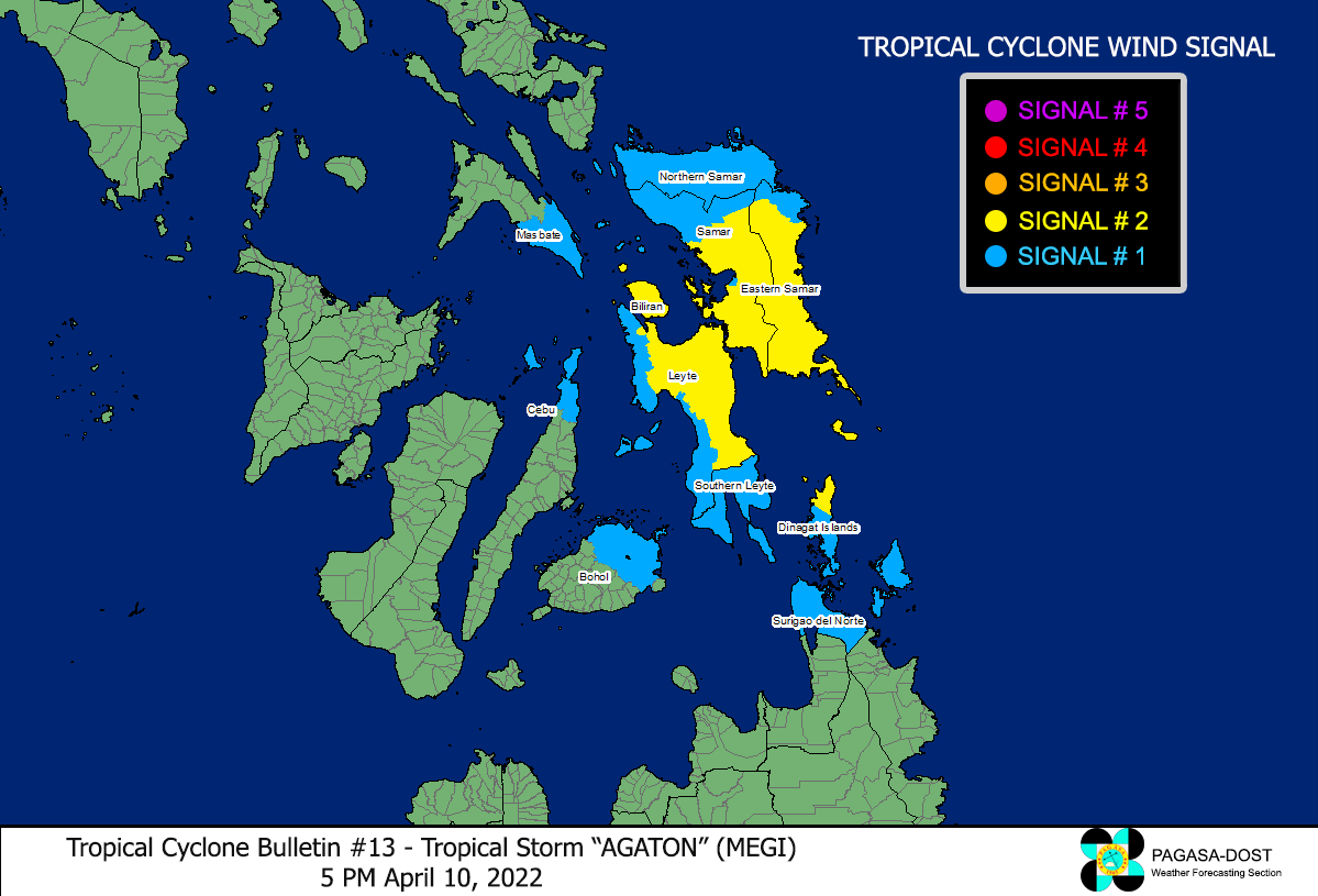
Image/Screenshot Source: DOST-PAGASA (http://bagong.pagasa.dost.gov.ph/tropical-cyclone-bulletin-iframe)


