
TROPICAL DEPRESSION CARINA ADVISORY NO. 02 (FINAL)Issued at: 7:00 AM PhT (23:00 GMT) Tuesday, 14 July 2020
|
|
|---|---|
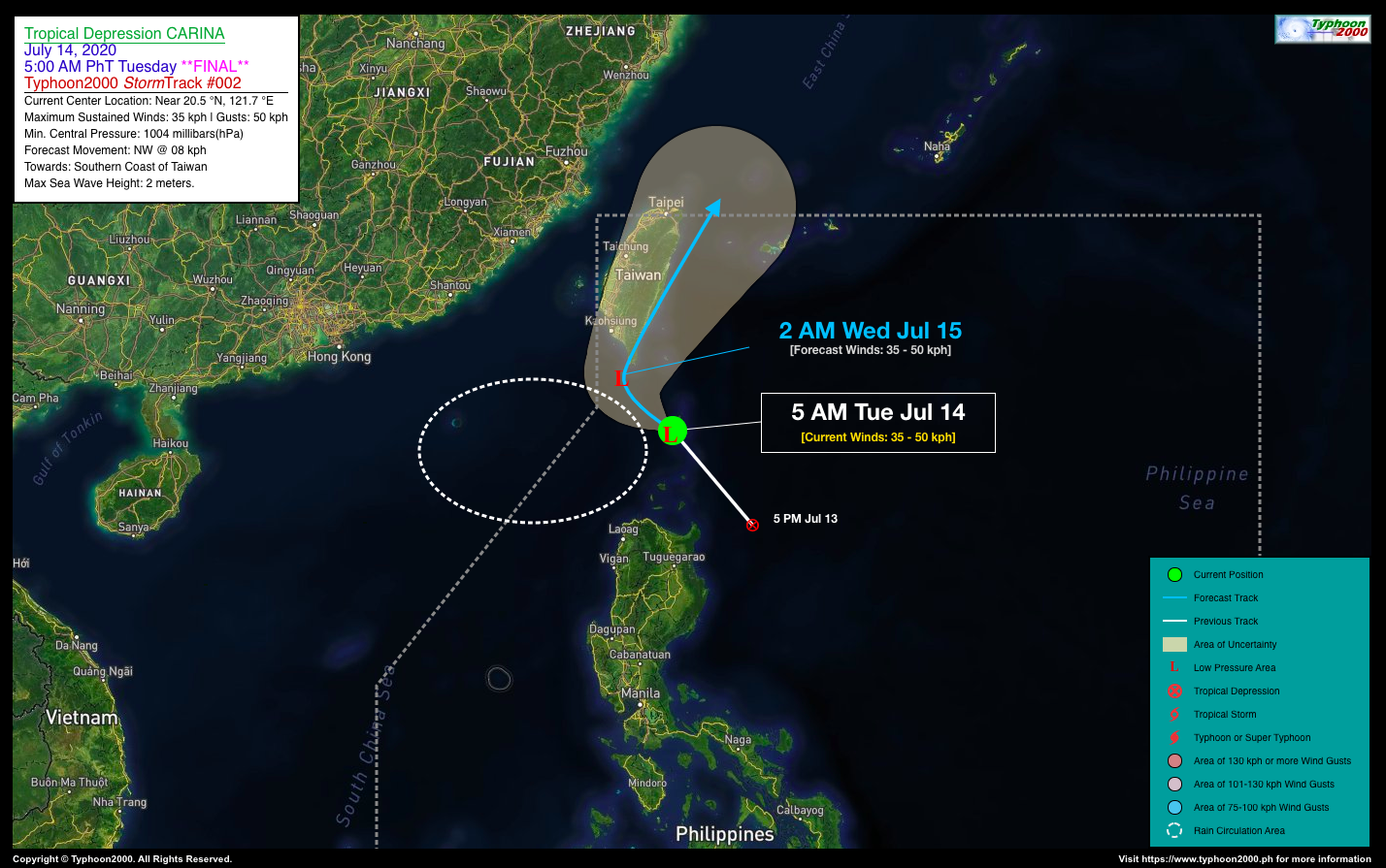
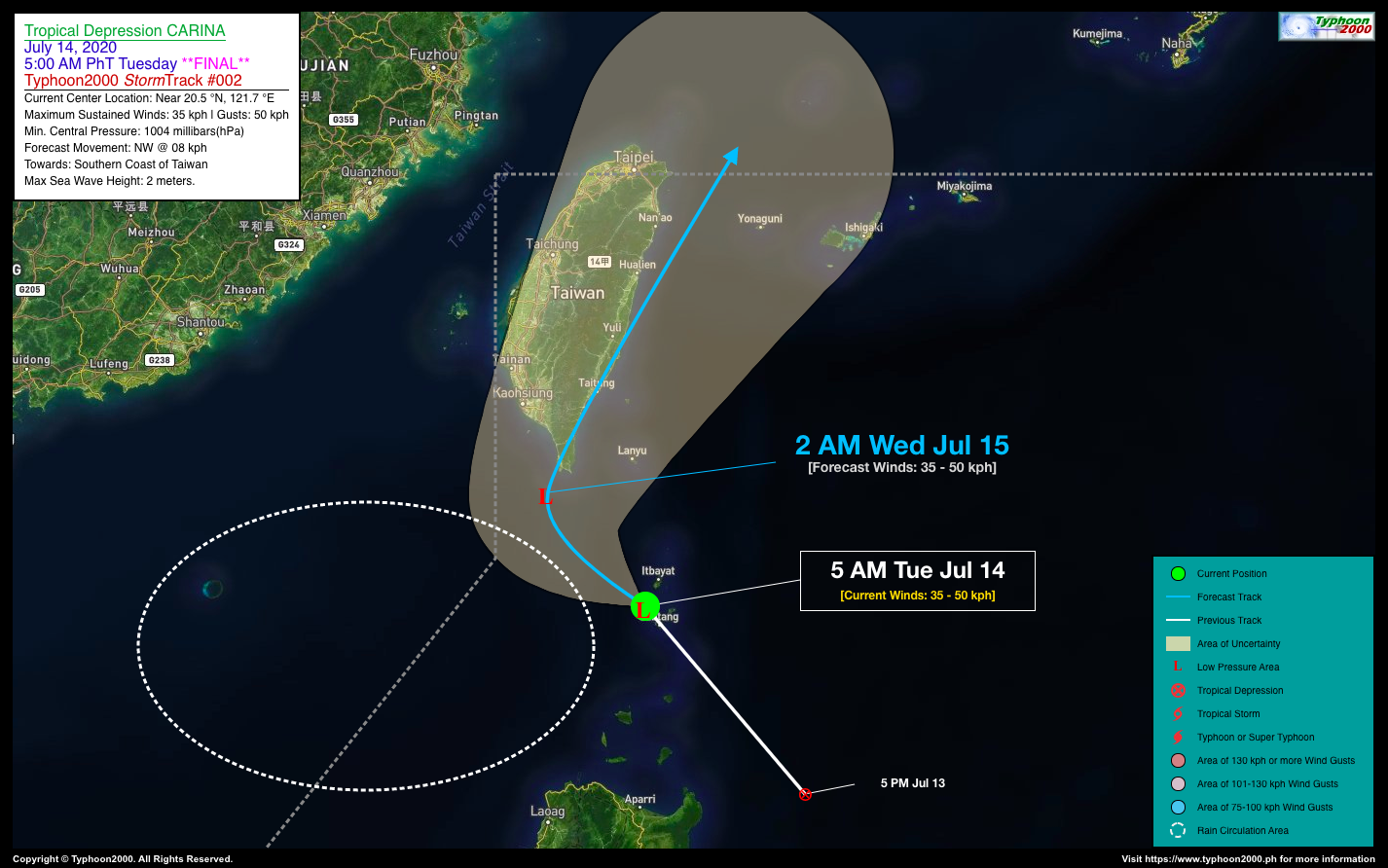
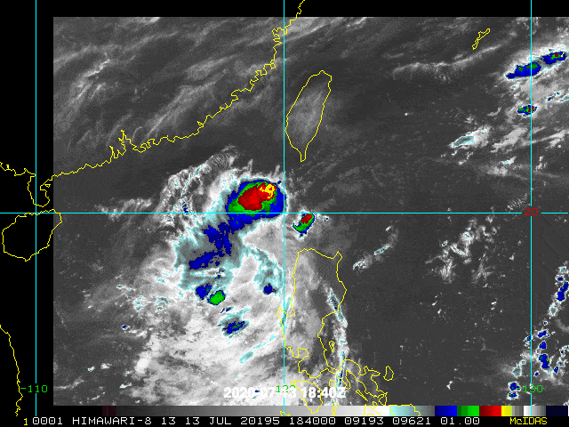
| Current Status and Outlook | Tropical Depression CARINA has weakened into a Tropical Disturbance (LPA) as it passes over the southern portion of the Bashi Channel (Luzon Strait), very close to Batanes. Its thick rainbands has been displaced hundreds of kilometers to the west. *With this development, this is the Final Advisory on TD CARINA.24-hr Outlook: Ex-CARINA is forecast to remain as an LPA and will move northwestward slowly with a decreased forward speed of 08 km/hr, across the northern part of the Bashi Channel and will be over the southern coast of Taiwan by early tomorrow morning (Wed July 15). |
| Where is Ex-TD CARINA? | As of 5:00 AM PhT today, July 14…2100 GMT. The weak center was located along the southern portion of the Bashi Channel (near 20.5°N 121.7°E), about 31 km west of Basco, Batanes or 233 km north of Aparri, Cagayan. |
| How strong is it? | Maximum Sustained Winds (1-min avg): 35 kph near the center…Gustiness: 45 kph. |
| Past Movement (06 hrs) | Northwest @ 24 kph, towards Southern Coast of Taiwan. |
| Potential Philippine Landfall Area(s) | :: None. |
| What Philippine areas will be directly affected? | Heavy to Extreme Rains (50 mm to >100 mm expected in 24 hrs): >> None. Damaging Winds (gusts of more than 100 km/hr expected): |
| Potential Storm Surge/Coastal Flooding Areas+ | :: None.
+Waves of 3 meters in height is expected in storm surge-prone areas, particularly in coastal areas on where the Tropical Cyclone is headed. Kindly visit the PAGASA Storm Surge Updates for more details. |
| 1-Day Forecast Outlook Summary** | WEDNESDAY EARLY MORNING: Its remnants hovering near the Southern Coast of Taiwan as it starts to recurve towards the North to NNE, as it interacts to an approaching Mei-Yu Frontal Boundary…about 197 km NW of Basco, Batanes [2AM Jul 15: 21.7°N 120.6°E @ 35kph]. Confidence Level: MEDIUM.
**Important Note: Please be reminded that the Forecast Outlook changes every 6 hours, and the Day 2 and 3 Forecast Track have an average error of 100 and 250 km respectively… while the wind speed forecast error, averages 35 km/hr per day. Therefore, a turn to the left or right of its future track and changes in its wind speed must be anticipated from time to time. |
| Other Storm’s Meteorological Info | > 24 hr. Rain Accumulation (across its circulation): 25 to 100 mm [Light to Heavy]
> Minimum Central Pressure: 1004 millibars (hPa) > Size of Circulation [Convective Cloud-Based, in diameter]: — km (—) > Area of Damaging Winds (100 kph or more wind gusts): None. |
| Current Summary/Additional Reference Points | Time/Date: 5:00 AM PhT Tue July 14, 2020 Location of Center/Eye: Near 20.5°N Lat 121.7°E Lon Distance 1: 35 km SSW of Itbayat, Batanes Distance 2: 321 km N of Tuguegarao, Cagayan Distance 3: 228 km NNW of Santa Ana, Cagayan Distance 4: 134 km N of Calayan Island, Cagayan Distance 5: 668 km N of Metro Manila 24 hr. Forecast Coordinates (Class): 21.7°N 120.6°E (LPA) |
| Information based on data collected by Typhoon2000 (T2K) shall not be taken as official data. Weather information broadcasted and distributed by PAGASA remains as official data. Typhoon2000 (T2K) shall not be responsible for the private use and reliance of its weather information. | |
Issued by: David Michael V. Padua for Typhoon2000 (T2K)
PAGASA TROPICAL CYCLONE WIND SIGNAL
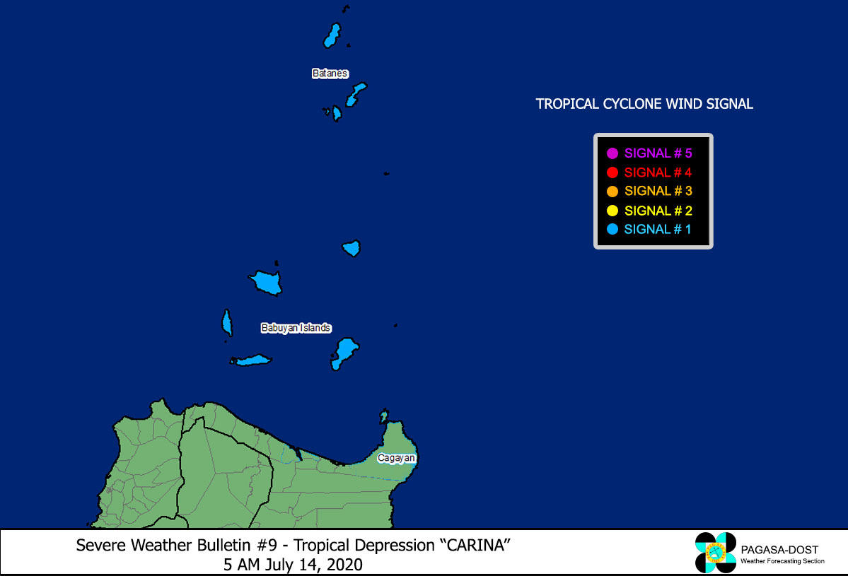
Image Source: DOST-PAGASA (http://pubfiles.pagasa.dost.


