
TROPICAL DEPRESSION TONYO (92W) STORMWATCH NO. 03 [FINAL]Issued at: 7:00 PM PhT (11:00 GMT) Sunday, 08 November 2020
|
|
|---|---|
| Current Status |
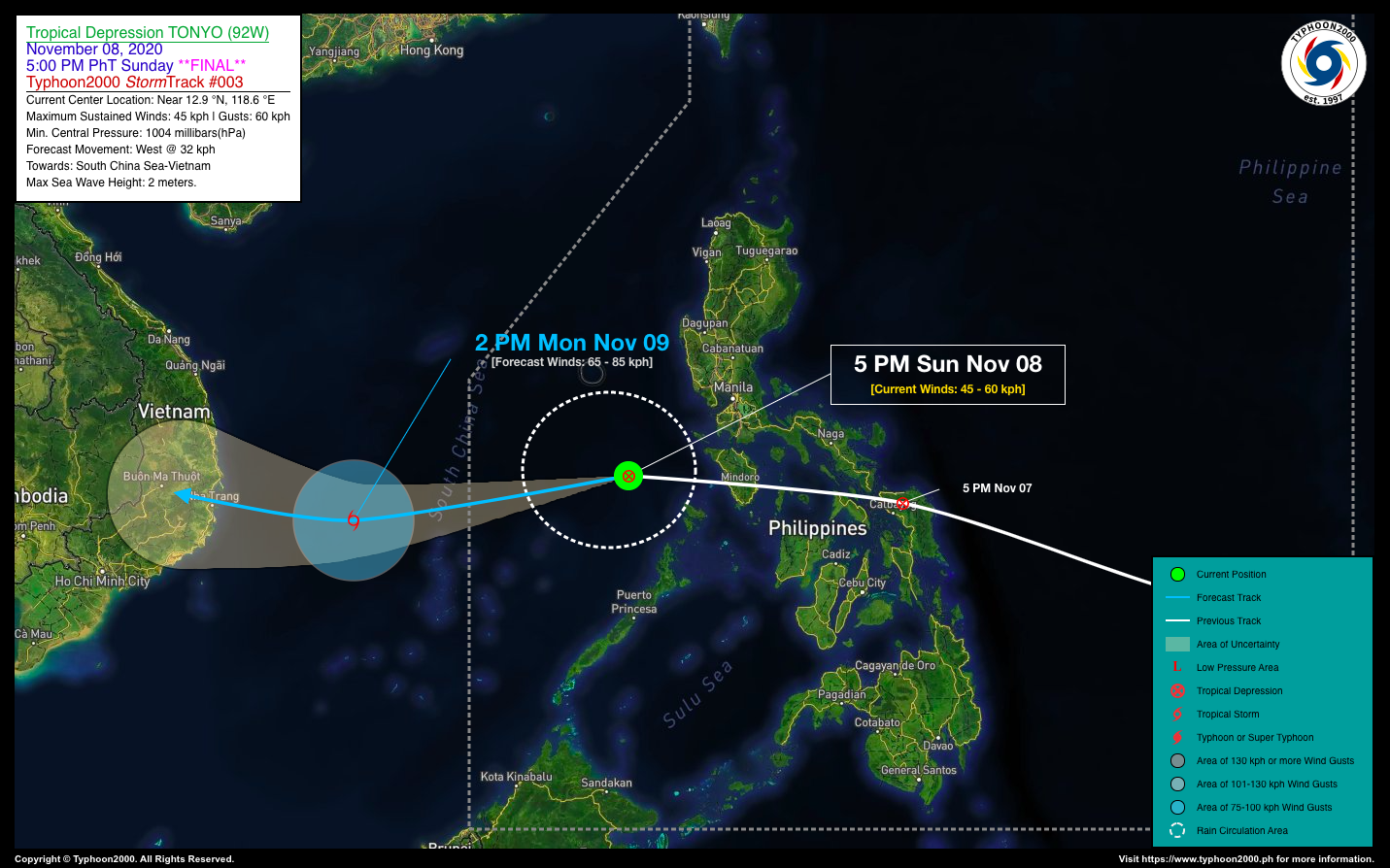
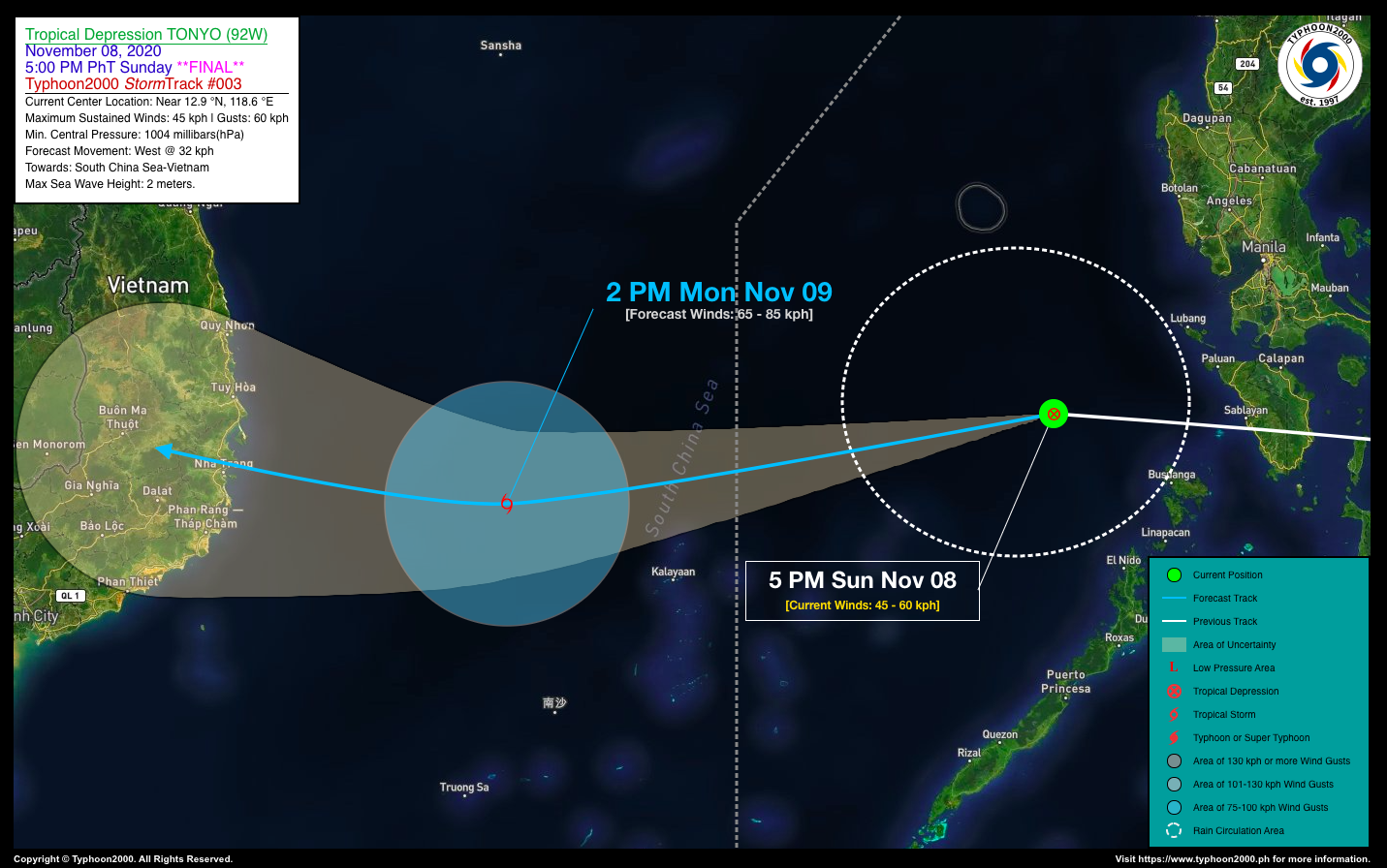
LPA 92W emerges over the West Philippine Sea and has developed into a weak & disorganized Tropical Depression (TD) named “TONYO.” It is then expected to move out of the Philippine Area of Responsibility (PAR) by tomorrow morning. *Since this is no longer a threat to the country, this is now the Final StormWatch on this Tropical Cyclone. |
| Where is TD TONYO? | As of 5:00 PM PhT today, November 08…0900 GMT:
|
| How strong is it? | Maximum Sustained Winds (1-min avg): 45 kph near the center…Gustiness: 60 kph. |
| Past Movement (06 hrs) | West @ 27 kph, towards South China Sea & Vietnam. |
| Forecast Highlights |
|
| Information based on data collected by Typhoon2000 (T2k) shall not be taken as official data. Weather information broadcasted and distributed by PAGASA remains as official data. Typhoon2000 (T2k) shall not be responsible for the private use and reliance of its weather information. | |
Issued by: David Michael V. Padua for T2K
o


