
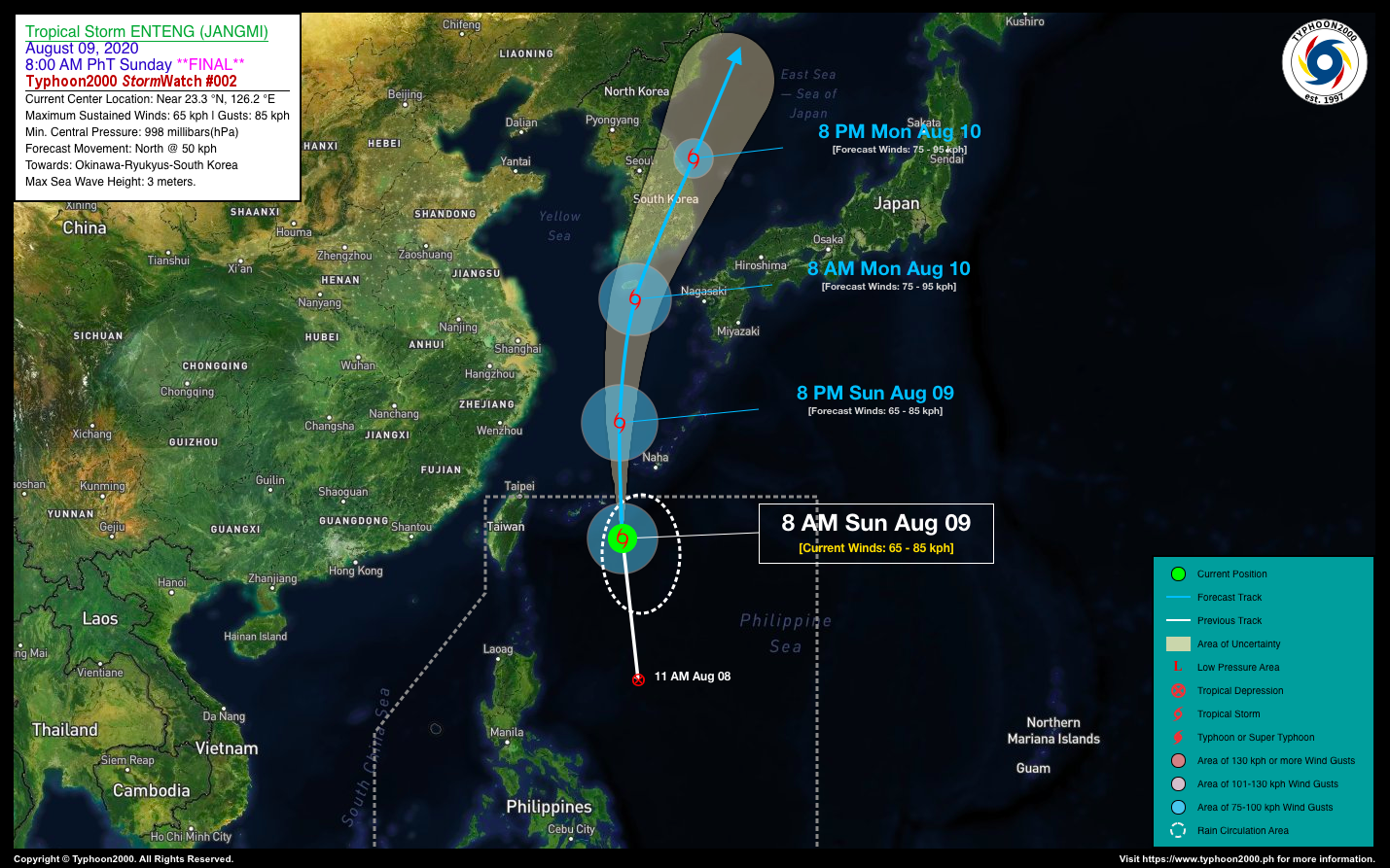
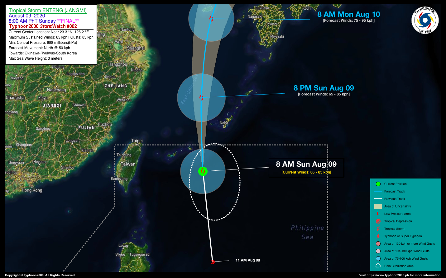
TROPICAL STORM ENTENG (JANGMI) STORMWATCH NO. 02 [Final]Issued at: 10:00 AM PhT (02:00 GMT) Sunday, 09 August 2020
|
|
|---|---|
| Current Status and Outlook |
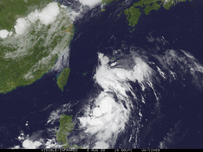
ENTENG becomes a Tropical Storm (TS) as it moves rapidly northward in the general direction of the Ryukyus and South Korea. It is now named internationally as “JANGMI”, a Korean word for a Rose. This storm is expected to move out of the Philippine Area of Responsibility (PAR) this afternoon. *With this development, this is now the Final StormWatch on this tropical cyclone. *Meanwhile, the presence of TS ENTENG (JANGMI) and another Tropical Disturbance (LPA) over the West Philippine Sea, some 217 km west of Iba, Zambales (15N 118E) will continue to enhance the Southwest Monsoon (Habagat) and bring cloudy skies & breezy conditions, with occasional rains and thunderstorms across the Western Sections of the Philippines. |
| Where is ENTENG (JANGMI)? | As of 8:00 AM PhT today, August 09…0000 GMT. The center was located over the North Philippine Sea (near 23.3°N 126.2°E), about 508 km east-southeast of Taipei, Taiwan or 681 km northeast of Santa Ana, Cagayan. |
| How strong is it? | Maximum Sustained Winds (1-min avg): 65 kph near the center…Gustiness: 85 kph. |
| Past Movement (06 hrs) | North @ 33 kph, towards the Ryukyus-South Korea Area. |
| Forecast Highlights |
|
| Information based on data collected by Typhoon2000 (T2k) shall not be taken as official data. Weather information broadcasted and distributed by PAGASA remains as official data. Typhoon2000 (T2k) shall not be responsible for the private use and reliance of its weather information. | |
Issued by: David Michael V. Padua for T2K


